THE ADVENTURE COLLECTIVE® · Independent discovery and booking for outdoor travel

Follow M-22 along Lake Michigan on a self-guided audio tour that links Sleeping Bear Dunes, historic lighthouses, and coastal villages. Download the app ahead of time, plan stops for dune climbs and beaches, and expect an 8–9 hour day of scenic driving and short hikes.
Follow M-22 along Lake Michigan on a self-guided audio tour that links Sleeping Bear Dunes, historic lighthouses, and coastal villages. Download the app ahead of time, plan stops for dune climbs and beaches, and expect an 8–9 hour day of scenic driving and short hikes.
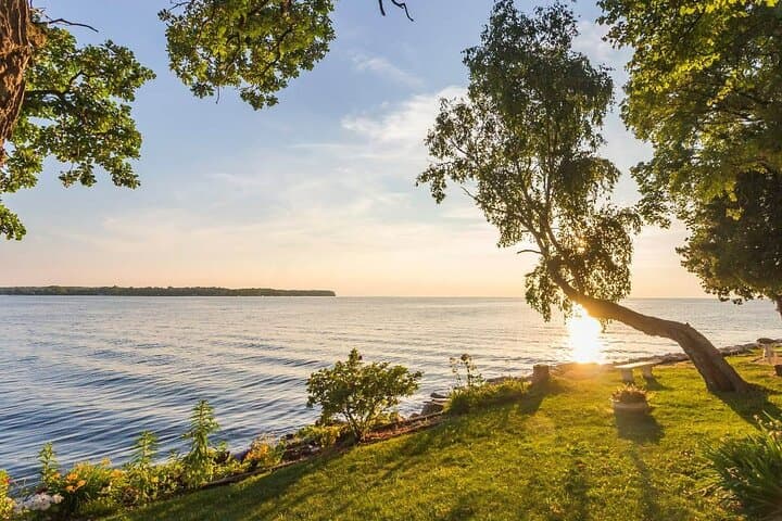
You turn off the interstate and M-22 unfurls along the lakeshore—pines leaning toward the water, sand ridges cutting the horizon, and the highway itself tracing the thumb-and-finger shape of Michigan’s Lower Peninsula.
Verified experiences and guided adventures in the surrounding area.
Operated by History with Action · Traverse City, Michigan
You turn off the interstate and M-22 unfurls along the lakeshore—pines leaning toward the water, sand ridges cutting the horizon, and the highway itself tracing the thumb-and-finger shape of Michigan’s Lower Peninsula.
This self-guided audio drive stitches together sleepy harbor towns, lighthouse beacons, and the high, mobile dunes of Sleeping Bear. The Great Lakes are geological giants: glacial tills and wind-blown sand shaped the shoreline you’ll pass, while small harbors and sawmill remnants whisper of 19th-century timber trade that once powered the region.
Culturally, the route crosses land long inhabited by Ojibwe and Odawa people; towns like Leland grew from fishing and trade at river mouths. The Manitou Islands, visible from several overlooks, were maritime waypoints and remain largely undeveloped—nature that still sets the pace here.
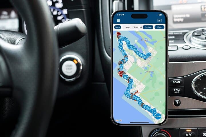
Practical guidance is the backbone of this trip. Download the Action Tour Guide app and the tour file before you travel—audio and offline maps rely on that step. Plan an 8–9 hour window if you want to stop: dune climbs, short hikes (Alligator Hill, Pyramid Point), beach breaks at Good Harbor or Frankfort, and Fishtown in Leland all reward detours.
Expect narrow state roads and seasonal crowds in summer; obey speed limits and use pullouts for photos. Fuel and services are spread out—top off in Manistee or Traverse City. Bring layers for lake-driven winds, a reusable water bottle, and patience: the route encourages lingering. When the lake calls, it often does so loudly—answer on foot, not at highway speed.
easy.
8–9 hours.
Minimal fitness required for driving; moderate fitness recommended if you plan dune climbs and 2–3 mile hikes.
No—download the tour and offline maps in the Action Tour Guide app ahead of time; the audio plays without a connection.
The full M-22 stretch covered by the tour is roughly 120–130 miles and is designed for an 8–9 hour day with stops.
No—entrance fees for national lakeshore areas, lighthouse tours, and parking are not included; check individual sites for hours and fees.
Yes—the audio tour is hands-free but can be paused, restarted, or replayed; it’s valid for one year from purchase.
This coastline grew on glacial deposits and 19th-century timber and maritime commerce; many lake towns started as sawmill or fishing ports and later became resort communities.
Sleeping Bear and local preserves protect fragile dunes and coastal marshes—stick to marked trails and boardwalks, pack out trash, and avoid disturbing nesting birds.
History with Action operates guided outdoor trips and adventures with an emphasis on safety, stewardship, and memorable experiences.

You turn off the interstate and M-22 unfurls along the lakeshore—pines leaning toward the water, sand ridges cutting the horizon, and the highway itself tracing the thumb-and-finger shape of Michigan’s Lower Peninsula.
You turn off the interstate and M-22 unfurls along the lakeshore—pines leaning toward the water, sand ridges cutting the horizon, and the highway itself tracing the thumb-and-finger shape of Michigan’s Lower Peninsula.
This self-guided audio drive stitches together sleepy harbor towns, lighthouse beacons, and the high, mobile dunes of Sleeping Bear. The Great Lakes are geological giants: glacial tills and wind-blown sand shaped the shoreline you’ll pass, while small harbors and sawmill remnants whisper of 19th-century timber trade that once powered the region.
Culturally, the route crosses land long inhabited by Ojibwe and Odawa people; towns like Leland grew from fishing and trade at river mouths. The Manitou Islands, visible from several overlooks, were maritime waypoints and remain largely undeveloped—nature that still sets the pace here.
Practical guidance is the backbone of this trip. Download the Action Tour Guide app and the tour file before you travel—audio and offline maps rely on that step. Plan an 8–9 hour window if you want to stop: dune climbs, short hikes (Alligator Hill, Pyramid Point), beach breaks at Good Harbor or Frankfort, and Fishtown in Leland all reward detours.
Expect narrow state roads and seasonal crowds in summer; obey speed limits and use pullouts for photos. Fuel and services are spread out—top off in Manistee or Traverse City. Bring layers for lake-driven winds, a reusable water bottle, and patience: the route encourages lingering. When the lake calls, it often does so loudly—answer on foot, not at highway speed.