THE ADVENTURE COLLECTIVE® · Independent discovery and booking for outdoor travel

A brisk 6–10 minute helicopter flight that climbs to roughly 1,500 feet, offering close-up views of Douglas Dam, more than 28,000 acres of Douglas Lake shoreline, and the Great Smoky Mountains on the horizon. Ideal for photographers and first-time flyers who want a condensed aerial perspective.
A brisk 6–10 minute helicopter flight that climbs to roughly 1,500 feet, offering close-up views of Douglas Dam, more than 28,000 acres of Douglas Lake shoreline, and the Great Smoky Mountains on the horizon. Ideal for photographers and first-time flyers who want a condensed aerial perspective.
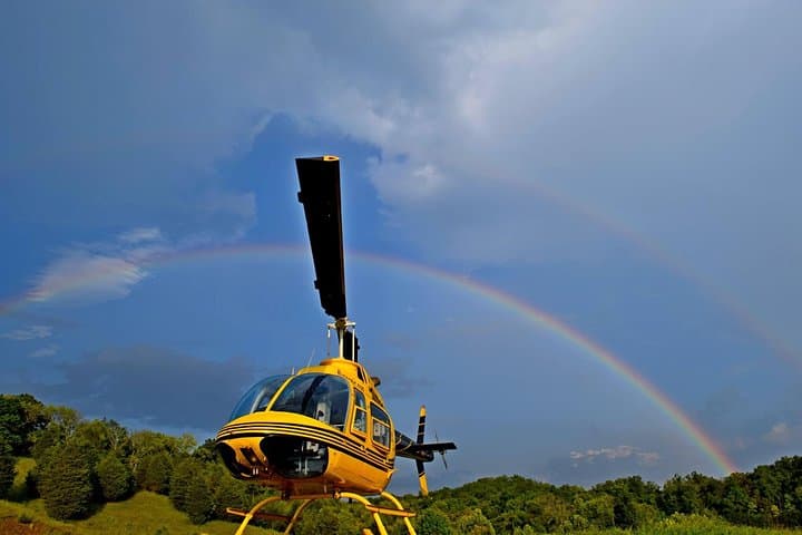
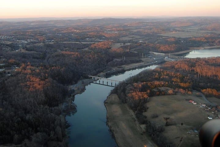
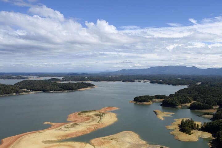
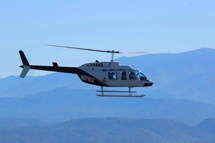
You lift off from a sun-warmed pad and the shoreline of Douglas Lake slips away like a page turning. The helicopter climbs to about 1,500 feet, tilting gently over quilt-like pastures and the braided ribbon of the French Broad River. Below, farms pattern the valley; ahead, the Great Smoky Mountains cut a blue line on the horizon that dares you to look closer.
Verified experiences and guided adventures in the surrounding area.
Operated by Scenic Helicopter Tours · Sevierville, Tennessee
You lift off from a sun-warmed pad and the shoreline of Douglas Lake slips away like a page turning. The helicopter climbs to about 1,500 feet, tilting gently over quilt-like pastures and the braided ribbon of the French Broad River. Below, farms pattern the valley; ahead, the Great Smoky Mountains cut a blue line on the horizon that dares you to look closer.
Douglas Lake (often called Douglas Reservoir) is a large TVA impoundment created in the early 1940s; Douglas Dam still hums with the legacy of mid-century hydroelectric work. Geologically, the flight frames the contrast between the Appalachian foothills and the flatter Plateau to the northwest — the plateau appears as a broad, stubborn shoulder dividing Tennessee from Kentucky.
Culturally, the lake is a working recreational landscape: marinas, fish camps, and seasonal draws like the Kyker Corn Maze give the shoreline human texture. English Mountain rises to the south, offering a foothill counterpoint to the smoky ridgelines.
Practically, expect a 6–10 minute experience that focuses on aerial sightlines rather than long-route storytelling. Bring a camera with a fast shutter, wear windproof layers, and follow pilot briefings for boarding and weight distribution — helicopters are sensitive to balance. Flights are weather-dependent; plan a flexible window and book morning slots for calmer air and clearer views. The operation accommodates most fitness levels and is wheelchair accessible at the ground level, but weight reporting may be required at booking. On clear days the ride delivers compact, unforgettable panoramas of dam infrastructure, wide shoreline, and distant peaks — a short, high-impact way to read this landscape from above.
easy.
6–10 minutes.
Minimal physical fitness required; must be able to board via small steps and follow safety briefings
The scenic loop lasts about 6–10 minutes from takeoff to landing, focusing on Douglas Lake, Douglas Dam, and distant Smoky Mountain views.
You may be asked to provide passenger weights at booking for safety and balance; operators usually allow all ages but check the supplier’s specific limits before booking.
Flights are weather-dependent and will be canceled or rescheduled in unsafe conditions; many operators offer a full refund if you cancel at least 24 hours in advance or if the operator cancels due to weather.
Ground-level facilities and boarding assistance are often available, but access to the helicopter cabin may require steps; confirm accessibility details with the operator before booking.
Douglas Dam and Reservoir were built by the Tennessee Valley Authority in the early 1940s for hydroelectric power and wartime industry, transforming the French Broad River corridor.
Shoreline development and heavy recreation pressure are ongoing concerns; follow no-wake zones, avoid low-flying over nesting areas when requested, and pack out all trash to minimize impact.
Scenic Helicopter Tours operates guided outdoor trips and adventures with an emphasis on safety, stewardship, and memorable experiences.
You lift off from a sun-warmed pad and the shoreline of Douglas Lake slips away like a page turning. The helicopter climbs to about 1,500 feet, tilting gently over quilt-like pastures and the braided ribbon of the French Broad River. Below, farms pattern the valley; ahead, the Great Smoky Mountains cut a blue line on the horizon that dares you to look closer.
You lift off from a sun-warmed pad and the shoreline of Douglas Lake slips away like a page turning. The helicopter climbs to about 1,500 feet, tilting gently over quilt-like pastures and the braided ribbon of the French Broad River. Below, farms pattern the valley; ahead, the Great Smoky Mountains cut a blue line on the horizon that dares you to look closer.
Douglas Lake (often called Douglas Reservoir) is a large TVA impoundment created in the early 1940s; Douglas Dam still hums with the legacy of mid-century hydroelectric work. Geologically, the flight frames the contrast between the Appalachian foothills and the flatter Plateau to the northwest — the plateau appears as a broad, stubborn shoulder dividing Tennessee from Kentucky.
Culturally, the lake is a working recreational landscape: marinas, fish camps, and seasonal draws like the Kyker Corn Maze give the shoreline human texture. English Mountain rises to the south, offering a foothill counterpoint to the smoky ridgelines.
Practically, expect a 6–10 minute experience that focuses on aerial sightlines rather than long-route storytelling. Bring a camera with a fast shutter, wear windproof layers, and follow pilot briefings for boarding and weight distribution — helicopters are sensitive to balance. Flights are weather-dependent; plan a flexible window and book morning slots for calmer air and clearer views. The operation accommodates most fitness levels and is wheelchair accessible at the ground level, but weight reporting may be required at booking. On clear days the ride delivers compact, unforgettable panoramas of dam infrastructure, wide shoreline, and distant peaks — a short, high-impact way to read this landscape from above.