THE ADVENTURE COLLECTIVE® · Independent discovery and booking for outdoor travel

Spend a full day on Thailand’s highest mountain: waterfalls, hill-tribe markets and a 2-hour hike along the Kew Mae Pan Nature Trail with panoramic summit views. This private day tour mixes cultural stops with a high-elevation evergreen forest walk.
Spend a full day on Thailand’s highest mountain: waterfalls, hill-tribe markets and a 2-hour hike along the Kew Mae Pan Nature Trail with panoramic summit views. This private day tour mixes cultural stops with a high-elevation evergreen forest walk.
Mist clings to the moss-soaked trunks as a private minivan climbs toward Thailand’s roof. By midmorning the air thins and the view opens: terraces and cloudstreets roll away beneath the park’s highest ridgeline while Wachirathan waterfall thunders nearby, daring you to step closer and feel its spray.
Verified experiences and guided adventures in the surrounding area.
Operated by AP Good@travel · Chiang Mai, Chiang Mai Province
Mist clings to the moss-soaked trunks as a private minivan climbs toward Thailand’s roof. By midmorning the air thins and the view opens: terraces and cloudstreets roll away beneath the park’s highest ridgeline while Wachirathan waterfall thunders nearby, daring you to step closer and feel its spray.
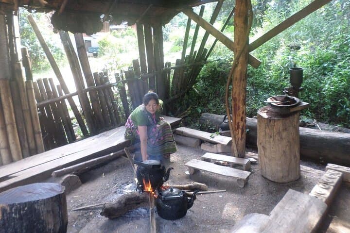
Doi Inthanon sits at the crest of the Thanon Thong Chai Range and the national park—established in 1972—protects a rare montane evergreen ecosystem, highland agricultural villages, and cascading granite cliffs carved by monsoon runoff. Cultural stops include Hmong markets and small hill-tribe coffee stalls where local growers roast beans on wood fires; these communities shape both the route and the region’s seasonal rhythms.
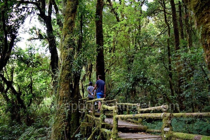
Geology here is blunt and old: uplifted Permian and Triassic bedrock topped by late Quaternary soils that support cloud forest pockets and rare orchids. The Kew Mae Pan Nature Trail threads boardwalks and root-strewn slopes for roughly 3.2 km and two hours, climbing to an open vantage where mountains curtain the horizon.
Practical guidance: expect cool mornings and rapid weather shifts—pack layers, rain protection, and comfortable hiking shoes with grip. The trail is well-marked but includes steep sections and exposed viewpoints; allow 9–10 hours for transfers, stops, and a guided nature walk. Visit between August and November for terraced rice vistas or November–February for clear summit panoramas. Respect marked paths, carry water, and move at a steady pace—this one-day itinerary balances cultural stops, waterfalls, and the high-altitude walk that makes Doi Inthanon a day-well-spent for active travelers.
moderate.
9–10 hours.
Suitable for moderately fit travelers who can manage 2 hours of uphill walking at altitude and several short cultural stops
The trail is about 3.2 km and generally takes around two hours round-trip, depending on your pace and stops for viewing platforms.
The summit is about 2,565 m—most visitors tolerate it fine on a day trip, but hydrate, move steadily, and avoid heavy exertion if you feel unwell.
There is an entrance fee for Doi Inthanon National Park; this tour typically covers admission as part of the itinerary—confirm when booking.
Moderate fitness is sufficient: expect some steep boardwalks and short climbs, but the trail is well-maintained and suitable for most active travelers.
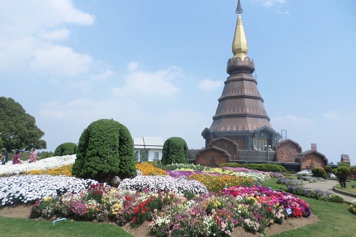
Doi Inthanon is the highest point in Thailand; the national park was established in 1972 to protect its montane ecosystems and local hill-tribe communities.
Stick to boardwalks and marked trails to protect fragile moss and orchid habitats; park fees and respectful tourism support local conservation and community projects.
AP Good@travel operates guided outdoor trips and adventures with an emphasis on safety, stewardship, and memorable experiences.
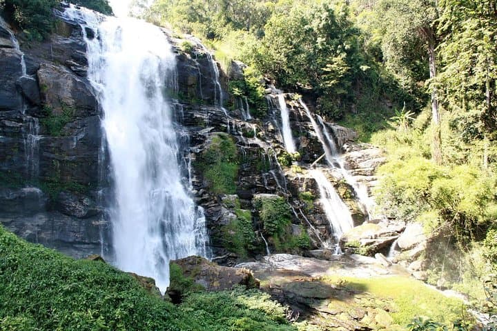
Mist clings to the moss-soaked trunks as a private minivan climbs toward Thailand’s roof. By midmorning the air thins and the view opens: terraces and cloudstreets roll away beneath the park’s highest ridgeline while Wachirathan waterfall thunders nearby, daring you to step closer and feel its spray.
Mist clings to the moss-soaked trunks as a private minivan climbs toward Thailand’s roof. By midmorning the air thins and the view opens: terraces and cloudstreets roll away beneath the park’s highest ridgeline while Wachirathan waterfall thunders nearby, daring you to step closer and feel its spray.
Doi Inthanon sits at the crest of the Thanon Thong Chai Range and the national park—established in 1972—protects a rare montane evergreen ecosystem, highland agricultural villages, and cascading granite cliffs carved by monsoon runoff. Cultural stops include Hmong markets and small hill-tribe coffee stalls where local growers roast beans on wood fires; these communities shape both the route and the region’s seasonal rhythms.
Geology here is blunt and old: uplifted Permian and Triassic bedrock topped by late Quaternary soils that support cloud forest pockets and rare orchids. The Kew Mae Pan Nature Trail threads boardwalks and root-strewn slopes for roughly 3.2 km and two hours, climbing to an open vantage where mountains curtain the horizon.
Practical guidance: expect cool mornings and rapid weather shifts—pack layers, rain protection, and comfortable hiking shoes with grip. The trail is well-marked but includes steep sections and exposed viewpoints; allow 9–10 hours for transfers, stops, and a guided nature walk. Visit between August and November for terraced rice vistas or November–February for clear summit panoramas. Respect marked paths, carry water, and move at a steady pace—this one-day itinerary balances cultural stops, waterfalls, and the high-altitude walk that makes Doi Inthanon a day-well-spent for active travelers.