THE ADVENTURE COLLECTIVE® · Independent discovery and booking for outdoor travel

Drive from Chiang Mai to Thailand’s highest peak and trade heat for cloud-forest air. This full-day guided tour covers Doi Inthanon summit, the Angkha Nature Trail, twin royal stupas, hill‑tribe villages, and Wachirathan Waterfall with lunch and park fees included.
Drive from Chiang Mai to Thailand’s highest peak and trade heat for cloud-forest air. This full-day guided tour covers Doi Inthanon summit, the Angkha Nature Trail, twin royal stupas, hill‑tribe villages, and Wachirathan Waterfall with lunch and park fees included.
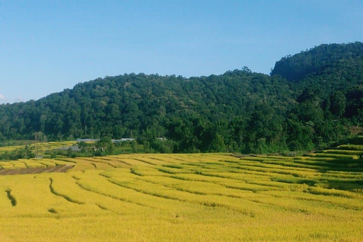
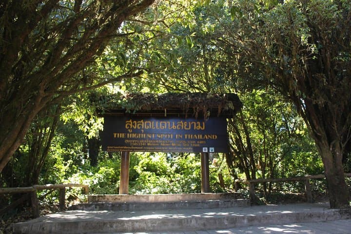
The road climbs out of Chiang Mai and the air thins and cools until the tropical city falls below a ribbon of rice fields and the clouds close in around the slopes. At 2,565 m the summit of Doi Inthanon opens like a new climate—pine-scented, brisk, with views that can pierce through low cloud on a clear day. You step from the van at the highest point in Thailand and feel the difference immediately: lighter, cooler, quieter.
Verified experiences and guided adventures in the surrounding area.
Operated by Touring Center · Chiang Mai, Chiang Mai Province
The road climbs out of Chiang Mai and the air thins and cools until the tropical city falls below a ribbon of rice fields and the clouds close in around the slopes. At 2,565 m the summit of Doi Inthanon opens like a new climate—pine-scented, brisk, with views that can pierce through low cloud on a clear day. You step from the van at the highest point in Thailand and feel the difference immediately: lighter, cooler, quieter.
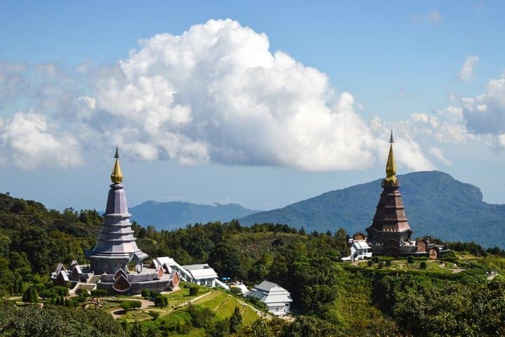
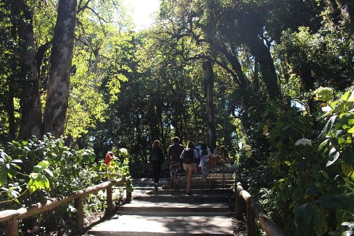
Doi Inthanon sits at the southern end of the Thanon Thong Chai Range and is geologically older and weathered than the limestone massifs to the north. National park status (established in 1972) protects cloud forest, highland streams and a mosaic of hill-tribe settlements. The day tour threads together short, interpretive walks—the Angkha Nature Trail (a 20–30 minute boardwalk through moss-draped forest), the manicured gardens around the King and Queen stupas built as royal projects, a visit to the Royal Agricultural Station, and a stop at Wachirathan Waterfall with its 80-m roar.
Culturally the route introduces Hmong and Karen communities and small-scale coffee and vegetable projects supported by royal development initiatives; expect market stalls selling woven goods and locally roasted beans. Practically, this is an 8–9 hour guided day with hotel pickup, entrance fees and Thai lunch included. Walking is short but some trails are uneven; layers are essential—temperatures can swing 10–15°C from Chiang Mai at the valley to the summit. Bring sturdy shoes, a waterproof shell in monsoon months, and allow time for traffic and comfort stops. The itinerary is ideal for travelers seeking highland ecosystems, birdlife and accessible mountain scenery without technical trekking.
moderate.
8–9 hours.
Suitable for travelers with moderate fitness—mostly short walks and standing; not a long trek.
The excursion lasts about 8–9 hours and includes hotel pickup/drop-off (Chiang Mai city centre), entrance fees, a Thai set lunch, bottled water, a professional guide and transport by air-conditioned minivan.
At 2,565 m symptoms are possible but uncommon on a day trip; stay hydrated, move at a moderate pace during walks, and inform the guide if you feel unwell.
Yes—stops include a Hmong market and village visits where you can buy woven goods and local coffee; bring small cash and ask permission before photographing people.
The tour is not recommended for travelers with serious back or heart problems and involves short walks on uneven terrain; infants must sit on laps.
Doi Inthanon is named after a local Lanna king and became Thailand’s first mountain national park in 1972; the royal agricultural projects here were initiated to support sustainable highland farming.
The park preserves rare cloud-forest habitats—stay on trails, avoid feeding wildlife and support local guides and markets to minimize visitor impact.
Touring Center operates guided outdoor trips and adventures with an emphasis on safety, stewardship, and memorable experiences.
The road climbs out of Chiang Mai and the air thins and cools until the tropical city falls below a ribbon of rice fields and the clouds close in around the slopes. At 2,565 m the summit of Doi Inthanon opens like a new climate—pine-scented, brisk, with views that can pierce through low cloud on a clear day. You step from the van at the highest point in Thailand and feel the difference immediately: lighter, cooler, quieter.
The road climbs out of Chiang Mai and the air thins and cools until the tropical city falls below a ribbon of rice fields and the clouds close in around the slopes. At 2,565 m the summit of Doi Inthanon opens like a new climate—pine-scented, brisk, with views that can pierce through low cloud on a clear day. You step from the van at the highest point in Thailand and feel the difference immediately: lighter, cooler, quieter.
Doi Inthanon sits at the southern end of the Thanon Thong Chai Range and is geologically older and weathered than the limestone massifs to the north. National park status (established in 1972) protects cloud forest, highland streams and a mosaic of hill-tribe settlements. The day tour threads together short, interpretive walks—the Angkha Nature Trail (a 20–30 minute boardwalk through moss-draped forest), the manicured gardens around the King and Queen stupas built as royal projects, a visit to the Royal Agricultural Station, and a stop at Wachirathan Waterfall with its 80-m roar.
Culturally the route introduces Hmong and Karen communities and small-scale coffee and vegetable projects supported by royal development initiatives; expect market stalls selling woven goods and locally roasted beans. Practically, this is an 8–9 hour guided day with hotel pickup, entrance fees and Thai lunch included. Walking is short but some trails are uneven; layers are essential—temperatures can swing 10–15°C from Chiang Mai at the valley to the summit. Bring sturdy shoes, a waterproof shell in monsoon months, and allow time for traffic and comfort stops. The itinerary is ideal for travelers seeking highland ecosystems, birdlife and accessible mountain scenery without technical trekking.