THE ADVENTURE COLLECTIVE® · Independent discovery and booking for outdoor travel

Navigate Melbourne’s CBD by solving 19 smartphone clues across laneways, civic boulevards and riverside stretches. This 2–3 hour self-guided trail mixes local history, street art and coffee culture into an active urban discovery.
Navigate Melbourne’s CBD by solving 19 smartphone clues across laneways, civic boulevards and riverside stretches. This 2–3 hour self-guided trail mixes local history, street art and coffee culture into an active urban discovery.
You step off Swanston Street into a grid of laneways that lean in close, each alley humming with café steam and stencil art daring you to look closer. The phone in your hand is both map and riddle-master: a prompt flashes, you read a street, scan a façade, answer — and the city nudges you toward the next clue. Over 2–3 hours the route threads through civic boulevards, past nineteenth-century stone of the State Library, across park edges and toward the river where the Yarra pulls the city’s stories downstream.
Verified experiences and guided adventures in the surrounding area.
Operated by Trixity Trails · Melbourne, Victoria
You step off Swanston Street into a grid of laneways that lean in close, each alley humming with café steam and stencil art daring you to look closer. The phone in your hand is both map and riddle-master: a prompt flashes, you read a street, scan a façade, answer — and the city nudges you toward the next clue. Over 2–3 hours the route threads through civic boulevards, past nineteenth-century stone of the State Library, across park edges and toward the river where the Yarra pulls the city’s stories downstream.
Melbourne’s CBD grew from a 19th-century port and gold-rush wealth; the State Library and its classical façade are reminders of that civic ambition. Beneath modern glass, bluestone laneways and arcades tell a different geological tale — volcanic basalts buried beneath asphalt, giving the city its durable foundations. Melbourne’s culture is performative: street artists, coffee craft, theatre posters and tram bells all play supporting roles to this urban puzzle.
Practical guidance: the trail has 19 clues, is self-guided via your device, and finishes near a bar on Swanston Street by the State Library. Expect mostly flat walking on pavement; allow 2–3 hours with pauses for answers, photos and a coffee stop. Bring a fully charged phone, comfortable shoes, and a data plan or offline map if you prefer. Start earlier on weekends to avoid peak lunchtime crowds and consult the local tram network for quick bail-outs if needed.
easy.
2–3 hours.
Suitable for most fitness levels; mostly flat walking with frequent stops for solving clues and sightseeing.
No — the trail is self-guided and suitable for solo travelers, couples or small groups; one booking covers a team.
Many parts run on flat pavements and major arcades are accessible, but some narrow laneways may be tight—plan a route that avoids alleys if needed.
You can use the Hint or Help options on the app; the system lets you try again and won’t penalize you beyond time to solve it.
Yes — this is a flexible, self-guided experience designed to start when you’re ready; check local opening hours for any specific POIs you want to enter.
Melbourne’s CBD expanded rapidly after the 1850s gold rush; many public buildings, like the State Library, reflect 19th-century civic architecture and the city’s early wealth.
Stick to footpaths, avoid chalking or affixing items to heritage facades, and support local businesses along the route to keep lanes active and well-maintained.
Trixity Trails operates guided outdoor trips and adventures with an emphasis on safety, stewardship, and memorable experiences.
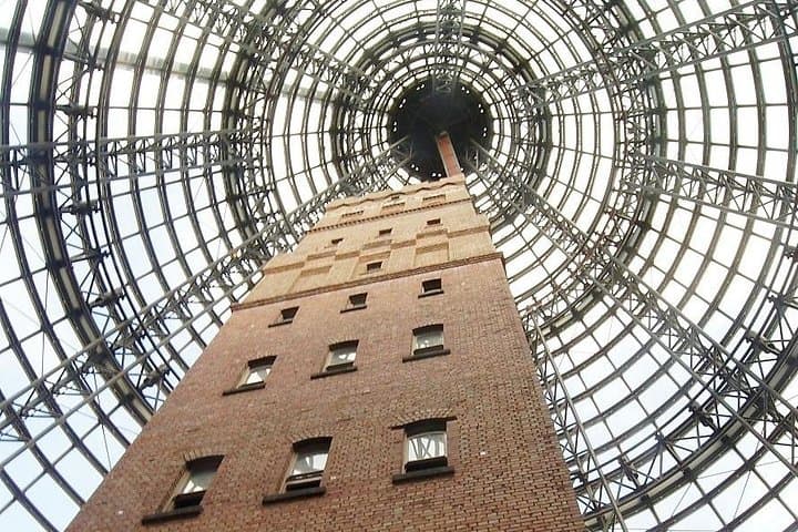
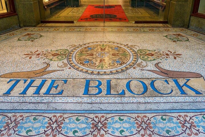

You step off Swanston Street into a grid of laneways that lean in close, each alley humming with café steam and stencil art daring you to look closer. The phone in your hand is both map and riddle-master: a prompt flashes, you read a street, scan a façade, answer — and the city nudges you toward the next clue. Over 2–3 hours the route threads through civic boulevards, past nineteenth-century stone of the State Library, across park edges and toward the river where the Yarra pulls the city’s stories downstream.
You step off Swanston Street into a grid of laneways that lean in close, each alley humming with café steam and stencil art daring you to look closer. The phone in your hand is both map and riddle-master: a prompt flashes, you read a street, scan a façade, answer — and the city nudges you toward the next clue. Over 2–3 hours the route threads through civic boulevards, past nineteenth-century stone of the State Library, across park edges and toward the river where the Yarra pulls the city’s stories downstream.
Melbourne’s CBD grew from a 19th-century port and gold-rush wealth; the State Library and its classical façade are reminders of that civic ambition. Beneath modern glass, bluestone laneways and arcades tell a different geological tale — volcanic basalts buried beneath asphalt, giving the city its durable foundations. Melbourne’s culture is performative: street artists, coffee craft, theatre posters and tram bells all play supporting roles to this urban puzzle.
Practical guidance: the trail has 19 clues, is self-guided via your device, and finishes near a bar on Swanston Street by the State Library. Expect mostly flat walking on pavement; allow 2–3 hours with pauses for answers, photos and a coffee stop. Bring a fully charged phone, comfortable shoes, and a data plan or offline map if you prefer. Start earlier on weekends to avoid peak lunchtime crowds and consult the local tram network for quick bail-outs if needed.