THE ADVENTURE COLLECTIVE® · Independent discovery and booking for outdoor travel

A self-guided, clue-driven walking trail across Adelaide’s historic grid. Follow 18 digital clues over 2–3 hours to uncover landmarks, local stories and hidden laneways — all from your smartphone.
A self-guided, clue-driven walking trail across Adelaide’s historic grid. Follow 18 digital clues over 2–3 hours to uncover landmarks, local stories and hidden laneways — all from your smartphone.
You step off the tram into the open grid of Adelaide and the city becomes a puzzle waiting to be read. Cobblestones, wide boulevards and parklands frame your route as a stream of clues pings on your phone; each correct answer nudges you further into laneways, past heritage façades and toward the River Torrens before the trail closes on East Terrace.
Verified experiences and guided adventures in the surrounding area.
Operated by Trixity Trails · Adelaide, South Australia
You step off the tram into the open grid of Adelaide and the city becomes a puzzle waiting to be read. Cobblestones, wide boulevards and parklands frame your route as a stream of clues pings on your phone; each correct answer nudges you further into laneways, past heritage façades and toward the River Torrens before the trail closes on East Terrace.
The route threads through Colonel William Light’s 1836 grid—streets planned to capture light and breezes—and sweeps by cultural landmarks on North Terrace and the city’s parklands. Geology here is soft: low limestone banks and the flat Adelaide Plains give way to the green ribbon of the Torrens, whose levees and bridges mark the city’s colonial and Kaurna histories.
Culture lives in cafés, markets and museums you’ll pass: Adelaide Central Market, small galleries and street art tucked into arcades. The experience is social and cerebral — a timed, clue-driven walk of 18 stops designed to test local knowledge and curiosity while keeping the pace gentle enough to enjoy coffee and views.
Practical guidance: allow 2–3 hours, bring a fully charged smartphone and a small water bottle, and expect flat, accessible surfaces suitable for strollers and wheelchairs. Public transport links run close to common start points, and clues pause the clock so you can take photos or ask for a hint. If heat or rain is forecast, shift the start time; cancellation is usually allowed up to 24 hours in advance. This is an easy, urban outdoor adventure that rewards observation as much as stamina.
easy.
2–3 hours.
Suitable for most fitness levels; participants should be comfortable walking on paved urban paths for several hours
Expect 2–3 hours to complete all 18 clues; the system pauses the clock each time you solve a clue so you can take breaks.
Yes—surfaces are generally paved and accessible, though some laneways or crosswalks may require caution; check local transit stops for nearest entry points.
No—clues range from easy to clever, and hints are available; it rewards local knowledge but is designed for visitors and residents alike.
The experience is self-guided with instant confirmation; you can start at your booked time but check opening hours for specific indoor stops like markets or museums.
Adelaide’s grid was surveyed by Colonel William Light in 1836; the surrounding parklands were planned as a public green belt from the city’s founding.
The city emphasizes its parklands and public transport—stick to paths, support local businesses you pass, and dispose of waste properly to keep public spaces healthy.
Trixity Trails operates guided outdoor trips and adventures with an emphasis on safety, stewardship, and memorable experiences.
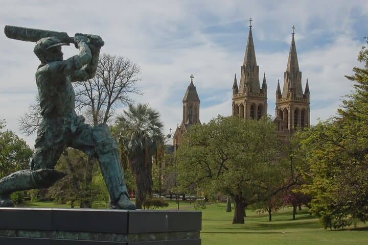

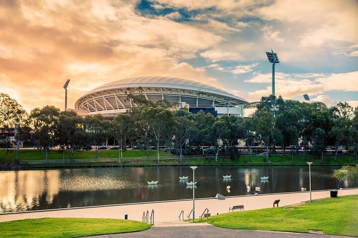

You step off the tram into the open grid of Adelaide and the city becomes a puzzle waiting to be read. Cobblestones, wide boulevards and parklands frame your route as a stream of clues pings on your phone; each correct answer nudges you further into laneways, past heritage façades and toward the River Torrens before the trail closes on East Terrace.
You step off the tram into the open grid of Adelaide and the city becomes a puzzle waiting to be read. Cobblestones, wide boulevards and parklands frame your route as a stream of clues pings on your phone; each correct answer nudges you further into laneways, past heritage façades and toward the River Torrens before the trail closes on East Terrace.
The route threads through Colonel William Light’s 1836 grid—streets planned to capture light and breezes—and sweeps by cultural landmarks on North Terrace and the city’s parklands. Geology here is soft: low limestone banks and the flat Adelaide Plains give way to the green ribbon of the Torrens, whose levees and bridges mark the city’s colonial and Kaurna histories.
Culture lives in cafés, markets and museums you’ll pass: Adelaide Central Market, small galleries and street art tucked into arcades. The experience is social and cerebral — a timed, clue-driven walk of 18 stops designed to test local knowledge and curiosity while keeping the pace gentle enough to enjoy coffee and views.
Practical guidance: allow 2–3 hours, bring a fully charged smartphone and a small water bottle, and expect flat, accessible surfaces suitable for strollers and wheelchairs. Public transport links run close to common start points, and clues pause the clock so you can take photos or ask for a hint. If heat or rain is forecast, shift the start time; cancellation is usually allowed up to 24 hours in advance. This is an easy, urban outdoor adventure that rewards observation as much as stamina.