THE ADVENTURE COLLECTIVE® · Independent discovery and booking for outdoor travel

Traverse northern Madagascar by private 4x4 from Antsiranana (Diego-Suarez) to Sambava—an eight-hour coastal route that mixes coastal vistas, vanilla country, and authentic village stops. Expect mixed road surfaces, flexible stops, and an experienced local driver to interpret landscape and culture.
Traverse northern Madagascar by private 4x4 from Antsiranana (Diego-Suarez) to Sambava—an eight-hour coastal route that mixes coastal vistas, vanilla country, and authentic village stops. Expect mixed road surfaces, flexible stops, and an experienced local driver to interpret landscape and culture.
The track opens like a map beneath the tires: red laterite that crunches, sudden blue bays appearing between serrated headlands, and villages where children pause to watch the convoy pass. In a private 4x4 you move at the country’s pace—stops decided by a roadside view, a cup of coffee, or a local who wants to trade a story. The sea keeps calling, and the inland hills push back with grasslands and pockets of humid forest.
Verified experiences and guided adventures in the surrounding area.
Operated by North Gascar Tours · Antsiranana, Diana Region
The track opens like a map beneath the tires: red laterite that crunches, sudden blue bays appearing between serrated headlands, and villages where children pause to watch the convoy pass. In a private 4x4 you move at the country’s pace—stops decided by a roadside view, a cup of coffee, or a local who wants to trade a story. The sea keeps calling, and the inland hills push back with grasslands and pockets of humid forest.
This route traces northern Madagascar’s layered history: French-era Antsiranana (Diego-Suarez) port infrastructure, coastal trading lanes, and the agricultural lifeways that fuel Sambava’s vanilla reputation. Geologically the coast alternates between uplifted limestone, low cliffs, and river-sculpted valleys; soils change from red laterite to dark alluvium as plantations appear. Culturally the road threads Antakarana, coastal communities and smallholders—drivers often double as cultural interpreters, explaining harvest cycles and village rites.
Practically, expect roughly an all-day drive (about 8 hours) along mixed paved and unpaved roads, with short climbs and coastal viewpoints. The rhythm is flexible: stops in Vohemar, market detours, and beach lookouts. Bring cash for small purchases, sun protection, and a camera with extra batteries. The vehicle’s air conditioning and an experienced local driver make long stretches comfortable, but sections can be bumpy and wet in the rainy season. Travel here is about windows down and taking the time to notice: the ocean daring you forward, the roadside groves offering shade. Plan for early starts, hydrate, and let the road set your tempo.
easy.
8 hours.
No special fitness required; comfortable sitting and short walk capability for stops recommended
The private 4x4 itinerary takes about 8 hours door-to-door, depending on stops and road conditions—roughly 250–320 km on mixed surfaces.
Vehicles and some transfer options are wheelchair accessible per operator info, but some stops may require stepping up or short uneven walks—confirm specific needs when booking.
Basic bottled water and soda are usually provided in the vehicle; plan cash for meals, snacks, and additional refreshments during stops.
Yes—local drivers commonly facilitate market stops, vanilla cooperative visits, or short village walks; request specific stops when booking to allow time.
Antsiranana (Diego-Suarez) grew as a strategic French-era port; the northern coast has long been a crossroads of trade and colonial influence.
Northern Madagascar’s coastal forests and vanilla landscapes face pressure from land conversion and overharvesting—support local guides, use reusable items, and avoid disturbing wildlife.
North Gascar Tours operates guided outdoor trips and adventures with an emphasis on safety, stewardship, and memorable experiences.

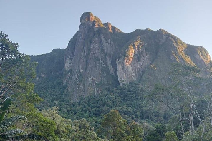
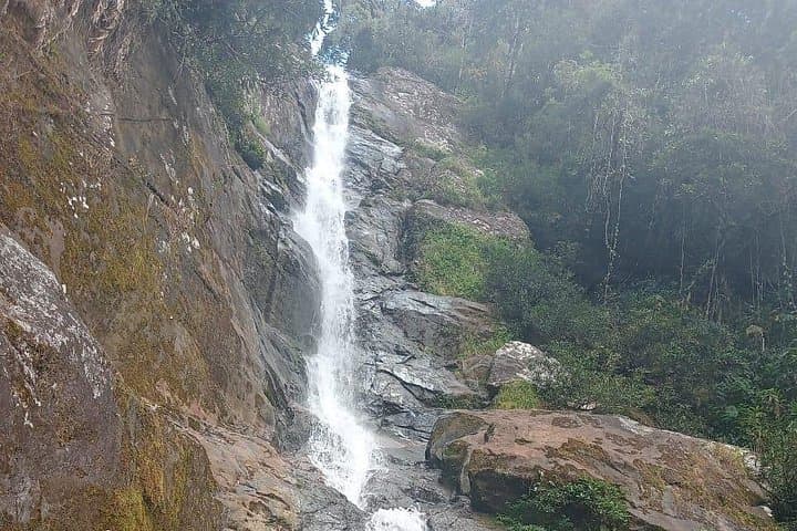
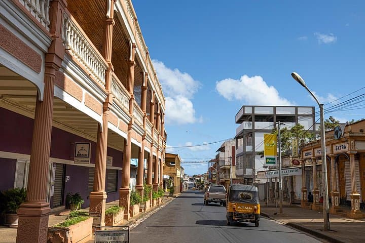
The track opens like a map beneath the tires: red laterite that crunches, sudden blue bays appearing between serrated headlands, and villages where children pause to watch the convoy pass. In a private 4x4 you move at the country’s pace—stops decided by a roadside view, a cup of coffee, or a local who wants to trade a story. The sea keeps calling, and the inland hills push back with grasslands and pockets of humid forest.
The track opens like a map beneath the tires: red laterite that crunches, sudden blue bays appearing between serrated headlands, and villages where children pause to watch the convoy pass. In a private 4x4 you move at the country’s pace—stops decided by a roadside view, a cup of coffee, or a local who wants to trade a story. The sea keeps calling, and the inland hills push back with grasslands and pockets of humid forest.
This route traces northern Madagascar’s layered history: French-era Antsiranana (Diego-Suarez) port infrastructure, coastal trading lanes, and the agricultural lifeways that fuel Sambava’s vanilla reputation. Geologically the coast alternates between uplifted limestone, low cliffs, and river-sculpted valleys; soils change from red laterite to dark alluvium as plantations appear. Culturally the road threads Antakarana, coastal communities and smallholders—drivers often double as cultural interpreters, explaining harvest cycles and village rites.
Practically, expect roughly an all-day drive (about 8 hours) along mixed paved and unpaved roads, with short climbs and coastal viewpoints. The rhythm is flexible: stops in Vohemar, market detours, and beach lookouts. Bring cash for small purchases, sun protection, and a camera with extra batteries. The vehicle’s air conditioning and an experienced local driver make long stretches comfortable, but sections can be bumpy and wet in the rainy season. Travel here is about windows down and taking the time to notice: the ocean daring you forward, the roadside groves offering shade. Plan for early starts, hydrate, and let the road set your tempo.