THE ADVENTURE COLLECTIVE® · Independent discovery and booking for outdoor travel

Follow an old estate road through cloud forest and tea slopes on a guided 19 km hike linking Bambarakanda Falls to the Ohiya–Horton Plains road. Expect dramatic drops, the engineered “V Cut,” and variable trail conditions that reward fit, prepared hikers.
Follow an old estate road through cloud forest and tea slopes on a guided 19 km hike linking Bambarakanda Falls to the Ohiya–Horton Plains road. Expect dramatic drops, the engineered “V Cut,” and variable trail conditions that reward fit, prepared hikers.
You step off an estate road and into a spine of green ridges; mist clings to the slopes and the track angles upward, the earth underfoot alternating between compacted soil and loose stones. The Devil's Staircase unfurls ahead — a long, old jeep track that snakes between tea terraces, through patches of cloud forest, and across streams that dare you to keep pace.
Verified experiences and guided adventures in the surrounding area.
Operated by Travceylon Leisure · Ohiya, Central Province
You step off an estate road and into a spine of green ridges; mist clings to the slopes and the track angles upward, the earth underfoot alternating between compacted soil and loose stones. The Devil's Staircase unfurls ahead — a long, old jeep track that snakes between tea terraces, through patches of cloud forest, and across streams that dare you to keep pace.
This route follows colonial-era estate roads carved through Sri Lanka’s central highlands during the 19th century to move tea and timber. Geologically the area sits on weathered uplifted plateaus; granite and metamorphic outcrops give way to peaty soils and steep drainage that feed the Bambarakanda Falls — the highest waterfall in Sri Lanka. Culturally, you pass estate settlements where Tamil and Sinhalese communities work smallholdings and maintain a quiet, practical rhythm tied to the land.
Expect around 19 km of walking between Bambarakanda and the Ohiya–Horton Plains road, much of it on eroded estate tracks with short, steep pitches. Highlights include the engineered “V Cut” — a neat notch cut through a hill — and the viewpoint above Bambarakanda Falls where water drops in a single, dramatic column. Wildlife is subtle: keep an eye for junglefowl and deer. Guides are recommended; cairns and paths fork often.
Practical notes: start early to avoid afternoon cloud and heavy rain, carry layered waterproofs, and bring 2–3 liters of water and high-energy snacks. Comfortable, grippy hiking shoes and a headlamp for unexpected delays are wise. First aid and a backup vehicle are typical inclusions on guided trips; permit and park fees may apply if you continue toward Horton Plains.
challenging.
7–10 hours.
Good aerobic fitness and steady hiking experience; comfortable with sustained uphill and uneven terrain.
The full route between Bambarakanda and the Ohiya–Horton Plains road is about 19 km and typically takes 7–10 hours; expect sustained climbs and rough estate tracks — rated challenging.
Yes — there are no formal markers and estate tracks fork frequently; guides improve safety, navigation, and local context.
Yes — the trail crosses streams and viewpoints near Bambarakanda Falls, Sri Lanka’s tallest waterfall; some stopping points offer clear views.
Guided tours commonly include a qualified first-aid officer and a backup vehicle for emergency transport, as noted in the tour inclusions.
The track follows old colonial estate roads built for tea and timber transport; many stone drains and shaded lines of eucalyptus remain from that era.
The montane ecosystems here are fragile — stick to established tracks, avoid disturbing streams, and pack out all waste to protect headwater habitats.
Travceylon Leisure operates guided outdoor trips and adventures with an emphasis on safety, stewardship, and memorable experiences.
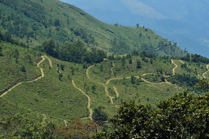
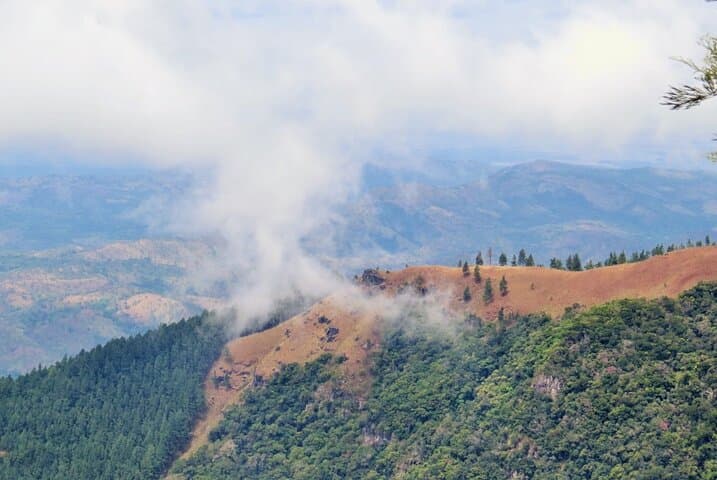
You step off an estate road and into a spine of green ridges; mist clings to the slopes and the track angles upward, the earth underfoot alternating between compacted soil and loose stones. The Devil's Staircase unfurls ahead — a long, old jeep track that snakes between tea terraces, through patches of cloud forest, and across streams that dare you to keep pace.
You step off an estate road and into a spine of green ridges; mist clings to the slopes and the track angles upward, the earth underfoot alternating between compacted soil and loose stones. The Devil's Staircase unfurls ahead — a long, old jeep track that snakes between tea terraces, through patches of cloud forest, and across streams that dare you to keep pace.
This route follows colonial-era estate roads carved through Sri Lanka’s central highlands during the 19th century to move tea and timber. Geologically the area sits on weathered uplifted plateaus; granite and metamorphic outcrops give way to peaty soils and steep drainage that feed the Bambarakanda Falls — the highest waterfall in Sri Lanka. Culturally, you pass estate settlements where Tamil and Sinhalese communities work smallholdings and maintain a quiet, practical rhythm tied to the land.
Expect around 19 km of walking between Bambarakanda and the Ohiya–Horton Plains road, much of it on eroded estate tracks with short, steep pitches. Highlights include the engineered “V Cut” — a neat notch cut through a hill — and the viewpoint above Bambarakanda Falls where water drops in a single, dramatic column. Wildlife is subtle: keep an eye for junglefowl and deer. Guides are recommended; cairns and paths fork often.
Practical notes: start early to avoid afternoon cloud and heavy rain, carry layered waterproofs, and bring 2–3 liters of water and high-energy snacks. Comfortable, grippy hiking shoes and a headlamp for unexpected delays are wise. First aid and a backup vehicle are typical inclusions on guided trips; permit and park fees may apply if you continue toward Horton Plains.