THE ADVENTURE COLLECTIVE® · Independent discovery and booking for outdoor travel

Walk the River Foyle with a narrated, self-guided audio tour that connects Peace Bridge, the quayside emigration sculptures, Magee College, and the city’s shipbuilding past. Download the VoiceMap audio and offline maps and expect a 60–90 minute, wheelchair-accessible route along paved riverside paths.
Walk the River Foyle with a narrated, self-guided audio tour that connects Peace Bridge, the quayside emigration sculptures, Magee College, and the city’s shipbuilding past. Download the VoiceMap audio and offline maps and expect a 60–90 minute, wheelchair-accessible route along paved riverside paths.
You start on the riverbank, where the Foyle slides past and the city edges into view: brick quays, a modern footbridge, and the distant roofline of Magee College. The audio voice guides you along the Quay Trail, pausing at sculptures that mark departures and arrivals, and pointing out the shipyards that once shaped this port.
Verified experiences and guided adventures in the surrounding area.
Operated by VoiceMap Audio Tours · Derry/Londonderry, Northern Ireland
You start on the riverbank, where the Foyle slides past and the city edges into view: brick quays, a modern footbridge, and the distant roofline of Magee College. The audio voice guides you along the Quay Trail, pausing at sculptures that mark departures and arrivals, and pointing out the shipyards that once shaped this port.
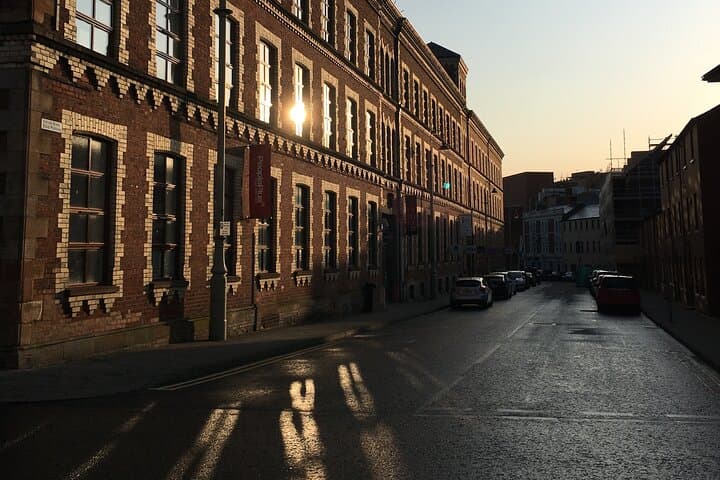
The route threads together Derry/Londonderry’s industrial past and civic life. Listeners learn how 19th-century shirt factories and shipbuilding launched waves of emigration during the Potato Famine, and how the port pivoted again during World War II. Geology is plain in the terrace and quay construction—glacially scoured river valley and reclaimed riverfront—while architecture ranges from Victorian brick to contemporary public works like the Peace Bridge.
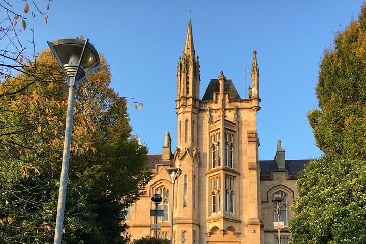
Culturally, the walk highlights working-class enterprise and the university’s long presence at Magee College; accents, murals, and place names reflect a city shaped by trade and politics.
Practical guidance: the tour runs about 60–90 minutes along mostly paved, level paths suitable for all abilities. Download the VoiceMap app and the offline files before you go to avoid data gaps along the river. Bring headphones, a charged phone and a compact waterproof layer—the Foyle can throw up sudden rain. Midday light is best for sculpture detail; evenings give stronger silhouettes on the water.
This is a low-effort, high-context way to move through Derry/Londonderry: expect historical snapshots, clear waypoints, and the steady presence of the river guiding the walk.
easy.
60–90 minutes.
Suitable for all fitness levels; mostly flat, paved walking for up to 1.5 hours.
The audio route is designed for 60–90 minutes depending on pace and stops for reading and photography.
Yes—most of the Quay Trail and riverside paths are paved and level; the listing notes wheelchair accessibility.
No—download the VoiceMap audio, geodata, and maps beforehand for offline playback and navigation.
This specific product provides lifetime access in English; check the app for other language options.
Derry/Londonderry’s quays grew with 19th-century shipbuilding and shirt factories; the port was also a departure point for famine-era emigration and played logistical roles in World War II.
Stick to paved trails and public docks, avoid disturbing riverbank vegetation, and carry out litter—high foot traffic makes basic Leave No Trace especially important here.
VoiceMap Audio Tours operates guided outdoor trips and adventures with an emphasis on safety, stewardship, and memorable experiences.
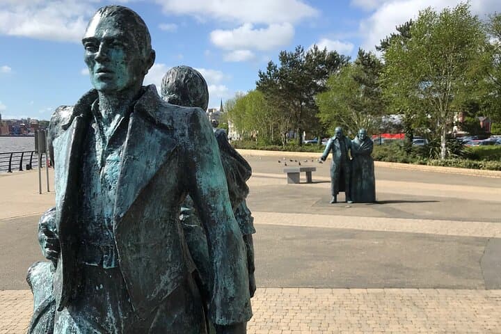
You start on the riverbank, where the Foyle slides past and the city edges into view: brick quays, a modern footbridge, and the distant roofline of Magee College. The audio voice guides you along the Quay Trail, pausing at sculptures that mark departures and arrivals, and pointing out the shipyards that once shaped this port.
You start on the riverbank, where the Foyle slides past and the city edges into view: brick quays, a modern footbridge, and the distant roofline of Magee College. The audio voice guides you along the Quay Trail, pausing at sculptures that mark departures and arrivals, and pointing out the shipyards that once shaped this port.
The route threads together Derry/Londonderry’s industrial past and civic life. Listeners learn how 19th-century shirt factories and shipbuilding launched waves of emigration during the Potato Famine, and how the port pivoted again during World War II. Geology is plain in the terrace and quay construction—glacially scoured river valley and reclaimed riverfront—while architecture ranges from Victorian brick to contemporary public works like the Peace Bridge.
Culturally, the walk highlights working-class enterprise and the university’s long presence at Magee College; accents, murals, and place names reflect a city shaped by trade and politics.
Practical guidance: the tour runs about 60–90 minutes along mostly paved, level paths suitable for all abilities. Download the VoiceMap app and the offline files before you go to avoid data gaps along the river. Bring headphones, a charged phone and a compact waterproof layer—the Foyle can throw up sudden rain. Midday light is best for sculpture detail; evenings give stronger silhouettes on the water.
This is a low-effort, high-context way to move through Derry/Londonderry: expect historical snapshots, clear waypoints, and the steady presence of the river guiding the walk.