THE ADVENTURE COLLECTIVE® · Independent discovery and booking for outdoor travel

See the Delaware Water Gap from above on a short, private 30-minute airplane flight from the Pocono Mountains. Expect low-altitude views of the river, Kittatinny Ridge, Mount Tammany and resort clusters with pilot narration via headset.
See the Delaware Water Gap from above on a short, private 30-minute airplane flight from the Pocono Mountains. Expect low-altitude views of the river, Kittatinny Ridge, Mount Tammany and resort clusters with pilot narration via headset.
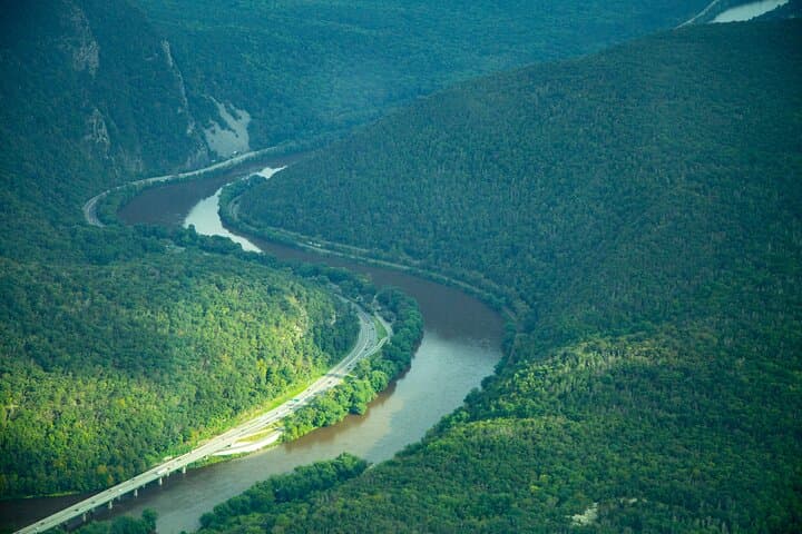
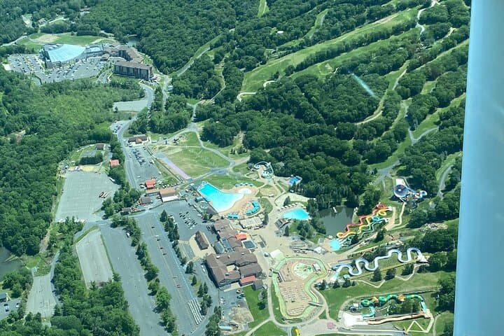
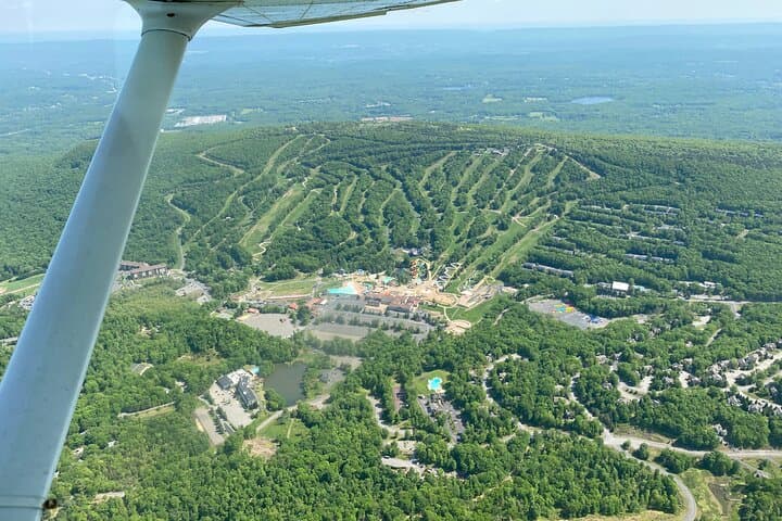
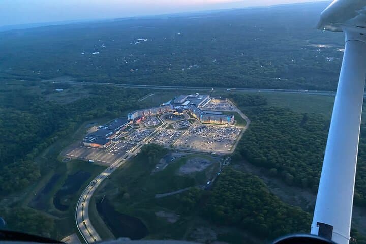
The engine thrum settles into a steady hum as the little plane lifts off from the Pocono Mountains Airport and the valley opens beneath you. Below, the Delaware River carves a sharp line between sandstone ridges; farms, ski resorts and pockets of forest recede into a patchwork you can take in in a single 30-minute circuit.
Verified experiences and guided adventures in the surrounding area.
Operated by HOP ON AIR · Delaware Water Gap, Pennsylvania
The engine thrum settles into a steady hum as the little plane lifts off from the Pocono Mountains Airport and the valley opens beneath you. Below, the Delaware River carves a sharp line between sandstone ridges; farms, ski resorts and pockets of forest recede into a patchwork you can take in in a single 30-minute circuit.
Geology here is readable from the air: the river has cut through resistant Silurian and Ordovician ridgelines—part of the broader Appalachian spine—forming the narrow notch known as the Delaware Water Gap. Human history sits layered on top. The Lenape traveled these river corridors long before colonial roads followed the river’s route; in the 20th century the corridor became protected as the Delaware Water Gap National Recreation Area (established 1965), preserving both recreational access and habitat.
From the cockpit you’ll pass recognizable landmarks—Mount Tammany’s steep red-rock face on the New Jersey side, the Kittatinny Ridge, and resort complexes clustered on the Pocono plateau. Operators provide headsets for narration and quiet communication; flights are short, intimate, and typically limited to two or three passengers so everyone gets unobstructed views.
Practical note: this is a low-altitude scenic flight—bring a warm layer, a camera with a strap, and a compact bag. Passengers must follow weight and ID requirements; flights are weather-dependent and can be rescheduled or canceled for fog, storms, or insufficient minimum bookings. Expect a brisk, elevated perspective that reveals how river, rock and human use meet at this iconic Appalachian cut.
easy.
25–30 minutes.
No special fitness required; passengers must be able to sit and use standard aircraft safety belts.
The tour is approximately 25–30 minutes of flight time, usually operated as a single low-altitude circuit over the gap.
Yes—flights typically require a minimum of two passengers and allow up to three, with a combined passenger weight cap (approximately 600 lb/273 kg); exact requirements are confirmed at booking.
Flights are weather-dependent; tours can be delayed, rerouted, or canceled for fog, low clouds, or storms—operators will offer alternatives or refunds per their policy.
Infants must sit on an adult’s lap; the flight is not recommended for pregnant travelers or those with serious spinal or cardiovascular conditions—check the operator’s health advisories before booking.
The river corridor was used for centuries by the Lenape people; the modern recreation area was established in 1965 to protect the gap’s natural and recreational values.
Operators coordinate with park guidelines to minimize disturbance; keep groups small, avoid tossing items from the aircraft, and respect seasonal wildlife sensitivity when choosing flight paths.
HOP ON AIR operates guided outdoor trips and adventures with an emphasis on safety, stewardship, and memorable experiences.
The engine thrum settles into a steady hum as the little plane lifts off from the Pocono Mountains Airport and the valley opens beneath you. Below, the Delaware River carves a sharp line between sandstone ridges; farms, ski resorts and pockets of forest recede into a patchwork you can take in in a single 30-minute circuit.
The engine thrum settles into a steady hum as the little plane lifts off from the Pocono Mountains Airport and the valley opens beneath you. Below, the Delaware River carves a sharp line between sandstone ridges; farms, ski resorts and pockets of forest recede into a patchwork you can take in in a single 30-minute circuit.
Geology here is readable from the air: the river has cut through resistant Silurian and Ordovician ridgelines—part of the broader Appalachian spine—forming the narrow notch known as the Delaware Water Gap. Human history sits layered on top. The Lenape traveled these river corridors long before colonial roads followed the river’s route; in the 20th century the corridor became protected as the Delaware Water Gap National Recreation Area (established 1965), preserving both recreational access and habitat.
From the cockpit you’ll pass recognizable landmarks—Mount Tammany’s steep red-rock face on the New Jersey side, the Kittatinny Ridge, and resort complexes clustered on the Pocono plateau. Operators provide headsets for narration and quiet communication; flights are short, intimate, and typically limited to two or three passengers so everyone gets unobstructed views.
Practical note: this is a low-altitude scenic flight—bring a warm layer, a camera with a strap, and a compact bag. Passengers must follow weight and ID requirements; flights are weather-dependent and can be rescheduled or canceled for fog, storms, or insufficient minimum bookings. Expect a brisk, elevated perspective that reveals how river, rock and human use meet at this iconic Appalachian cut.