THE ADVENTURE COLLECTIVE® · Independent discovery and booking for outdoor travel

A high‑altitude day hike from Cusco, Vinicunca — Rainbow Mountain — rewards an early start with ribboned mineral slopes and sweeping views of Apu Ausangate. Expect a long day, thin air, and nontechnical but demanding trails at 5,200 m.
A high‑altitude day hike from Cusco, Vinicunca — Rainbow Mountain — rewards an early start with ribboned mineral slopes and sweeping views of Apu Ausangate. Expect a long day, thin air, and nontechnical but demanding trails at 5,200 m.
A pale dawn lifts off the high plain as the minivan threads its way south from Cusco, and by breakfast in Cusipata the air already tastes thin and cold. The trail from Phulawasipata climbs across puna grasslands and terraced farmland, past grazing alpacas and toward Apu Ausangate’s ragged skyline. At 5,200 meters the banded slopes of Vinicunca — the so‑called Rainbow Mountain — unfold in stripes of ochre, rose, and mint where iron, copper and clay minerals intersect.
Verified experiences and guided adventures in the surrounding area.
Operated by Machupicchu Agency · Cusco, Cusco
A pale dawn lifts off the high plain as the minivan threads its way south from Cusco, and by breakfast in Cusipata the air already tastes thin and cold. The trail from Phulawasipata climbs across puna grasslands and terraced farmland, past grazing alpacas and toward Apu Ausangate’s ragged skyline. At 5,200 meters the banded slopes of Vinicunca — the so‑called Rainbow Mountain — unfold in stripes of ochre, rose, and mint where iron, copper and clay minerals intersect.
Geology here is blunt and readable: layered sedimentary tills and volcanic ash, uplifted by Andean orogeny and revealed by erosion and past glacial activity. The site sits within traditional Quechua territory; local communities revere Ausangate as an Apu (sacred mountain) and maintain herding and high‑alt agriculture in the valleys below.
Practically, expect a 12–13 hour day from Cusco with roughly 3–4 hours of walking roundtrip at high elevation. Trails range from packed dirt to loose scree; the ascent is steady rather than technical but altitude adds strain. Bring layered insulation, water, sun protection, and a slow pace to reduce symptoms of altitude sickness. Start early to avoid afternoon clouds, respect fencing and local guides, and limit time at the summit to reduce exposure to wind and cold.
Beyond the photo, the route offers quiet canyons, grazing camelids, and panoramic views of Ausangate’s glaciers. For responsible visitors: stay on established paths, carry out waste, and consider hiring local guides who help support nearby communities.
challenging.
12–13 hours.
Good aerobic fitness recommended; accustomed to long walks and some high‑altitude exertion
The full outing from Cusco is about 12–13 hours door‑to‑door; pickups typically leave around 4:30 a.m. to reach the trailhead for a morning ascent.
The trail is nontechnical but exposed and steep in sections; the primary hazard is altitude and weather rather than technical terrain.
A guide is strongly recommended — local operators provide transport, route knowledge and support; no special permit beyond park rules is typically required.
Headache, nausea, dizziness and extreme fatigue are common; stop, hydrate, descend if symptoms worsen and seek assistance if severe.
Vinicunca’s colorful strata became widely visited only in the last decade after glacial retreat and increased accessibility; the area lies within indigenous Quechua territory with longstanding reverence for Ausangate.
Heavy foot traffic accelerates erosion and disturbs fragile puna soils; stick to marked trails, avoid littering, and consider tours that pay local communities and manage group sizes.
Machupicchu Agency operates guided outdoor trips and adventures with an emphasis on safety, stewardship, and memorable experiences.

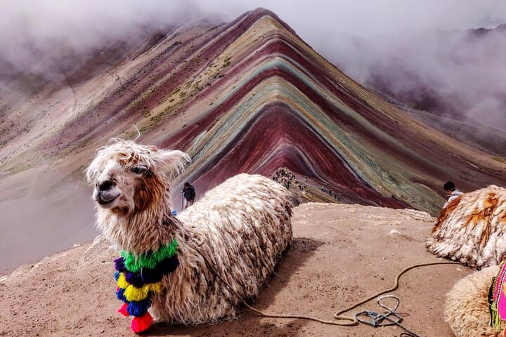
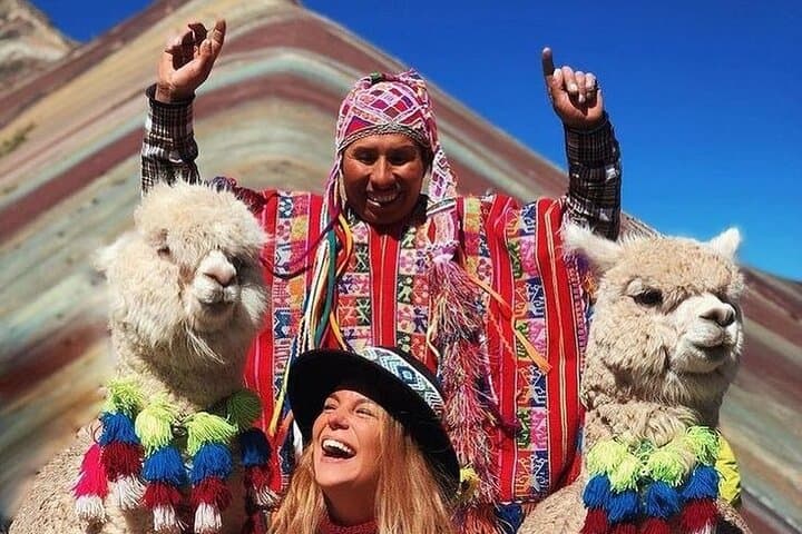
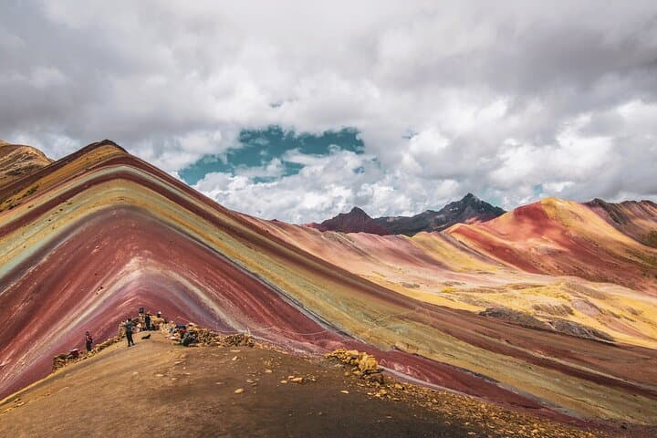
A pale dawn lifts off the high plain as the minivan threads its way south from Cusco, and by breakfast in Cusipata the air already tastes thin and cold. The trail from Phulawasipata climbs across puna grasslands and terraced farmland, past grazing alpacas and toward Apu Ausangate’s ragged skyline. At 5,200 meters the banded slopes of Vinicunca — the so‑called Rainbow Mountain — unfold in stripes of ochre, rose, and mint where iron, copper and clay minerals intersect.
A pale dawn lifts off the high plain as the minivan threads its way south from Cusco, and by breakfast in Cusipata the air already tastes thin and cold. The trail from Phulawasipata climbs across puna grasslands and terraced farmland, past grazing alpacas and toward Apu Ausangate’s ragged skyline. At 5,200 meters the banded slopes of Vinicunca — the so‑called Rainbow Mountain — unfold in stripes of ochre, rose, and mint where iron, copper and clay minerals intersect.
Geology here is blunt and readable: layered sedimentary tills and volcanic ash, uplifted by Andean orogeny and revealed by erosion and past glacial activity. The site sits within traditional Quechua territory; local communities revere Ausangate as an Apu (sacred mountain) and maintain herding and high‑alt agriculture in the valleys below.
Practically, expect a 12–13 hour day from Cusco with roughly 3–4 hours of walking roundtrip at high elevation. Trails range from packed dirt to loose scree; the ascent is steady rather than technical but altitude adds strain. Bring layered insulation, water, sun protection, and a slow pace to reduce symptoms of altitude sickness. Start early to avoid afternoon clouds, respect fencing and local guides, and limit time at the summit to reduce exposure to wind and cold.
Beyond the photo, the route offers quiet canyons, grazing camelids, and panoramic views of Ausangate’s glaciers. For responsible visitors: stay on established paths, carry out waste, and consider hiring local guides who help support nearby communities.