THE ADVENTURE COLLECTIVE® · Independent discovery and booking for outdoor travel

Drive the Cumbrian coast at your own pace with a 173-mile online route plan covering Morecambe Bay, the Furness Peninsula, Ravenglass, Whitehaven and Hadrian’s Wall. This web-based guide provides mapped stops, sample itineraries for 3–14 days and practical notes for tides, parking and ferries.
Drive the Cumbrian coast at your own pace with a 173-mile online route plan covering Morecambe Bay, the Furness Peninsula, Ravenglass, Whitehaven and Hadrian’s Wall. This web-based guide provides mapped stops, sample itineraries for 3–14 days and practical notes for tides, parking and ferries.
Pull up a map and feel the coast unfurl: salt-bright air off Morecambe Bay, cliffs at St. Bees that throw themselves into the Irish Sea, and the low industrial lines of Barrow giving way to glacial ridges as the route bends toward Hadrian’s Wall. This online guidebook lays out a 173-mile (278 km) point-to-point plan across 20 stops and four sections — a practical spine for a self-driven 3–14 day holiday.
Verified experiences and guided adventures in the surrounding area.
Operated by Uncover Britain Road Trips · Carlisle, Cumbria
Pull up a map and feel the coast unfurl: salt-bright air off Morecambe Bay, cliffs at St. Bees that throw themselves into the Irish Sea, and the low industrial lines of Barrow giving way to glacial ridges as the route bends toward Hadrian’s Wall. This online guidebook lays out a 173-mile (278 km) point-to-point plan across 20 stops and four sections — a practical spine for a self-driven 3–14 day holiday.
The coastline here is readable history: Roman stones along Hadrian’s Wall, medieval priory walls at Cartmel, and Victorian harbour engineering in Whitehaven. Geology is equally plain — glacially carved estuaries meet younger coastal sands and dramatic headlands where seabirds congregate. The culture alternates between quiet fishing villages, market towns like Ulverston and the food reputation of Cartmel, and industrial stories in Barrow-in-Furness.
Use the guide to choose sections, not a script. Each section includes pre-populated Google Map pins and suggested parking, plus sample daily plans for short or long stays. Practical notes: allow time for tides at Morecambe and Ravenglass estuary, expect single-track lanes and narrow village streets, and factor in ferry times if you want Piel Island. The plan is web-accessible with one account valid for 12 months — no download required — so it’s best used on a phone with offline map access and a car charger.
For first-timers, focus on pacing: combine a coastal walk, a short Lake District detour, and a Hadrian’s Wall visit in one section rather than trying to cover everything. The guide is a navigational companion and inspiration source — it shows what’s possible and leaves you the freedom to choose how far off-road you go.
easy.
3–14 days.
Suitable for all fitness levels; mostly driving with optional short walks on beaches, headlands, or trail sections.
One account licence gives 12 months of access from purchase so you can plan ahead or refer back after your trip.
The guide itself is not editable, but each section includes Google Maps with pre-set pins and directions you can copy into your own maps for customization.
The guide provides parking locations and practical tips, but parking fees and admission charges for museums or forts (e.g., some Hadrian’s Wall sites) are not included.
No — the published route uses surfaced public roads; however some minor lanes are narrow and may be uneven, so drive cautiously.
The route crosses Roman frontiers, Victorian ports, and older coastal fishing communities; Hadrian’s Wall marks the Roman isolation of northern Britain from the 2nd century.
Tidal flats and coastal lagoons are sensitive habitats — stick to marked paths, avoid disturbing bird colonies during breeding season, and take litter home.
Uncover Britain Road Trips operates guided outdoor trips and adventures with an emphasis on safety, stewardship, and memorable experiences.
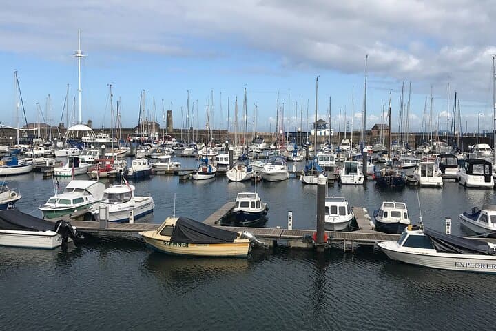


Pull up a map and feel the coast unfurl: salt-bright air off Morecambe Bay, cliffs at St. Bees that throw themselves into the Irish Sea, and the low industrial lines of Barrow giving way to glacial ridges as the route bends toward Hadrian’s Wall. This online guidebook lays out a 173-mile (278 km) point-to-point plan across 20 stops and four sections — a practical spine for a self-driven 3–14 day holiday.
Pull up a map and feel the coast unfurl: salt-bright air off Morecambe Bay, cliffs at St. Bees that throw themselves into the Irish Sea, and the low industrial lines of Barrow giving way to glacial ridges as the route bends toward Hadrian’s Wall. This online guidebook lays out a 173-mile (278 km) point-to-point plan across 20 stops and four sections — a practical spine for a self-driven 3–14 day holiday.
The coastline here is readable history: Roman stones along Hadrian’s Wall, medieval priory walls at Cartmel, and Victorian harbour engineering in Whitehaven. Geology is equally plain — glacially carved estuaries meet younger coastal sands and dramatic headlands where seabirds congregate. The culture alternates between quiet fishing villages, market towns like Ulverston and the food reputation of Cartmel, and industrial stories in Barrow-in-Furness.
Use the guide to choose sections, not a script. Each section includes pre-populated Google Map pins and suggested parking, plus sample daily plans for short or long stays. Practical notes: allow time for tides at Morecambe and Ravenglass estuary, expect single-track lanes and narrow village streets, and factor in ferry times if you want Piel Island. The plan is web-accessible with one account valid for 12 months — no download required — so it’s best used on a phone with offline map access and a car charger.
For first-timers, focus on pacing: combine a coastal walk, a short Lake District detour, and a Hadrian’s Wall visit in one section rather than trying to cover everything. The guide is a navigational companion and inspiration source — it shows what’s possible and leaves you the freedom to choose how far off-road you go.