THE ADVENTURE COLLECTIVE® · Independent discovery and booking for outdoor travel

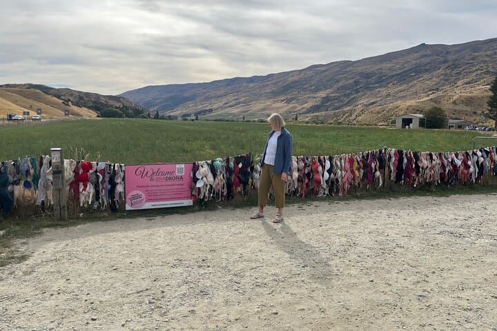
Drive New Zealand’s highest sealed alpine road on a compact, self-guided audio tour between Wānaka and Queenstown. Expect dramatic alpine views, gold-rush history in Arrowtown, and quirky roadside stops like the Cardrona Bra Fence.
Drive New Zealand’s highest sealed alpine road on a compact, self-guided audio tour between Wānaka and Queenstown. Expect dramatic alpine views, gold-rush history in Arrowtown, and quirky roadside stops like the Cardrona Bra Fence.
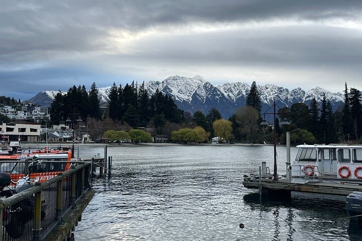
The road climbs before the view opens — a narrow ribbon of tarmac that pulls you up through tussock and scree to a high ridge, where wind and sky set the pace. From the driver’s seat, the Wakatipu Basin spreads below like a carved bowl; daylight sketches the Remarkables and the distant peaks of the Southern Alps.
Verified experiences and guided adventures in the surrounding area.
Operated by VoiceMap Audio Tours · Wānaka, Otago
The road climbs before the view opens — a narrow ribbon of tarmac that pulls you up through tussock and scree to a high ridge, where wind and sky set the pace. From the driver’s seat, the Wakatipu Basin spreads below like a carved bowl; daylight sketches the Remarkables and the distant peaks of the Southern Alps.
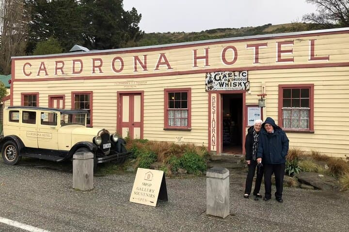
This two-hour self-guided audio drive stitches together Māori travel routes, gold-rush stories and 19th-century settlement. The Crown Range is New Zealand’s highest sealed road, carved through grey schist and glacial deposits, and punctuated by the iconic Cardrona Hotel — an 1860s watering hole whose weathered façade still keeps a ledger of travelers. Arrowtown’s restored miners’ cottages and the Chinese Settlement speak plainly of the region’s boom era and multicultural past.
Geology here is visible: steep, folded schist faces, moraine-topped benches, and alluvial river flats where miners once sluiced for gold. Culture sits in smaller details — braids of remembrance at Cardrona, boutique cafés in Arrowtown, and local ski lore at Coronet Peak.
Practical guidance is simple: allow two to two-and-a-half hours for a direct run, more if you stop. The route includes narrow alpine sections where weather changes fast — carry a charged phone with offline maps, watch for single-lane bridges and give way at marked pullouts. Fuel and daylight matter; after winter storms the Crown Range can be closed or icy. Use the audio guide to pace your stops: take short walks at the summit lookout, stretch beside the Arrow River, and leave time in Queenstown to explore the lakeside energy. Respect private property and local signage, and the landscape will reward you with clear light, sharp air, and views that push onward.
easy.
2–2.5 hours.
No special fitness required beyond the ability to step in and out of the car for short walks and photos.
The direct drive is about 2–2.5 hours; with stops in Cardrona and Arrowtown plan 4–6 hours depending on how long you linger.
It can be icy or snow-covered; chains may be required and sections can close — check road conditions and consider an alternative route in severe weather.
Yes — the audio tour works in either direction and covers the same points of interest; choose the direction that fits your schedule and light for photos.
Cardrona and Arrowtown have cafés and services, but fuel stations are limited — fill up before you leave the main towns.
The route follows Māori travel corridors later used by goldrush miners; Arrowtown preserves many 1860s buildings tied to Otago’s mining boom.
Stay on formed roads and tracks, pack out waste, and avoid driving on fragile alpine tussock to prevent erosion and protect native plants.
VoiceMap Audio Tours operates guided outdoor trips and adventures with an emphasis on safety, stewardship, and memorable experiences.

The road climbs before the view opens — a narrow ribbon of tarmac that pulls you up through tussock and scree to a high ridge, where wind and sky set the pace. From the driver’s seat, the Wakatipu Basin spreads below like a carved bowl; daylight sketches the Remarkables and the distant peaks of the Southern Alps.
The road climbs before the view opens — a narrow ribbon of tarmac that pulls you up through tussock and scree to a high ridge, where wind and sky set the pace. From the driver’s seat, the Wakatipu Basin spreads below like a carved bowl; daylight sketches the Remarkables and the distant peaks of the Southern Alps.
This two-hour self-guided audio drive stitches together Māori travel routes, gold-rush stories and 19th-century settlement. The Crown Range is New Zealand’s highest sealed road, carved through grey schist and glacial deposits, and punctuated by the iconic Cardrona Hotel — an 1860s watering hole whose weathered façade still keeps a ledger of travelers. Arrowtown’s restored miners’ cottages and the Chinese Settlement speak plainly of the region’s boom era and multicultural past.
Geology here is visible: steep, folded schist faces, moraine-topped benches, and alluvial river flats where miners once sluiced for gold. Culture sits in smaller details — braids of remembrance at Cardrona, boutique cafés in Arrowtown, and local ski lore at Coronet Peak.
Practical guidance is simple: allow two to two-and-a-half hours for a direct run, more if you stop. The route includes narrow alpine sections where weather changes fast — carry a charged phone with offline maps, watch for single-lane bridges and give way at marked pullouts. Fuel and daylight matter; after winter storms the Crown Range can be closed or icy. Use the audio guide to pace your stops: take short walks at the summit lookout, stretch beside the Arrow River, and leave time in Queenstown to explore the lakeside energy. Respect private property and local signage, and the landscape will reward you with clear light, sharp air, and views that push onward.