THE ADVENTURE COLLECTIVE® · Independent discovery and booking for outdoor travel

Race through Madison’s State Street, lakeside parks, and quiet alleys with the Crazy Dash app. This relaxed, two-hour scavenger hunt blends urban history, local culture, and photo challenges—perfect for groups and families who want a playful city tour.
Race through Madison’s State Street, lakeside parks, and quiet alleys with the Crazy Dash app. This relaxed, two-hour scavenger hunt blends urban history, local culture, and photo challenges—perfect for groups and families who want a playful city tour.
You tap the app on your phone and the Capitol dome looms ahead, white stone catching late-afternoon light. Teams scatter across State Street, cameras up, chasing clues that send you into alleys, along the Yahara, and past college bookstores. The game moves at your pace—no strict clock—so you can linger at a mural or sprint for points.
Verified experiences and guided adventures in the surrounding area.
Operated by Crazy Dash Digital Adventures · Madison, Wisconsin
You tap the app on your phone and the Capitol dome looms ahead, white stone catching late-afternoon light. Teams scatter across State Street, cameras up, chasing clues that send you into alleys, along the Yahara, and past college bookstores. The game moves at your pace—no strict clock—so you can linger at a mural or sprint for points.
Madison sits on a glacial isthmus between Lakes Mendota and Monona; that geology shaped the city grid and the waterfronts you’ll cross. The Dane County scene mixes university energy with Midwestern civic pride—farmers markets, political rallies, and public art are common finds during your route. Indigenous Ho-Chunk history predates the grid; interpretive signs and place names nod to that deeper story.
As you play, the city’s layers reveal themselves: the limestone and concrete of the Capitol, the tree-lined hum of university neighborhoods, and the smaller currents of the Yahara River daring you to explore its bridges. Local cafés and pocket parks become checkpoints; Monona Terrace and Olbrich Gardens sit near likely clue clusters.
Practical essentials: download the Crazy Dash app ahead of time, charge your phone, and enable GPS. The game takes about two hours and is walkable on mostly paved surfaces—suitable for casual walkers and families. Public transit and bike-share are nearby; dress in layers for Wisconsin’s quick weather swings and carry a portable battery if you plan on heavy photo use. A remote host is on chat if you need help, and cancellations are allowed up to 24 hours prior. This is a low-stress way to see Madison with a playful, local twist.
easy.
2 hours.
Suitable for most fitness levels; expect 1.5–3 miles of walking depending on route choices
You’ll receive a message before your scheduled time with instructions and a link to start the game; if you don’t, contact the operator at the provided phone number.
Yes—this Crazy Dash is easy-paced and stroller-accessible, with content appropriate for families.
No—bookings are private for your party, but you can play solo, as a couple, or with a small team; the format is flexible.
For a full refund cancel at least 24 hours before the scheduled departure time; same-day cancellations are not refundable.
Madison was laid out on an isthmus between two glacial lakes and named for President James Madison; the city’s public spaces reflect a long civic tradition tied to the state capitol.
Madison emphasizes bike infrastructure, lake management, and community cleanups—stick to paths and pack out trash to support local conservation efforts.
Crazy Dash Digital Adventures operates guided outdoor trips and adventures with an emphasis on safety, stewardship, and memorable experiences.


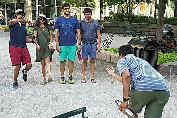

You tap the app on your phone and the Capitol dome looms ahead, white stone catching late-afternoon light. Teams scatter across State Street, cameras up, chasing clues that send you into alleys, along the Yahara, and past college bookstores. The game moves at your pace—no strict clock—so you can linger at a mural or sprint for points.
You tap the app on your phone and the Capitol dome looms ahead, white stone catching late-afternoon light. Teams scatter across State Street, cameras up, chasing clues that send you into alleys, along the Yahara, and past college bookstores. The game moves at your pace—no strict clock—so you can linger at a mural or sprint for points.
Madison sits on a glacial isthmus between Lakes Mendota and Monona; that geology shaped the city grid and the waterfronts you’ll cross. The Dane County scene mixes university energy with Midwestern civic pride—farmers markets, political rallies, and public art are common finds during your route. Indigenous Ho-Chunk history predates the grid; interpretive signs and place names nod to that deeper story.
As you play, the city’s layers reveal themselves: the limestone and concrete of the Capitol, the tree-lined hum of university neighborhoods, and the smaller currents of the Yahara River daring you to explore its bridges. Local cafés and pocket parks become checkpoints; Monona Terrace and Olbrich Gardens sit near likely clue clusters.
Practical essentials: download the Crazy Dash app ahead of time, charge your phone, and enable GPS. The game takes about two hours and is walkable on mostly paved surfaces—suitable for casual walkers and families. Public transit and bike-share are nearby; dress in layers for Wisconsin’s quick weather swings and carry a portable battery if you plan on heavy photo use. A remote host is on chat if you need help, and cancellations are allowed up to 24 hours prior. This is a low-stress way to see Madison with a playful, local twist.