THE ADVENTURE COLLECTIVE® · Independent discovery and booking for outdoor travel

A 7-day, GPS-driven self-guided tour and treasure hunt across County Londonderry that blends city walking, countryside drives, and location-based quizzes. Use one ticket on a single device to unlock local sites, solve clues, and collect points at your own pace.
A 7-day, GPS-driven self-guided tour and treasure hunt across County Londonderry that blends city walking, countryside drives, and location-based quizzes. Use one ticket on a single device to unlock local sites, solve clues, and collect points at your own pace.
You open the app in the car as the city walls of Derry/Londonderry thin into rolling pasture and low stone walls. The screen pins bloom like a handful of discoveries — a riverside mural, a lonely mill, a viewpoint that looks out over lough and farmland — and the route nudges you toward each one, tasking you to read, answer, or photograph what you find.
Verified experiences and guided adventures in the surrounding area.
Operated by City Break by Cluecation · Derry / Londonderry, County Londonderry
You open the app in the car as the city walls of Derry/Londonderry thin into rolling pasture and low stone walls. The screen pins bloom like a handful of discoveries — a riverside mural, a lonely mill, a viewpoint that looks out over lough and farmland — and the route nudges you toward each one, tasking you to read, answer, or photograph what you find.
This self-guided experience folds modern GPS play into a landscape shaped by glaciation and centuries of settlement. County Londonderry’s drumlins and river channels taught early farmers where to sit fields; its walled city recalls 17th-century military engineering and a resilient urban culture. The app’s clues point to civic art, narrow alleyways, and lesser-known estates as much as to major sites, giving a local cultural thread to each stop.
Expect mixed modes: urban walking around the walled city, short countryside hops by car, and light trail sections across grassy tracks. Terrain is generally easy underfoot but can be muddy after rain. Play at your own pace — the 7‑day pass lets you spread challenges across multiple outings.
Practical guidance: carry a charged smartphone and a power bank, wear waterproof layers and sturdy shoes, and keep mobile data for real-time GPS. Start puzzles mid-morning to avoid low light and pack snacks for rural stretches. Respect private land and local signage; clues will usually direct you to public access points.
This is an exploratory tool, not a guided tour — it replaces rote planning with curiosity, pushing you toward local eyes and off-the-beaten-path moments while giving practical flexibility for families and independent travelers.
easy.
2–4 hours per session.
Suitable for people with light walking fitness; able to manage short urban walks and brief countryside trails.
The ticket grants access for seven consecutive days from first use, with unlimited play on that single device during the period.
Yes — one ticket allows access on a single device that your group can share; everyone can participate using that device.
Active mobile data is recommended for real-time GPS and map tiles, though some apps allow limited offline caching if prepared in advance.
Many urban pins and promenades are stroller-accessible, but some countryside stops include uneven ground — check specific pins in the app before attempting.
Londonderry’s 17th-century walls and later civic murals reflect a history of military architecture, trade, and strong local identity; rural lanes reveal older agrarian patterns laid over glacial landscapes.
Stick to marked public access routes and follow Leave No Trace principles; rural lanes and wetlands are sensitive habitats, especially for ground-nesting birds in spring.
City Break by Cluecation operates guided outdoor trips and adventures with an emphasis on safety, stewardship, and memorable experiences.

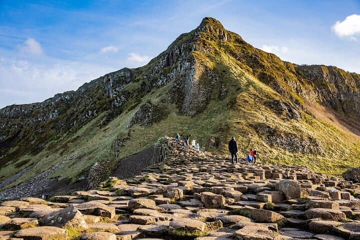


You open the app in the car as the city walls of Derry/Londonderry thin into rolling pasture and low stone walls. The screen pins bloom like a handful of discoveries — a riverside mural, a lonely mill, a viewpoint that looks out over lough and farmland — and the route nudges you toward each one, tasking you to read, answer, or photograph what you find.
You open the app in the car as the city walls of Derry/Londonderry thin into rolling pasture and low stone walls. The screen pins bloom like a handful of discoveries — a riverside mural, a lonely mill, a viewpoint that looks out over lough and farmland — and the route nudges you toward each one, tasking you to read, answer, or photograph what you find.
This self-guided experience folds modern GPS play into a landscape shaped by glaciation and centuries of settlement. County Londonderry’s drumlins and river channels taught early farmers where to sit fields; its walled city recalls 17th-century military engineering and a resilient urban culture. The app’s clues point to civic art, narrow alleyways, and lesser-known estates as much as to major sites, giving a local cultural thread to each stop.
Expect mixed modes: urban walking around the walled city, short countryside hops by car, and light trail sections across grassy tracks. Terrain is generally easy underfoot but can be muddy after rain. Play at your own pace — the 7‑day pass lets you spread challenges across multiple outings.
Practical guidance: carry a charged smartphone and a power bank, wear waterproof layers and sturdy shoes, and keep mobile data for real-time GPS. Start puzzles mid-morning to avoid low light and pack snacks for rural stretches. Respect private land and local signage; clues will usually direct you to public access points.
This is an exploratory tool, not a guided tour — it replaces rote planning with curiosity, pushing you toward local eyes and off-the-beaten-path moments while giving practical flexibility for families and independent travelers.