THE ADVENTURE COLLECTIVE® · Independent discovery and booking for outdoor travel

A full-day drive from Quito brings you to Cotopaxi National Park where Limpiopungo’s calm waters sit beneath one of the Andes’ most dramatic cones. Expect high-altitude páramo, quick hikes, and sweeping volcano views — with an optional climb to the José Rivas refuge for acclimatized hikers.
A full-day drive from Quito brings you to Cotopaxi National Park where Limpiopungo’s calm waters sit beneath one of the Andes’ most dramatic cones. Expect high-altitude páramo, quick hikes, and sweeping volcano views — with an optional climb to the José Rivas refuge for acclimatized hikers.
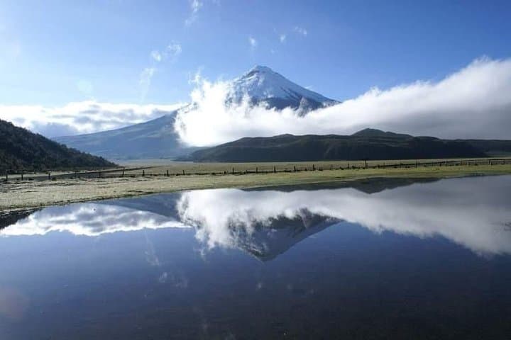
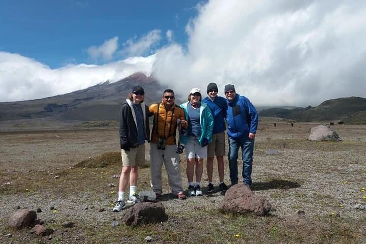
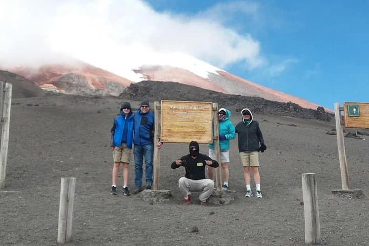
You step from the van into a cold, thin air that sharpens every sound — wind across the páramo, the distant scrape of gravel under boot. Cotopaxi towers ahead, cone white near the summit, its slopes holding weather like a mood. A short walk around Limpiopungo places the lake at your feet, a glassy counterpoint to the volcano’s austere profile.
Verified experiences and guided adventures in the surrounding area.
Operated by Great Horned Owl Tours · Latacunga, Cotopaxi
You step from the van into a cold, thin air that sharpens every sound — wind across the páramo, the distant scrape of gravel under boot. Cotopaxi towers ahead, cone white near the summit, its slopes holding weather like a mood. A short walk around Limpiopungo places the lake at your feet, a glassy counterpoint to the volcano’s austere profile.
Geology here reads like an open page: Cotopaxi is one of the world’s highest active stratovolcanoes, rising to about 5,897 m (19,347 ft). The páramo ecosystem that frames the lake is young, sculpted by volcanic soils and persistent winds; it supports a distinct plant and bird community used historically by Kichwa communities for grazing and ritual passage. Many tours approach from Quito along the Avenue of the Volcanoes, giving a corridor view of snow-capped peaks that trace the spine of the Andes.
On the ground the hike around Limpiopungo is gentle — roughly an hour on mostly flat, rocky trail at 3,845 m (12,600 ft) — but altitude is the real variable. Guides commonly offer coca tea and a short market stop near the park entrance. For those with time and acclimatization, an optional ascent to the José Rivas refuge (4,800 m) is a brisk, high-altitude effort: plan on steep, loose footing and thin air for the two-hour round trip.
Practical guidance: dress in layers, carry water and sun protection, pace yourself and prioritize acclimatization. Weather changes fast; allow extra time for visibility shifts and stick to marked trails to protect fragile páramo and preserve the views you came for.
moderate.
7 hours.
Moderate cardiovascular fitness recommended; ability to hike on uneven ground at altitude is required.
The loop takes about 45–60 minutes on mostly flat, rocky terrain at 3,845 m; allow extra time for birding and photo stops.
Yes — it reaches 4,800 m and involves steep, loose footing; it’s suitable for acclimatized hikers with good fitness and no cardiovascular issues.
This tour’s description lists transportation and bottled water; visitors should confirm whether park fees are included when booking.
Not recommended — the tour provider advises against participation for pregnant travelers and those with heart conditions due to high altitude.
Local Kichwa communities have long used the slopes for grazing and ritual pathways; the Avenue of the Volcanoes was documented by 19th-century explorers and remains a prominent travel corridor.
The páramo is fragile and slow to recover; follow Leave No Trace, avoid collecting plants, and use marked trails to minimize erosion.
Great Horned Owl Tours operates guided outdoor trips and adventures with an emphasis on safety, stewardship, and memorable experiences.
You step from the van into a cold, thin air that sharpens every sound — wind across the páramo, the distant scrape of gravel under boot. Cotopaxi towers ahead, cone white near the summit, its slopes holding weather like a mood. A short walk around Limpiopungo places the lake at your feet, a glassy counterpoint to the volcano’s austere profile.
You step from the van into a cold, thin air that sharpens every sound — wind across the páramo, the distant scrape of gravel under boot. Cotopaxi towers ahead, cone white near the summit, its slopes holding weather like a mood. A short walk around Limpiopungo places the lake at your feet, a glassy counterpoint to the volcano’s austere profile.
Geology here reads like an open page: Cotopaxi is one of the world’s highest active stratovolcanoes, rising to about 5,897 m (19,347 ft). The páramo ecosystem that frames the lake is young, sculpted by volcanic soils and persistent winds; it supports a distinct plant and bird community used historically by Kichwa communities for grazing and ritual passage. Many tours approach from Quito along the Avenue of the Volcanoes, giving a corridor view of snow-capped peaks that trace the spine of the Andes.
On the ground the hike around Limpiopungo is gentle — roughly an hour on mostly flat, rocky trail at 3,845 m (12,600 ft) — but altitude is the real variable. Guides commonly offer coca tea and a short market stop near the park entrance. For those with time and acclimatization, an optional ascent to the José Rivas refuge (4,800 m) is a brisk, high-altitude effort: plan on steep, loose footing and thin air for the two-hour round trip.
Practical guidance: dress in layers, carry water and sun protection, pace yourself and prioritize acclimatization. Weather changes fast; allow extra time for visibility shifts and stick to marked trails to protect fragile páramo and preserve the views you came for.