THE ADVENTURE COLLECTIVE® · Independent discovery and booking for outdoor travel

See two of Ecuador’s most dramatic volcanic landscapes in one long day: Cotopaxi’s snow-brimmed cone and Quilotoa’s jewel-toned crater. Practical route details, elevation notes and local insights to help you plan the high-altitude trip.
See two of Ecuador’s most dramatic volcanic landscapes in one long day: Cotopaxi’s snow-brimmed cone and Quilotoa’s jewel-toned crater. Practical route details, elevation notes and local insights to help you plan the high-altitude trip.
A cold wind cuts off the high plain as the van climbs out of Quito and the city’s hum becomes a distant echo. By midmorning you stand at Limpiopungo’s edge—wind-swept grasses, a shallow lagoon at 3,900 m, and the cone of Cotopaxi pressing the sky. Later the road falls away to a green bowl that hides Quilotoa’s aquamarine crater, a water-filled caldera rimmed by steep trails.
Verified experiences and guided adventures in the surrounding area.
Operated by Galapagos My World · Quilotoa, Cotopaxi
A cold wind cuts off the high plain as the van climbs out of Quito and the city’s hum becomes a distant echo. By midmorning you stand at Limpiopungo’s edge—wind-swept grasses, a shallow lagoon at 3,900 m, and the cone of Cotopaxi pressing the sky. Later the road falls away to a green bowl that hides Quilotoa’s aquamarine crater, a water-filled caldera rimmed by steep trails.
Both landscapes tell volcanic stories: Cotopaxi is a stratovolcano sculpted by repeated eruptions and glacial trimming, Quilotoa a collapsed caldera stained by dissolved minerals. The region is dominated by páramo—high-altitude grassland that local Kichwa communities have grazed and farmed for generations. En route you’ll pass fields of corn, potatoes and barley and small artisan stalls where wool and carved gourds reveal local craft and cuisine.
The walking is straightforward but high: Limpiopungo’s loop is an easy 1–2 km and largely flat; Quilotoa’s rim-to-lake trail drops roughly 350–450 m over 1.5–2 km and is steep on the return. Expect loose volcanic scree, strong sun and sudden wind. The full-day itinerary runs about 10 hours with two drives (Quito→Cotopaxi ~77 km) and time to hike, photograph and have lunch.
Practical edge: acclimatize in Quito (2,800–2,900 m) before tackling the 3,800–4,000 m stops, bring layered insulation and sun protection, carry 1–2 liters of water, and budget small change for local mule rentals or crafts. Midday offers the best light for Quilotoa’s colors; mornings are clearer at Cotopaxi.
moderate.
10 hours.
Requires moderate fitness: short hikes with a steep 350–450 m descent/ascent at high altitude; comfortable walking at high elevation recommended.
The rim-to-lake trail descends roughly 350–450 m over 1.5–2 km; the descent is quicker but the return is steep—expect 1–1.5 hours round-trip depending on pace.
Possibly—you move between Quito (≈2,900 m) and sites at 3,800–4,000 m; rest, hydrate, avoid alcohol and consider coca tea for mild symptoms; seek medical help for severe signs.
On this tour the itinerary notes admission is included, but confirm with the operator before travel if you plan to join independently.
Yes—locals commonly rent mules to assist the steep return; bring cash if you may need this option.
The highlands are shaped by repeated volcanic activity and long-settled by Kichwa (Quichua) communities whose farming and craft traditions continue along the route.
The páramo ecosystem is fragile—stay on trails, pack out trash, and avoid disturbing grazing areas and archaeological features.
Galapagos My World operates guided outdoor trips and adventures with an emphasis on safety, stewardship, and memorable experiences.
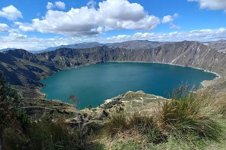
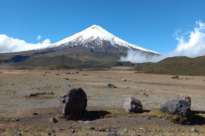
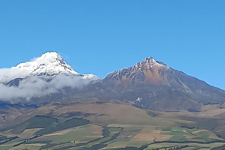
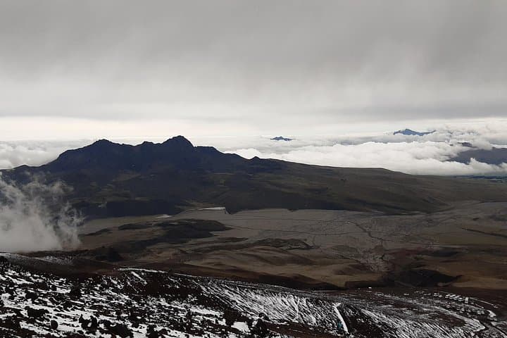
A cold wind cuts off the high plain as the van climbs out of Quito and the city’s hum becomes a distant echo. By midmorning you stand at Limpiopungo’s edge—wind-swept grasses, a shallow lagoon at 3,900 m, and the cone of Cotopaxi pressing the sky. Later the road falls away to a green bowl that hides Quilotoa’s aquamarine crater, a water-filled caldera rimmed by steep trails.
A cold wind cuts off the high plain as the van climbs out of Quito and the city’s hum becomes a distant echo. By midmorning you stand at Limpiopungo’s edge—wind-swept grasses, a shallow lagoon at 3,900 m, and the cone of Cotopaxi pressing the sky. Later the road falls away to a green bowl that hides Quilotoa’s aquamarine crater, a water-filled caldera rimmed by steep trails.
Both landscapes tell volcanic stories: Cotopaxi is a stratovolcano sculpted by repeated eruptions and glacial trimming, Quilotoa a collapsed caldera stained by dissolved minerals. The region is dominated by páramo—high-altitude grassland that local Kichwa communities have grazed and farmed for generations. En route you’ll pass fields of corn, potatoes and barley and small artisan stalls where wool and carved gourds reveal local craft and cuisine.
The walking is straightforward but high: Limpiopungo’s loop is an easy 1–2 km and largely flat; Quilotoa’s rim-to-lake trail drops roughly 350–450 m over 1.5–2 km and is steep on the return. Expect loose volcanic scree, strong sun and sudden wind. The full-day itinerary runs about 10 hours with two drives (Quito→Cotopaxi ~77 km) and time to hike, photograph and have lunch.
Practical edge: acclimatize in Quito (2,800–2,900 m) before tackling the 3,800–4,000 m stops, bring layered insulation and sun protection, carry 1–2 liters of water, and budget small change for local mule rentals or crafts. Midday offers the best light for Quilotoa’s colors; mornings are clearer at Cotopaxi.