
Cotopaxi Private Day Tour from Quito: Drive, Laguna Limpiopungo & José Rivas Hike
A private full-day drive from Quito into Cotopaxi National Park that mixes scenic viewpoints, a reflective highland lagoon, and a high-altitude hike to the José Rivas Refuge. Ideal for travelers who want flexible pacing and close-up volcano views without a summit attempt.
An Adventure In Quito.
A private full-day drive from Quito into Cotopaxi National Park that mixes scenic viewpoints, a reflective highland lagoon, and a high-altitude hike to the José Rivas Refuge. Ideal for travelers who want flexible pacing and close-up volcano views without a summit attempt.
Read the full experience
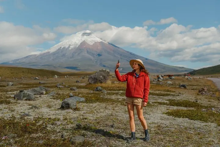
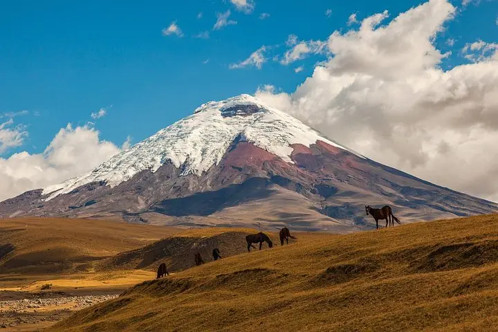
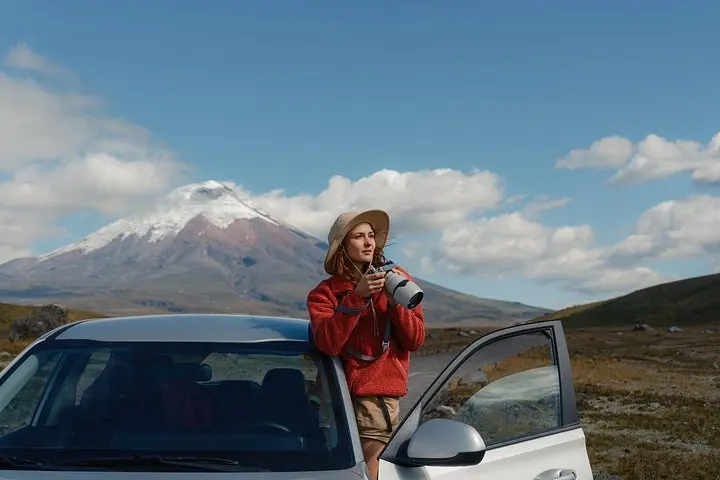
You step out of the private vehicle into thin, cold air and the volcano fills the horizon—white-capped cone rising above a band of wind-scoured páramo. The road from Quito slips through agricultural valleys and volcanic ridges until the national park gate opens onto sweeping grasslands and the first viewpoint of Cotopaxi's near-perfect cone.
You step out of the private vehicle into thin, cold air and the volcano fills the horizon—white-capped cone rising above a band of wind-scoured páramo. The road from Quito slips through agricultural valleys and volcanic ridges until the national park gate opens onto sweeping grasslands and the first viewpoint of Cotopaxi's near-perfect cone.
Cotopaxi National Park sits on the Andean volcanic axis; its glaciated summit (5,897 m) and the volcanic soils around it record recent geological unrest and Pleistocene glacial sculpting. Nearby Laguna de Limpiopungo lies at roughly 3,800–3,900 m, a calm mirror for migrating waterfowl and the lower slopes’ rolling volcanic ridges. The José Rivas Refuge, perched around 4,800 m, was established as a shelter and acclimatization point for climbers attempting higher routes, and offers expansive views of Cotopaxi, Rumiñahui and Sangay on clear days.
Expect high-altitude páramo terrain: tussock grasses, volcanic scree, and compacted dirt tracks. Typical guided hiking to the José Rivas Refuge is a steep 3–5 km outing (round-trip distances vary by starting point) with roughly 400–600 m elevation gain and 3–4 hours of walking time within the day’s 8–12 hour itinerary.
Practical guidance: dress in breathable layers, prioritize slow pacing to manage altitude, and sip fluids regularly. Sun is intense above 3,500 m—wide-brim protection and SPF are essential. With a private guide and vehicle you gain flexibility for photo stops at viewpoints and the lagoon; plan for early starts from Quito to catch clearer mountain light and lower winds in the morning.
Frequently asked questions
Expect about 1.5–2 hours each way depending on traffic and your pickup location in Quito.
Entrance fees are typically included with guided tours; independent visitors pay a park entry fee at the gate.
No—reaching the refuge is a non-technical high-altitude hike, but the terrain can be steep with loose volcanic scree.
Common issues include headache, dizziness and shortness of breath; acclimatize beforehand, hydrate, rest, and descend if symptoms worsen.
About This Experience
Opatrip Ecuador operates guided outdoor trips and adventures with an emphasis on safety, stewardship, and memorable experiences.
Adventure tips
Recommended gear
- Sturdy hiking boots: Support and traction for steep, rocky and scree-covered sections on the approach to the refuge.
- Insulating mid-layer + windproof shell: Keeps you warm against sharp temperature drops and cutting winds at higher elevations.
- Sun protection (hat, sunglasses, SPF): High-altitude UV is intense year-round—protect exposed skin and eyes during open-plateau stretches.
- Hydration system (1–2 L) and snacks: Regular, small sips and quick-energy snacks help manage altitude effects and sustain effort on steep sections.
Photos of the experience
Related adventures & guides
Read the full experience
You step out of the private vehicle into thin, cold air and the volcano fills the horizon—white-capped cone rising above a band of wind-scoured páramo. The road from Quito slips through agricultural valleys and volcanic ridges until the national park gate opens onto sweeping grasslands and the first viewpoint of Cotopaxi's near-perfect cone.
You step out of the private vehicle into thin, cold air and the volcano fills the horizon—white-capped cone rising above a band of wind-scoured páramo. The road from Quito slips through agricultural valleys and volcanic ridges until the national park gate opens onto sweeping grasslands and the first viewpoint of Cotopaxi's near-perfect cone.
Cotopaxi National Park sits on the Andean volcanic axis; its glaciated summit (5,897 m) and the volcanic soils around it record recent geological unrest and Pleistocene glacial sculpting. Nearby Laguna de Limpiopungo lies at roughly 3,800–3,900 m, a calm mirror for migrating waterfowl and the lower slopes’ rolling volcanic ridges. The José Rivas Refuge, perched around 4,800 m, was established as a shelter and acclimatization point for climbers attempting higher routes, and offers expansive views of Cotopaxi, Rumiñahui and Sangay on clear days.
Expect high-altitude páramo terrain: tussock grasses, volcanic scree, and compacted dirt tracks. Typical guided hiking to the José Rivas Refuge is a steep 3–5 km outing (round-trip distances vary by starting point) with roughly 400–600 m elevation gain and 3–4 hours of walking time within the day’s 8–12 hour itinerary.
Practical guidance: dress in breathable layers, prioritize slow pacing to manage altitude, and sip fluids regularly. Sun is intense above 3,500 m—wide-brim protection and SPF are essential. With a private guide and vehicle you gain flexibility for photo stops at viewpoints and the lagoon; plan for early starts from Quito to catch clearer mountain light and lower winds in the morning.
Make a day of it nearby.
Verified experiences and guided adventures in the surrounding area.