THE ADVENTURE COLLECTIVE® · Independent discovery and booking for outdoor travel

A compact two-day loop from Quito that pairs Cotopaxi’s snow-capped cone with Quilotoa’s turquoise crater lake. Expect high-altitude hiking, sweeping páramo views, and cultural stops at community viewpoints and Tigua artisan workshops.
A compact two-day loop from Quito that pairs Cotopaxi’s snow-capped cone with Quilotoa’s turquoise crater lake. Expect high-altitude hiking, sweeping páramo views, and cultural stops at community viewpoints and Tigua artisan workshops.
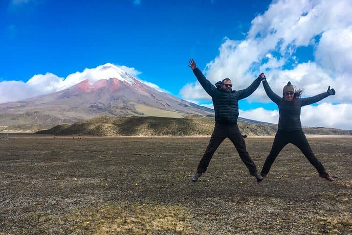
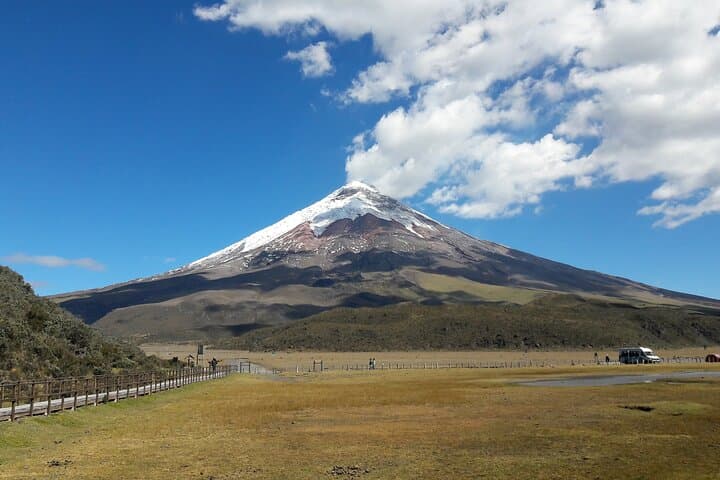
They load the minivan at dawn in Quito and you watch the city fall away as the páramo opens—grasslands rolling under a sky sharpened by altitude. Cotopaxi’s cone appears like a blunt thumb against the air; steam and snow still mark the summit while winds push the layered clouds across the crater.
Verified experiences and guided adventures in the surrounding area.
Operated by Best Trip Ecuador · Quito, Pichincha
They load the minivan at dawn in Quito and you watch the city fall away as the páramo opens—grasslands rolling under a sky sharpened by altitude. Cotopaxi’s cone appears like a blunt thumb against the air; steam and snow still mark the summit while winds push the layered clouds across the crater.
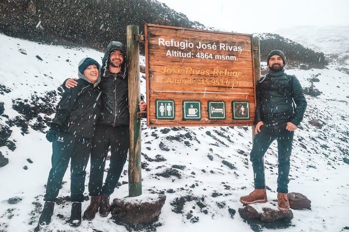
This two-day route threads two of Ecuador’s most dramatic volcanic sites. Cotopaxi (5,897 m) dominates a high-altitude landscape shaped by repeated eruptions and glacial sculpting; Limpiopungo lagoon reflects the volcano’s slope and hosts Andean waterfowl. The José Rivas refuge, built in the 1970s by local mountaineers, sits high on the volcano’s flank as a waypoint for climbers and a marker of the region’s long alpinist culture.
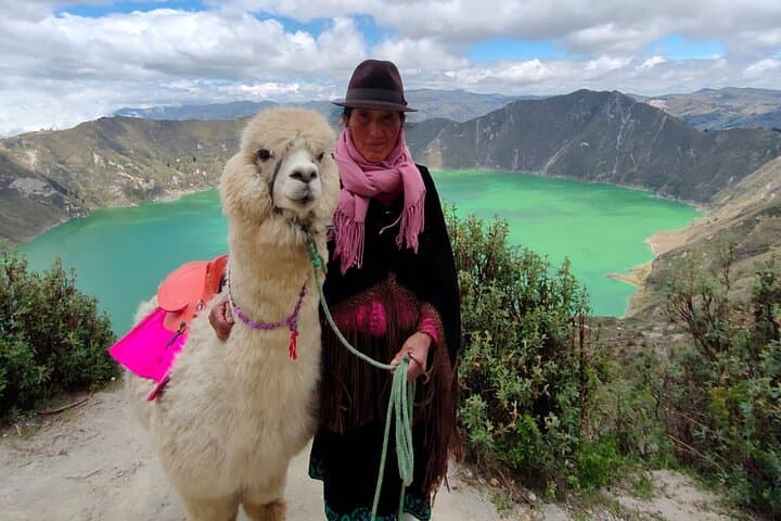
On day two the tour descends into the Quilotoa caldera: a dormant crater whose turquoise lake owes its color to mineral deposits and light. Community-built viewpoints like Shalalá use local materials and modern design to frame the rim, and nearby Tigua artisans keep pre-Columbian painting traditions alive with sheep-skin canvases and carved masks.
Practical edge: altitude is the defining variable—expect thin air, strong sun, and sudden wind. Wear firm hiking shoes, layer for cold and wind, and move deliberately on steep crater trails; mules are commonly available for the steep ascent at Quilotoa if needed. Carry water, sunscreen, and your passport if you want the José Rivas stamp. Plan daylight hiking windows, and allow time for acclimatization—this trip rewards steady pacing as much as ambition.
challenging.
2 days.
Good aerobic fitness and some experience with high-elevation hiking; expect reduced stamina due to thin air.
The refuge is roughly an hour's walk from the parking area at high elevation; the trail is steep and tiring mainly because of altitude rather than technical difficulty.
Yes—local communities commonly offer mule rides for the steep ascent from the lake to the rim, which is useful for those with limited fitness or previous injuries.
Guides often recommend bringing your passport to receive a commemorative stamp at the refuge, though it is not mandatory for park access.
This tour is not recommended for pregnant travelers or those with cardiovascular issues due to high altitude and physical exertion.
Cotopaxi and Quilotoa occupy long-inhabited Andean landscapes where volcanic activity shaped settlement patterns; the José Rivas refuge was established by local climbers in the 1970s.
Both sites are managed with visitor limits and community projects; stick to marked trails, avoid feeding wildlife, and support local artisans to keep tourism benefits local.
Best Trip Ecuador operates guided outdoor trips and adventures with an emphasis on safety, stewardship, and memorable experiences.
They load the minivan at dawn in Quito and you watch the city fall away as the páramo opens—grasslands rolling under a sky sharpened by altitude. Cotopaxi’s cone appears like a blunt thumb against the air; steam and snow still mark the summit while winds push the layered clouds across the crater.
They load the minivan at dawn in Quito and you watch the city fall away as the páramo opens—grasslands rolling under a sky sharpened by altitude. Cotopaxi’s cone appears like a blunt thumb against the air; steam and snow still mark the summit while winds push the layered clouds across the crater.
This two-day route threads two of Ecuador’s most dramatic volcanic sites. Cotopaxi (5,897 m) dominates a high-altitude landscape shaped by repeated eruptions and glacial sculpting; Limpiopungo lagoon reflects the volcano’s slope and hosts Andean waterfowl. The José Rivas refuge, built in the 1970s by local mountaineers, sits high on the volcano’s flank as a waypoint for climbers and a marker of the region’s long alpinist culture.
On day two the tour descends into the Quilotoa caldera: a dormant crater whose turquoise lake owes its color to mineral deposits and light. Community-built viewpoints like Shalalá use local materials and modern design to frame the rim, and nearby Tigua artisans keep pre-Columbian painting traditions alive with sheep-skin canvases and carved masks.
Practical edge: altitude is the defining variable—expect thin air, strong sun, and sudden wind. Wear firm hiking shoes, layer for cold and wind, and move deliberately on steep crater trails; mules are commonly available for the steep ascent at Quilotoa if needed. Carry water, sunscreen, and your passport if you want the José Rivas stamp. Plan daylight hiking windows, and allow time for acclimatization—this trip rewards steady pacing as much as ambition.