THE ADVENTURE COLLECTIVE® · Independent discovery and booking for outdoor travel

Short on time but craving desert drama? The Copper Mile is a 3-mile guided loop east of Phoenix that combines wild-horse sightings, a climb to red-rock viewpoints, and an abandoned copper mine last used in 1947.
Short on time but craving desert drama? The Copper Mile is a 3-mile guided loop east of Phoenix that combines wild-horse sightings, a climb to red-rock viewpoints, and an abandoned copper mine last used in 1947.
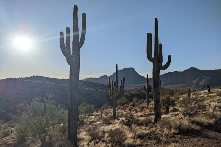
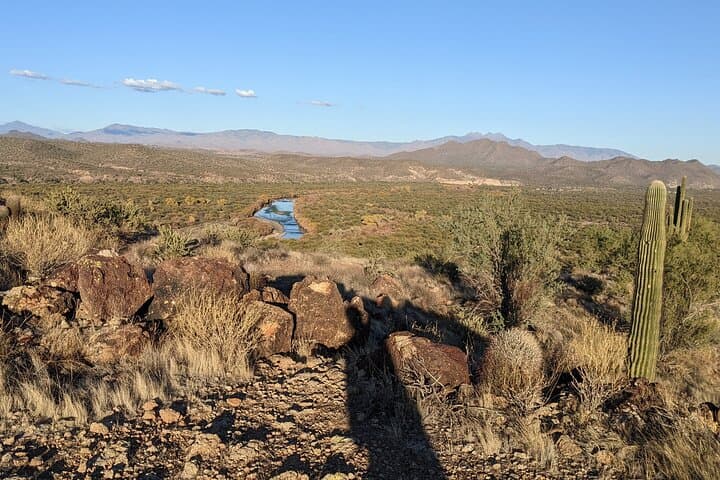
You step out of the parking dust into a sun-baked cut of desert that refuses to be flat. The trail climbs in soft switchbacks, scrubby mesquite and cholla leaning like neighbors along the path. Ahead, Red Mountain frames the Lower Salt River valley — its iron-red face holding heat and history — while the Salt River itself glints below, daring you to look away.
Verified experiences and guided adventures in the surrounding area.
Operated by Saguaro Lake Ranch, Inc. · Mesa, Arizona
You step out of the parking dust into a sun-baked cut of desert that refuses to be flat. The trail climbs in soft switchbacks, scrubby mesquite and cholla leaning like neighbors along the path. Ahead, Red Mountain frames the Lower Salt River valley — its iron-red face holding heat and history — while the Salt River itself glints below, daring you to look away.
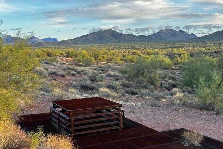
The Copper Mile route is compact but varied: a roughly 3-mile loop with about 242 feet of elevation gain and pitches that push to a 60% grade on shorter stretches. Guides from Saguaro Lake Ranch shepherd small groups from the Phon D. Sutton Mid-Mountain lot, pointing out basalt outcrops and the rails of an abandoned copper prospect that was last worked in 1947. The mine’s corrugated shack and rusted machinery are reminders of Arizona’s early 20th-century scramble for ore — humble artifacts set against a desert that has always been more persistent than industry.
Geologically, you’re walking along the margins of the Tonto Basin where volcanic flows and river-cut alluvium create abrupt texture: red volcanic ridges, sandy wash corridors, and shelves of fractured rock that catch the late light. Culturally, the area sits on ancestral lands long traveled by Apache and Yavapai people; later, ranchers and miners used the same trails to move livestock and supplies. Today the route is as likely to offer a herd of feral horses as a history lesson — the horses have become a signature attraction, moving through washes with the same casual authority as the river.
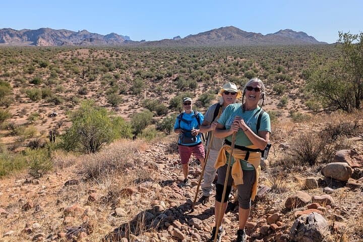
Practically, this is a guided moderate hike best for anyone comfortable with uneven trail and short steep sections. Expect two hours on the trail; guides provide water and snacks and handle navigation, but sun and heat are the real variables to plan for. Arrive early in summer to avoid the peak thermal load; autumn and spring deliver the most pleasant temperatures and clearer light for photos.
Wear sturdy hiking shoes with good traction for the steeper grades and bring a 1–2 liter water system even though bottled water is included. Keep a buffer for sunscreen and a wide-brim hat — shade is scarce and deceptive. If your goal is photography or wildlife viewing, slow your pace at washes and ridgelines: mornings and late afternoons coax the horses out, and the abandoned mine makes a compelling foreground against Red Mountain.
This hike trades length for intensity: it’s short, scenic, and layered with history, geology, and desert wildlife. For travelers based in Mesa or the East Valley, it’s an efficient half-day that delivers both the wide, open mood of the Sonoran Desert and the small, human traces that whisper of Arizona’s mining past.
moderate.
2 hours.
Suitable for hikers with a moderate fitness level; comfortable on uneven terrain and short steep sections
The route is about a 3-mile loop with roughly 242 feet of elevation gain; plan on about two hours including stops.
No single sighting is guaranteed, but the area has frequent wild-horse activity and the guide knows the best viewing spots.
No — the meeting lot at Phon D. Sutton Mid-Mountain is a dirt lot off Bush Hwy and does not require a Tonto parking pass for this tour.
The tour notes advise against participation for pregnant travelers and those with significant spinal or cardiovascular issues; children may join if physically capable of the terrain and within the operator’s age policy.
Bring sunscreen, a hat, layered clothing for temperature changes, and a small daypack for snacks and personal items; guides supply bottled water and snacks.
Yes — participants meet at the Phon D. Sutton Mid-Mountain parking lot off Bush Hwy; the operator meets groups there and no pickup is provided.
The abandoned mine on the loop was last active in 1947 and reflects the small-scale copper prospecting that dotted Arizona in the early 20th century.
Stick to the established tracks, pack out all trash, and keep distance from the wild horses—feeding or approaching them stresses herds and is illegal in some areas.
Saguaro Lake Ranch, Inc. operates guided outdoor trips and adventures with an emphasis on safety, stewardship, and memorable experiences.
You step out of the parking dust into a sun-baked cut of desert that refuses to be flat. The trail climbs in soft switchbacks, scrubby mesquite and cholla leaning like neighbors along the path. Ahead, Red Mountain frames the Lower Salt River valley — its iron-red face holding heat and history — while the Salt River itself glints below, daring you to look away.
You step out of the parking dust into a sun-baked cut of desert that refuses to be flat. The trail climbs in soft switchbacks, scrubby mesquite and cholla leaning like neighbors along the path. Ahead, Red Mountain frames the Lower Salt River valley — its iron-red face holding heat and history — while the Salt River itself glints below, daring you to look away.
The Copper Mile route is compact but varied: a roughly 3-mile loop with about 242 feet of elevation gain and pitches that push to a 60% grade on shorter stretches. Guides from Saguaro Lake Ranch shepherd small groups from the Phon D. Sutton Mid-Mountain lot, pointing out basalt outcrops and the rails of an abandoned copper prospect that was last worked in 1947. The mine’s corrugated shack and rusted machinery are reminders of Arizona’s early 20th-century scramble for ore — humble artifacts set against a desert that has always been more persistent than industry.
Geologically, you’re walking along the margins of the Tonto Basin where volcanic flows and river-cut alluvium create abrupt texture: red volcanic ridges, sandy wash corridors, and shelves of fractured rock that catch the late light. Culturally, the area sits on ancestral lands long traveled by Apache and Yavapai people; later, ranchers and miners used the same trails to move livestock and supplies. Today the route is as likely to offer a herd of feral horses as a history lesson — the horses have become a signature attraction, moving through washes with the same casual authority as the river.
Practically, this is a guided moderate hike best for anyone comfortable with uneven trail and short steep sections. Expect two hours on the trail; guides provide water and snacks and handle navigation, but sun and heat are the real variables to plan for. Arrive early in summer to avoid the peak thermal load; autumn and spring deliver the most pleasant temperatures and clearer light for photos.
Wear sturdy hiking shoes with good traction for the steeper grades and bring a 1–2 liter water system even though bottled water is included. Keep a buffer for sunscreen and a wide-brim hat — shade is scarce and deceptive. If your goal is photography or wildlife viewing, slow your pace at washes and ridgelines: mornings and late afternoons coax the horses out, and the abandoned mine makes a compelling foreground against Red Mountain.
This hike trades length for intensity: it’s short, scenic, and layered with history, geology, and desert wildlife. For travelers based in Mesa or the East Valley, it’s an efficient half-day that delivers both the wide, open mood of the Sonoran Desert and the small, human traces that whisper of Arizona’s mining past.