THE ADVENTURE COLLECTIVE® · Independent discovery and booking for outdoor travel

A compact two-day trek to Fansipan takes you from Sapa’s terraces into alpine ridgelines and a high-camp under the stars. Expect steep climbs, changing weather, and cultural encounters with local hill-tribe communities.
A compact two-day trek to Fansipan takes you from Sapa’s terraces into alpine ridgelines and a high-camp under the stars. Expect steep climbs, changing weather, and cultural encounters with local hill-tribe communities.
Dawn presses cold fingers through the pines as you leave Sapa and climb into the Hoàng Liên Sơn. The trail climbs hard—roots, rock, and switchbacks—while clouds spool around the ridge and the mountain seems to test every step. By evening you reach a simple campsite where the wind narrates the high country and starlight is sharper for the altitude.
Verified experiences and guided adventures in the surrounding area.
Operated by SAIGONESE TREKKING HOUSE · Sa Pa, Lao Cai
Dawn presses cold fingers through the pines as you leave Sapa and climb into the Hoàng Liên Sơn. The trail climbs hard—roots, rock, and switchbacks—while clouds spool around the ridge and the mountain seems to test every step. By evening you reach a simple campsite where the wind narrates the high country and starlight is sharper for the altitude.
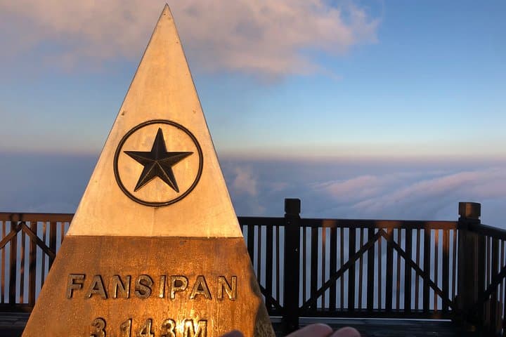
Fansipan rises to 3,143 m, the highest point in Indochina, born of tectonic uplift and long weathering that carved steep ridges and sheltered valleys. The region is home to Hmong and Dao communities; their stilt houses and terraced fields frame the lower slopes, and local porters and guides have threaded routes here for generations. Geologically the range links to the Himalayan orogeny, producing hard, weathered rock and soils that can be loose after rain.
On a 2-day, 1-night itinerary expect roughly 10–12 km of hiking each way overall with about 1,200–1,400 m of total elevation gain to the summit area depending on your route. Trails vary from forested, root-strewn sections to exposed ridgelines where wind pushes you along. Spring (Feb–Apr) and autumn (Aug–Oct) bring the most stable conditions; summer is lush but wetter, winter can be cold and clouded.
Practical guidance: train for sustained uphill hiking, pack layered insulation, waterproofs, and a reliable headlamp for early starts and night camp chores. Use a local licensed guide or operator—routes are steep and weather can change rapidly. Hydrate, pace conservatively on steep pitches, and plan for a slow summit push so altitude and fatigue don’t steal the view.
challenging.
2 days (approx. 48 hours).
Suitable for fit hikers used to sustained uphill trekking—regular cardio and hill training recommended
No special permit is required for typical guided treks; organized operators handle trail access and logistics.
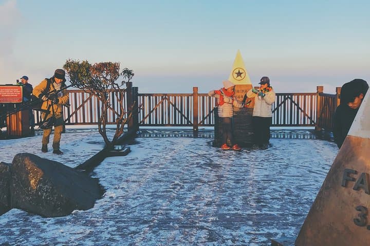
Temperatures can drop near or below freezing in winter nights; bring warm layers and wind protection year-round.
Not recommended for inexperienced hikers—this itinerary requires sustained uphill hiking, good stamina, and comfort with overnight camping.
Yes—operators generally accommodate vegetarian, vegan, and gluten-free requests if noted when booking.
The Hoàng Liên Sơn range has long been home to Hmong and Dao peoples; Fansipan itself became a modern trekking destination in the late 20th century as access from Sapa improved.
Stick to marked trails and pack out waste—fragile alpine soils and local water sources are sensitive to erosion and pollution. Support local guides to ensure economic benefits stay in the community.
SAIGONESE TREKKING HOUSE operates guided outdoor trips and adventures with an emphasis on safety, stewardship, and memorable experiences.
Dawn presses cold fingers through the pines as you leave Sapa and climb into the Hoàng Liên Sơn. The trail climbs hard—roots, rock, and switchbacks—while clouds spool around the ridge and the mountain seems to test every step. By evening you reach a simple campsite where the wind narrates the high country and starlight is sharper for the altitude.
Dawn presses cold fingers through the pines as you leave Sapa and climb into the Hoàng Liên Sơn. The trail climbs hard—roots, rock, and switchbacks—while clouds spool around the ridge and the mountain seems to test every step. By evening you reach a simple campsite where the wind narrates the high country and starlight is sharper for the altitude.
Fansipan rises to 3,143 m, the highest point in Indochina, born of tectonic uplift and long weathering that carved steep ridges and sheltered valleys. The region is home to Hmong and Dao communities; their stilt houses and terraced fields frame the lower slopes, and local porters and guides have threaded routes here for generations. Geologically the range links to the Himalayan orogeny, producing hard, weathered rock and soils that can be loose after rain.
On a 2-day, 1-night itinerary expect roughly 10–12 km of hiking each way overall with about 1,200–1,400 m of total elevation gain to the summit area depending on your route. Trails vary from forested, root-strewn sections to exposed ridgelines where wind pushes you along. Spring (Feb–Apr) and autumn (Aug–Oct) bring the most stable conditions; summer is lush but wetter, winter can be cold and clouded.
Practical guidance: train for sustained uphill hiking, pack layered insulation, waterproofs, and a reliable headlamp for early starts and night camp chores. Use a local licensed guide or operator—routes are steep and weather can change rapidly. Hydrate, pace conservatively on steep pitches, and plan for a slow summit push so altitude and fatigue don’t steal the view.