THE ADVENTURE COLLECTIVE® · Independent discovery and booking for outdoor travel

Explore Winnipeg on foot with a self-guided Let’s Roam scavenger hunt that threads The Forks, St. Boniface and the Legislative Building into a two-hour urban adventure. Solve clues, complete photo challenges and discover local history at your own pace.
Explore Winnipeg on foot with a self-guided Let’s Roam scavenger hunt that threads The Forks, St. Boniface and the Legislative Building into a two-hour urban adventure. Solve clues, complete photo challenges and discover local history at your own pace.
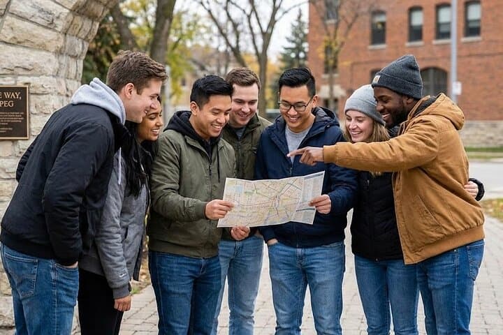
Morning light skates across the confluence of the Red and Assiniboine Rivers as teams fan out, phones in hand and curiosity switched to high. The scavenger hunt begins at The Forks—an active public meeting place where river stones, market stalls and murals mark layers of the city’s life. Players trade measured strides for sudden sprints when a riddle points toward a bronze statue or a hidden plaque.
Verified experiences and guided adventures in the surrounding area.
Operated by Let's Roam · Winnipeg, Manitoba
Morning light skates across the confluence of the Red and Assiniboine Rivers as teams fan out, phones in hand and curiosity switched to high. The scavenger hunt begins at The Forks—an active public meeting place where river stones, market stalls and murals mark layers of the city’s life. Players trade measured strides for sudden sprints when a riddle points toward a bronze statue or a hidden plaque.
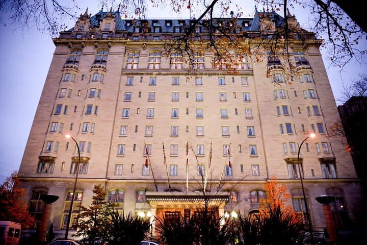
Winnipeg’s story is visible in the route: Indigenous peoples have used the Forks for millennia, French-Canadian and Métis communities shaped St. Boniface, and the Manitoba Legislative Building watches the river with its Golden Boy atop the dome. The landscape is a post-glacial plain where rivers carved broad, flat valleys, feeding parks and riverwalks that frame the downtown.
Expect paved streets, pedestrian promenades and short detours through pocket parks and historic blocks. Typical hunt distance is 2–4 km with negligible elevation gain—city walking more than trail scrambling. The Let’s Roam app delivers maps, photo challenges and trivia while assigning roles like Brainiac or Photographer so every player contributes.
Practical edge: start mid-morning to avoid rush-hour crowds and give yourself two hours to explore without rushing. Wear grippy shoes for slick riverwalk stones after rain, carry a power bank because the experience is phone-driven, and download the app before you go. Transit stops cluster nearby and many checkpoints are wheelchair and stroller accessible, but expect some cobblestone and curb cuts. This hunt is equal parts history, architecture and friendly competition—an efficient, engaging way to feel Winnipeg underfoot and in the city’s stories.
easy.
2 hours.
Light to moderate—comfortable on-foot mobility for a couple of hours and the ability to walk a few kilometers.
Yes—there is no minimum age; younger players can participate with adult supervision and roles can be adjusted for group energy and pace.
Much of the route is wheelchair and stroller accessible with paved promenades and curb cuts, though expect a few historic paving sections that may be bumpy.
No—this is a self-guided private tour that can start at any time; you’ll receive app instructions at booking to begin when ready.
All sales are final—there are no refunds, so check weather and availability before booking.
The Forks has been a human meeting place for thousands of years and later became a trading and cultural hub shaped by Indigenous, Métis and European communities; the Manitoba Legislative Building (completed 1920) anchors downtown with its Golden Boy statue.
The Forks area balances heavy public use with riverbank restoration projects; visitors should stick to paths, carry out waste and respect interpretive signs that protect archeological areas.
Let's Roam operates guided outdoor trips and adventures with an emphasis on safety, stewardship, and memorable experiences.


Morning light skates across the confluence of the Red and Assiniboine Rivers as teams fan out, phones in hand and curiosity switched to high. The scavenger hunt begins at The Forks—an active public meeting place where river stones, market stalls and murals mark layers of the city’s life. Players trade measured strides for sudden sprints when a riddle points toward a bronze statue or a hidden plaque.
Morning light skates across the confluence of the Red and Assiniboine Rivers as teams fan out, phones in hand and curiosity switched to high. The scavenger hunt begins at The Forks—an active public meeting place where river stones, market stalls and murals mark layers of the city’s life. Players trade measured strides for sudden sprints when a riddle points toward a bronze statue or a hidden plaque.
Winnipeg’s story is visible in the route: Indigenous peoples have used the Forks for millennia, French-Canadian and Métis communities shaped St. Boniface, and the Manitoba Legislative Building watches the river with its Golden Boy atop the dome. The landscape is a post-glacial plain where rivers carved broad, flat valleys, feeding parks and riverwalks that frame the downtown.
Expect paved streets, pedestrian promenades and short detours through pocket parks and historic blocks. Typical hunt distance is 2–4 km with negligible elevation gain—city walking more than trail scrambling. The Let’s Roam app delivers maps, photo challenges and trivia while assigning roles like Brainiac or Photographer so every player contributes.
Practical edge: start mid-morning to avoid rush-hour crowds and give yourself two hours to explore without rushing. Wear grippy shoes for slick riverwalk stones after rain, carry a power bank because the experience is phone-driven, and download the app before you go. Transit stops cluster nearby and many checkpoints are wheelchair and stroller accessible, but expect some cobblestone and curb cuts. This hunt is equal parts history, architecture and friendly competition—an efficient, engaging way to feel Winnipeg underfoot and in the city’s stories.