THE ADVENTURE COLLECTIVE® · Independent discovery and booking for outdoor travel

A focused, six-day push up Kilimanjaro via the Machame Route: expect rainforest, moorland, scree and a midnight summit ascent. This guide explains the geology, daily gains, cultural context and practical tips to make the climb safer and more successful.
A focused, six-day push up Kilimanjaro via the Machame Route: expect rainforest, moorland, scree and a midnight summit ascent. This guide explains the geology, daily gains, cultural context and practical tips to make the climb safer and more successful.
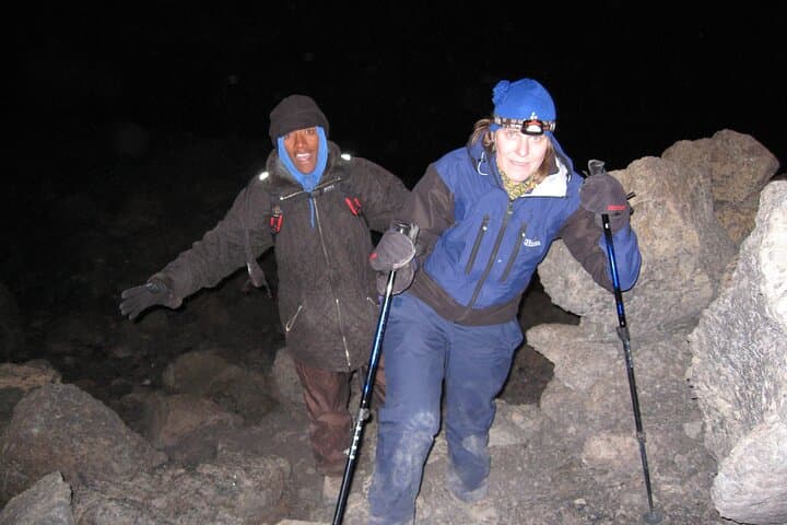
At 02:00 under a sky smeared with stars, a string of headlamps snakes away from Barafu Camp and into the cold. The mountain breathes around you—wind at first patient, then insistent—pushing climbers up a slope of loose scree toward Stella Point. By the time the sun slices the rim of Kibo crater, the slopes below glow and Mawenzi’s jagged spine casts a long shadow across the caldera. This is the Machame route: steep, uncompromising, and one of the most scenic ways to reach Uhuru Peak (5,895 m).
Verified experiences and guided adventures in the surrounding area.
Operated by Yedi Explorers · Moshi, Kilimanjaro Region
At 02:00 under a sky smeared with stars, a string of headlamps snakes away from Barafu Camp and into the cold. The mountain breathes around you—wind at first patient, then insistent—pushing climbers up a slope of loose scree toward Stella Point. By the time the sun slices the rim of Kibo crater, the slopes below glow and Mawenzi’s jagged spine casts a long shadow across the caldera. This is the Machame route: steep, uncompromising, and one of the most scenic ways to reach Uhuru Peak (5,895 m).
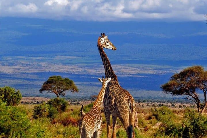
Geologically, Kilimanjaro is a freestanding stratovolcano made of three cones—Kibo, Mawenzi, and Shira. The climb threads through ecological zones that change fast: rainforest at 1,800–3,000 m, heath and moorland on the Shira Plateau, arid alpine desert above 4,000 m. Culturally, the mountain’s lower flanks are farmed by the Chagga people; Moshi’s coffee farms and bustling markets supply the porters and guides whose local knowledge makes summit day possible.
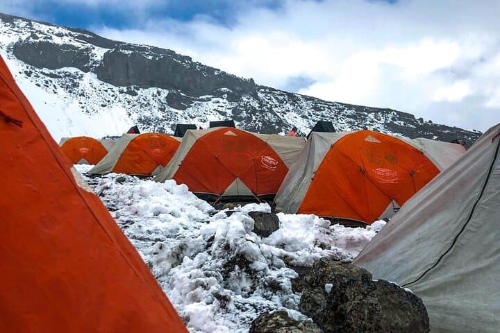
The Machame itinerary compresses big elevation gains into six active days: Machame Gate (1,790 m) to Machame Camp (3,010 m), then across the Shira Plateau and up toward Lava Tower and Barranco Camp, over the Barranco Wall, onto Barafu (4,640 m), and a midnight push to Uhuru Peak before a long descent to Mweka. Expect total elevation gain of roughly 4,100 m from gate to summit and daily hiking of 5–10 km on mixed terrain—muddy rainforest trails, rocky plateaus, scree fields and steep rock sections.
Practical preparation matters. Hydrate starting days before, train on long uphill hikes with a loaded pack, and practice walking on loose scree. Accept the mountain’s pace: slow, steady steps and frequent short breaks are your best acclimatization strategy. Gear up with a 4-season sleeping bag, sturdy waterproof boots, and layers that breathe—temperatures swing from warm daytime air to sub-zero at the rim. Porters carry most kit, but you’ll want a daypack with water, snacks, and layers for summit night.
On the trail, watch the light change on the Shira Plateau and time breaks by views of Mount Meru to the west. Respect the mountain—listen to your guide about symptoms of altitude sickness and be honest about how you feel. After descent, a hot shower in Moshi tastes like victory.
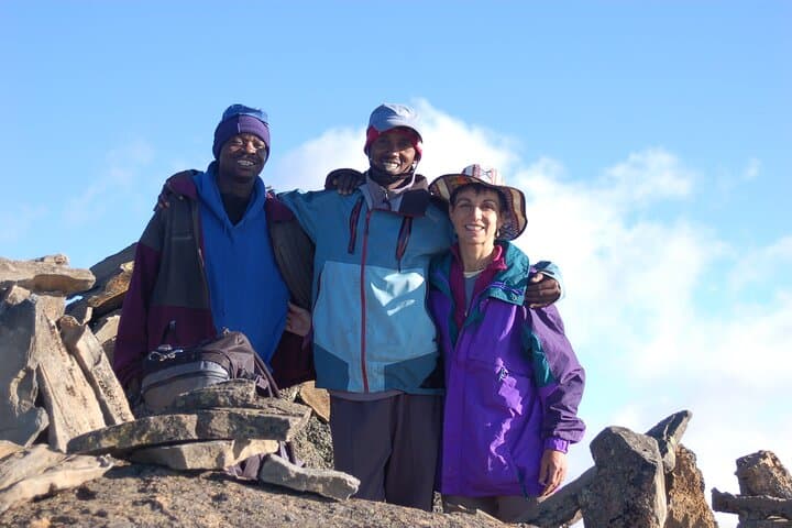
For travelers seeking a compact summit experience, the Machame route delivers drama and variety. It demands fitness, patience and respect—but the payoff is spectacular: standing on Africa’s roof with the world laid out below.
challenging.
6–8 days.
Good aerobic fitness with experience on multi-day hikes and long uphill days; practice with loaded hikes.
No technical climbing skills are required on the Machame route; the climb is a strenuous hike, not a roped alpine climb.
Success varies by fitness and acclimatization; six-day itineraries have lower summit rates than 7–8 day options—consider adding an extra day if possible.
Acute mountain sickness is possible above 3,000 m; guides monitor symptoms and may recommend descent if signs worsen—honest reporting is critical.
The tour package typically includes park fees, camping fees, and meals as listed—confirm exact inclusions before booking.
Tipping is customary; most groups pool tips for guides, cooks and porters—plan around 10–15% of the trek cost or follow operator guidance.
Dry months—January–March and June–October—offer the most stable weather and clearer summit conditions.
Kilimanjaro’s slopes are home to the Chagga, who historically farmed coffee and bananas on the lower ridges and provided local guiding traditions that remain central to modern treks.
Mount Kilimanjaro National Park enforces strict waste and human-waste policies; use biodegradable toiletries, pack out plastics where possible and respect porter load limits to reduce impact.
Yedi Explorers operates guided outdoor trips and adventures with an emphasis on safety, stewardship, and memorable experiences.
At 02:00 under a sky smeared with stars, a string of headlamps snakes away from Barafu Camp and into the cold. The mountain breathes around you—wind at first patient, then insistent—pushing climbers up a slope of loose scree toward Stella Point. By the time the sun slices the rim of Kibo crater, the slopes below glow and Mawenzi’s jagged spine casts a long shadow across the caldera. This is the Machame route: steep, uncompromising, and one of the most scenic ways to reach Uhuru Peak (5,895 m).
At 02:00 under a sky smeared with stars, a string of headlamps snakes away from Barafu Camp and into the cold. The mountain breathes around you—wind at first patient, then insistent—pushing climbers up a slope of loose scree toward Stella Point. By the time the sun slices the rim of Kibo crater, the slopes below glow and Mawenzi’s jagged spine casts a long shadow across the caldera. This is the Machame route: steep, uncompromising, and one of the most scenic ways to reach Uhuru Peak (5,895 m).
Geologically, Kilimanjaro is a freestanding stratovolcano made of three cones—Kibo, Mawenzi, and Shira. The climb threads through ecological zones that change fast: rainforest at 1,800–3,000 m, heath and moorland on the Shira Plateau, arid alpine desert above 4,000 m. Culturally, the mountain’s lower flanks are farmed by the Chagga people; Moshi’s coffee farms and bustling markets supply the porters and guides whose local knowledge makes summit day possible.
The Machame itinerary compresses big elevation gains into six active days: Machame Gate (1,790 m) to Machame Camp (3,010 m), then across the Shira Plateau and up toward Lava Tower and Barranco Camp, over the Barranco Wall, onto Barafu (4,640 m), and a midnight push to Uhuru Peak before a long descent to Mweka. Expect total elevation gain of roughly 4,100 m from gate to summit and daily hiking of 5–10 km on mixed terrain—muddy rainforest trails, rocky plateaus, scree fields and steep rock sections.
Practical preparation matters. Hydrate starting days before, train on long uphill hikes with a loaded pack, and practice walking on loose scree. Accept the mountain’s pace: slow, steady steps and frequent short breaks are your best acclimatization strategy. Gear up with a 4-season sleeping bag, sturdy waterproof boots, and layers that breathe—temperatures swing from warm daytime air to sub-zero at the rim. Porters carry most kit, but you’ll want a daypack with water, snacks, and layers for summit night.
On the trail, watch the light change on the Shira Plateau and time breaks by views of Mount Meru to the west. Respect the mountain—listen to your guide about symptoms of altitude sickness and be honest about how you feel. After descent, a hot shower in Moshi tastes like victory.
For travelers seeking a compact summit experience, the Machame route delivers drama and variety. It demands fitness, patience and respect—but the payoff is spectacular: standing on Africa’s roof with the world laid out below.