THE ADVENTURE COLLECTIVE® · Independent discovery and booking for outdoor travel

Spend a night under the watchful glow of Volcán Fuego on this 2-day Acatenango trek from Guatemala City. Camp at high elevation, witness nightly eruptions, and summit at sunrise for 360° views of the Guatemalan highlands.
Spend a night under the watchful glow of Volcán Fuego on this 2-day Acatenango trek from Guatemala City. Camp at high elevation, witness nightly eruptions, and summit at sunrise for 360° views of the Guatemalan highlands.
A predawn van pulls out of Antigua and the city lights fall away as you climb toward the mountain village of La Soledad. The trail begins with a steady, earth-smelling ascent through pine and farmland; by mid-afternoon the air thins and the wind starts to speak, pushing you toward the bench-cut campsite at roughly 3,750 m. From camp, Fuego rumbles across the valley — an insistent, incandescent presence that dominates the night.
Verified experiences and guided adventures in the surrounding area.
Operated by Guatemalan Adventure · Antigua Guatemala, Sacatepéquez
A predawn van pulls out of Antigua and the city lights fall away as you climb toward the mountain village of La Soledad. The trail begins with a steady, earth-smelling ascent through pine and farmland; by mid-afternoon the air thins and the wind starts to speak, pushing you toward the bench-cut campsite at roughly 3,750 m. From camp, Fuego rumbles across the valley — an insistent, incandescent presence that dominates the night.
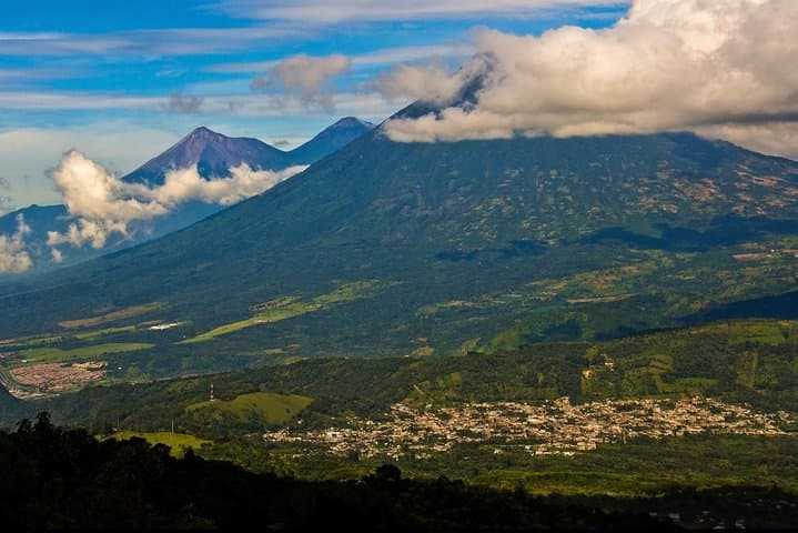
Geology here is blunt and recent: Acatenango shares a ridgeline with Volcán de Fuego, both products of the Cocos Plate diving beneath Central America. The route crosses four distinct microclimates — cultivated lower slopes, humid cloud forest, scrub and volcanic scree — each a shift in footing and temperature. Local highland communities like La Soledad have guided hikers for decades; their knowledge of weather windows and safe camping spots is part of the experience.
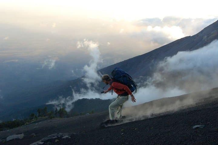
Expect roughly 6–8 km and about 1,350 m (4,400 ft) of gain to camp over 4–6 hours, then a steep 45-minute push of ~225 m to the 3,975 m summit at sunrise. Trails become rocky and exposed near the top; crampons are not required but trekking poles and steady footing are. Plan for cold nights near freezing, strong sun during the day, and thin air that makes pace slower than at sea level.
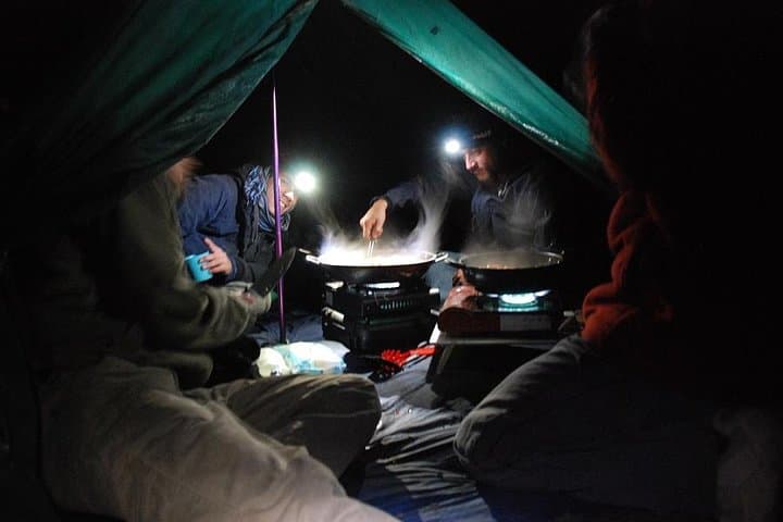
Practical tips: stay hydrated (minimum 3–4 L), layer aggressively, and arrive in Antigua the night before. Guides provide tents, pads, and meals, but personal warm clothing, a headlamp, and solid trekking boots are non-negotiable. The reward is a panoramic highland view that stretches to the Mexican border and a close, raw look at volcanic power.
challenging.
2 days (approx. 48 hours including travel; 8–10 hours hiking).
Good aerobic fitness with experience on sustained uphill hikes; ability to carry a daypack and tolerate thin air is important.
The approach to camp is a sustained uphill of roughly 6–8 km with about 1,350 m elevation gain; it’s challenging due to length and altitude but technically non-technical.
Yes—this tour supplies certified bilingual guides, tents, sleeping pads and sleeping bags, plus meals at camp.
Recommended but not mandatory; hikers should have moderate to good fitness and be prepared for reduced performance at altitude.
Dry season (November–April) offers the most stable weather and clear summit views; afternoons can be sunny, nights near freezing.
Acatenango and neighboring Fuego are part of a volcanic chain central to Maya highland settlement; nearby villages historically farmed volcanic soils and now support guiding economies.
Stick to established trails and campsites to protect fragile páramo vegetation; local guides help minimize impact and routes concentrate camping to reduce erosion.
Guatemalan Adventure operates guided outdoor trips and adventures with an emphasis on safety, stewardship, and memorable experiences.
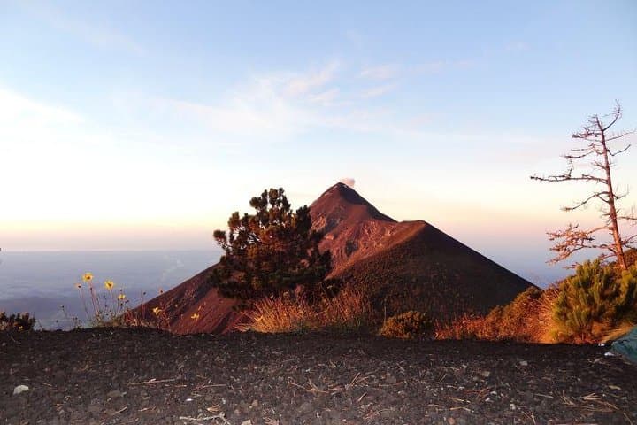
A predawn van pulls out of Antigua and the city lights fall away as you climb toward the mountain village of La Soledad. The trail begins with a steady, earth-smelling ascent through pine and farmland; by mid-afternoon the air thins and the wind starts to speak, pushing you toward the bench-cut campsite at roughly 3,750 m. From camp, Fuego rumbles across the valley — an insistent, incandescent presence that dominates the night.
A predawn van pulls out of Antigua and the city lights fall away as you climb toward the mountain village of La Soledad. The trail begins with a steady, earth-smelling ascent through pine and farmland; by mid-afternoon the air thins and the wind starts to speak, pushing you toward the bench-cut campsite at roughly 3,750 m. From camp, Fuego rumbles across the valley — an insistent, incandescent presence that dominates the night.
Geology here is blunt and recent: Acatenango shares a ridgeline with Volcán de Fuego, both products of the Cocos Plate diving beneath Central America. The route crosses four distinct microclimates — cultivated lower slopes, humid cloud forest, scrub and volcanic scree — each a shift in footing and temperature. Local highland communities like La Soledad have guided hikers for decades; their knowledge of weather windows and safe camping spots is part of the experience.
Expect roughly 6–8 km and about 1,350 m (4,400 ft) of gain to camp over 4–6 hours, then a steep 45-minute push of ~225 m to the 3,975 m summit at sunrise. Trails become rocky and exposed near the top; crampons are not required but trekking poles and steady footing are. Plan for cold nights near freezing, strong sun during the day, and thin air that makes pace slower than at sea level.
Practical tips: stay hydrated (minimum 3–4 L), layer aggressively, and arrive in Antigua the night before. Guides provide tents, pads, and meals, but personal warm clothing, a headlamp, and solid trekking boots are non-negotiable. The reward is a panoramic highland view that stretches to the Mexican border and a close, raw look at volcanic power.