THE ADVENTURE COLLECTIVE® · Independent discovery and booking for outdoor travel

A steep hike that becomes a scramble and short abseil, Pieter Both delivers a compact, technical summit with panoramic island views. This guided 5‑hour activity mixes trail, rock steps and exposed ledges—ideal for fit hikers who want a hands‑on summit.
A steep hike that becomes a scramble and short abseil, Pieter Both delivers a compact, technical summit with panoramic island views. This guided 5‑hour activity mixes trail, rock steps and exposed ledges—ideal for fit hikers who want a hands‑on summit.
You round a last bend and the peak fills the sky: a squat granite head balanced on a narrow column, jagged seams catching light. The path up Pieter Both pushes through cane fields, then steep forested gullies, until rock takes over and you trade a walking rhythm for handholds and careful footwork.
Verified experiences and guided adventures in the surrounding area.
Operated by Offline · Port Louis, Pamplemousses District
You round a last bend and the peak fills the sky: a squat granite head balanced on a narrow column, jagged seams catching light. The path up Pieter Both pushes through cane fields, then steep forested gullies, until rock takes over and you trade a walking rhythm for handholds and careful footwork.
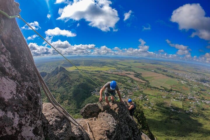
The mountain bears the name of a 17th‑century Dutch governor; geologically it's an eroded granite tor left from Mauritius’s deep volcanic past. Local guides—often bilingual in English and French—point out endemic shrubs clinging to cracks and the way trade winds sweep the upper slopes. The climb mixes hiking, scrambling and short assisted abseils; ropes and helmets are usually supplied, and the final crest rewards you with a nearly 360° sweep from the north coast to the central plateau.
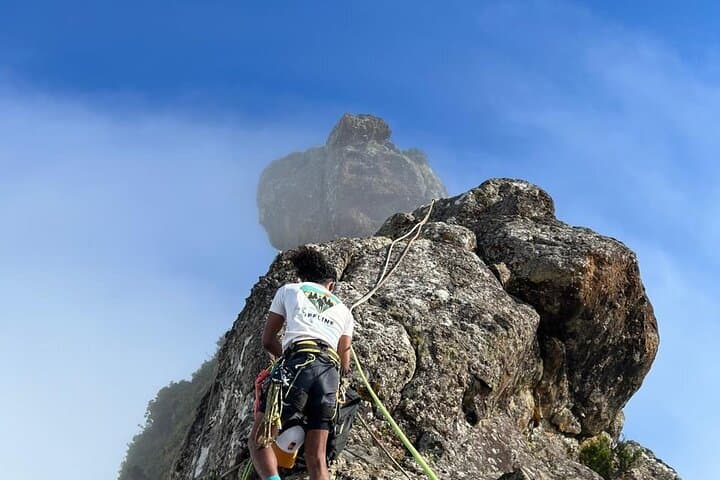
Culturally the route threads through working countryside where Creole and French influence are visible in lane names and small shrines. Expect humid lowland air giving way to sharper wind on the ridge; the rock dares you with exposed steps and narrow ledges, but experienced guides break it into manageable pitches.
Practical notes: the activity typically takes about five hours round trip. Bring at least 1.5–2 liters of water, sturdy grippy footwear, sun protection and a light wind layer. Start early to avoid heat and afternoon showers; if you have any cardiovascular concerns, discuss them before booking. With basic fitness and a head for heights, the summit view is an unforgettable reward—rock, sea and sky arranged like a map of Mauritius beneath you.
challenging.
5 hours.
Good aerobic fitness and leg strength; comfortable with sustained uphill and short technical scrambling.
The route starts as a steep hike but becomes exposed with scrambling and short abseils; novices can do it with a guide, but you should be comfortable on rock and heights.
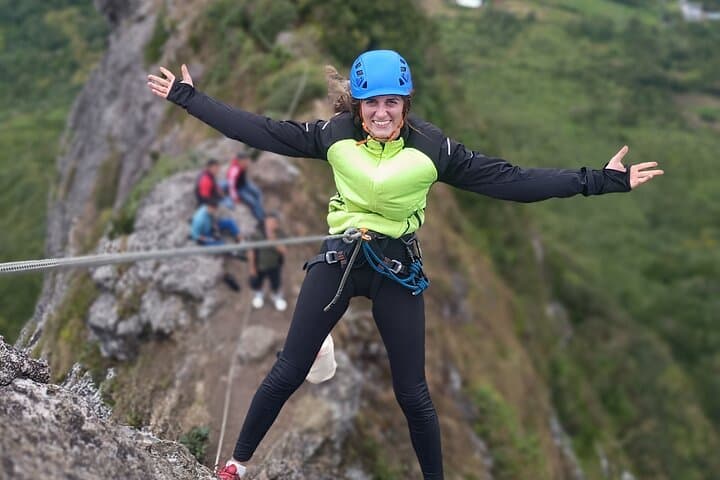
Yes—guides commonly provide harnesses, helmets and ropes for abseiling and technical sections as part of the activity.
Wear closed‑toe hiking shoes, sun protection, and bring 1.5–2 L of water, snacks, and a light wind/rain layer.
Most travelers stay in Port Louis or nearby towns and reach the meeting point by car or local transport; confirm meet location and transport options with the operator.
Named after Pieter Both, a Dutch colonial figure, the peak has been a landmark for sailors and settlers since early European mapping of Mauritius.
The summit and approach host fragile endemic plants; stay on marked paths, avoid collecting plants and pack out all waste to limit erosion and habitat disturbance.
Offline operates guided outdoor trips and adventures with an emphasis on safety, stewardship, and memorable experiences.
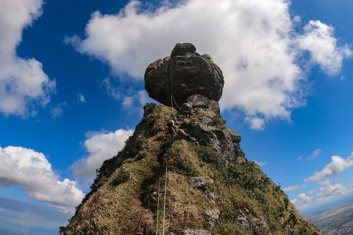
You round a last bend and the peak fills the sky: a squat granite head balanced on a narrow column, jagged seams catching light. The path up Pieter Both pushes through cane fields, then steep forested gullies, until rock takes over and you trade a walking rhythm for handholds and careful footwork.
You round a last bend and the peak fills the sky: a squat granite head balanced on a narrow column, jagged seams catching light. The path up Pieter Both pushes through cane fields, then steep forested gullies, until rock takes over and you trade a walking rhythm for handholds and careful footwork.
The mountain bears the name of a 17th‑century Dutch governor; geologically it's an eroded granite tor left from Mauritius’s deep volcanic past. Local guides—often bilingual in English and French—point out endemic shrubs clinging to cracks and the way trade winds sweep the upper slopes. The climb mixes hiking, scrambling and short assisted abseils; ropes and helmets are usually supplied, and the final crest rewards you with a nearly 360° sweep from the north coast to the central plateau.
Culturally the route threads through working countryside where Creole and French influence are visible in lane names and small shrines. Expect humid lowland air giving way to sharper wind on the ridge; the rock dares you with exposed steps and narrow ledges, but experienced guides break it into manageable pitches.
Practical notes: the activity typically takes about five hours round trip. Bring at least 1.5–2 liters of water, sturdy grippy footwear, sun protection and a light wind layer. Start early to avoid heat and afternoon showers; if you have any cardiovascular concerns, discuss them before booking. With basic fitness and a head for heights, the summit view is an unforgettable reward—rock, sea and sky arranged like a map of Mauritius beneath you.