THE ADVENTURE COLLECTIVE® · Independent discovery and booking for outdoor travel

Ascend Pico do Fogo, Cape Verde’s 2,829 m active volcano, for a raw high-altitude hike across volcanic sand and basalt ridgelines. This difficult climb rewards strong fitness and an early start with crater views and a fast ash descent.
Ascend Pico do Fogo, Cape Verde’s 2,829 m active volcano, for a raw high-altitude hike across volcanic sand and basalt ridgelines. This difficult climb rewards strong fitness and an early start with crater views and a fast ash descent.
You step out into a cracked lunar bowl — Chã das Caldeiras opens like a hidden room below the summit — and the cone of Pico do Fogo rises ahead, dark against a wide Atlantic sky. Wind carries dry ash across your jacket; every step crunches with the island’s volcanic memory. The climb begins over loose volcanic sand and rocky switchbacks, each bend revealing a broader arc of ocean and the black fields that rebuilt lives here.
Verified experiences and guided adventures in the surrounding area.
Operated by Qualitur Viagens e Turismo · Chã das Caldeiras, Fogo
You step out into a cracked lunar bowl — Chã das Caldeiras opens like a hidden room below the summit — and the cone of Pico do Fogo rises ahead, dark against a wide Atlantic sky. Wind carries dry ash across your jacket; every step crunches with the island’s volcanic memory. The climb begins over loose volcanic sand and rocky switchbacks, each bend revealing a broader arc of ocean and the black fields that rebuilt lives here.
Pico do Fogo is the archipelago’s highest point at 2,829 m and an active stratovolcano whose last major eruption reshaped local settlements. The island’s geology is young and raw: basalt flows, scoria cones, and a caldera floor that hosts farms in an otherworldly microclimate. Culturally, Chã das Caldeiras is a resilient hamlet where wine and coffee are coaxed from ash-rich soils — a quiet human story at the foot of a roaring system.
Practically, expect a demanding ascent: roughly 1,000+ meters of elevation gain, 3–4 hours up and 1–2 down depending on pace. Trails alternate hard-packed lava, scree, and volcanic sand that makes for a fast, playful descent. You’ll want a certified local guide (required on many excursions), sun protection, layered clothing for wind and rapid temperature shifts, and 2–3 liters of water. Start early to avoid heat and afternoon winds; check eruption advisories and fitness requirements — this route is rated difficult and is not suitable for those with cardiovascular or spinal conditions.
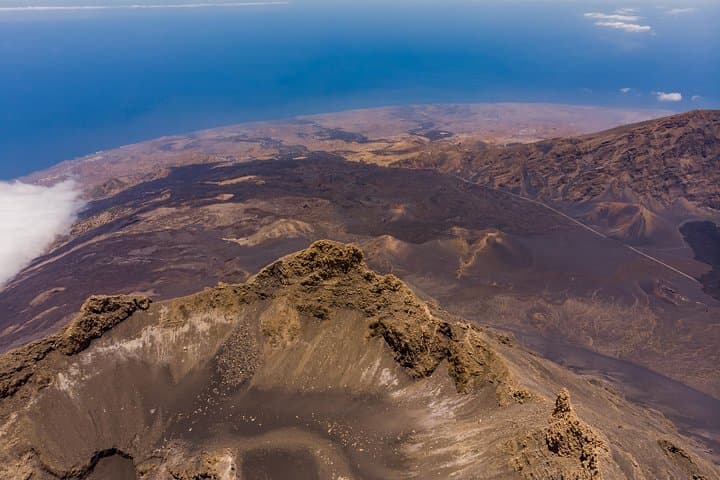
Reward arrives at the rim: a silent, steaming crater and a panoramic sweep that pulls the map of Cape Verde into a single, unforgettable view. The descent down ash feels almost mischievous — gravity helping you laugh all the way back to the caldera.
difficult.
4–6 hours.
You should have strong cardiovascular fitness and experience with sustained uphill hiking; frequent hikers and trail runners will find the pace demanding.
The itinerary estimates 3–4 hours to ascend and 1–2 hours to descend, so plan on roughly 4–6 hours total depending on pace.
No technical rock-climbing gear is necessary for the normal route; the trail is steep and loose but non-technical when guided.
Climbs only proceed when local authorities and guides confirm conditions; operators cancel in case of unrest, so check advisories and local updates before booking.
Yes — many operators offer departures from São Filipe or direct starts from Chã das Caldeiras; confirm pickup and drop-off when booking.
The caldera and surrounding villages were formed and reshaped by repeated eruptions; agriculture in Chã das Caldeiras adapted to rich, volcanic soils and periodic upheaval.
The area is sensitive: stick to paths to avoid fragile vegetation and erosion, and pack out all waste; local guides help minimize human impact.
Qualitur Viagens e Turismo operates guided outdoor trips and adventures with an emphasis on safety, stewardship, and memorable experiences.
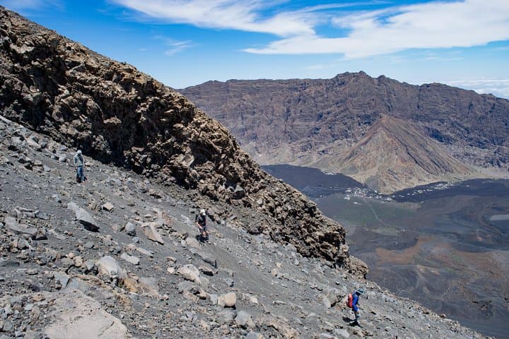
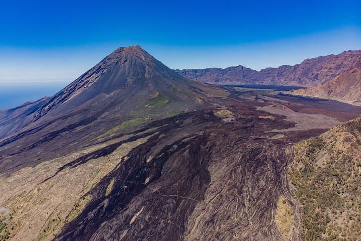
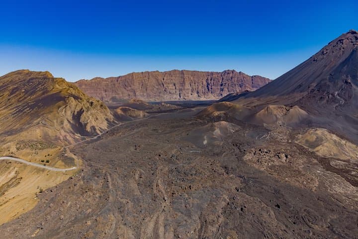
You step out into a cracked lunar bowl — Chã das Caldeiras opens like a hidden room below the summit — and the cone of Pico do Fogo rises ahead, dark against a wide Atlantic sky. Wind carries dry ash across your jacket; every step crunches with the island’s volcanic memory. The climb begins over loose volcanic sand and rocky switchbacks, each bend revealing a broader arc of ocean and the black fields that rebuilt lives here.
You step out into a cracked lunar bowl — Chã das Caldeiras opens like a hidden room below the summit — and the cone of Pico do Fogo rises ahead, dark against a wide Atlantic sky. Wind carries dry ash across your jacket; every step crunches with the island’s volcanic memory. The climb begins over loose volcanic sand and rocky switchbacks, each bend revealing a broader arc of ocean and the black fields that rebuilt lives here.
Pico do Fogo is the archipelago’s highest point at 2,829 m and an active stratovolcano whose last major eruption reshaped local settlements. The island’s geology is young and raw: basalt flows, scoria cones, and a caldera floor that hosts farms in an otherworldly microclimate. Culturally, Chã das Caldeiras is a resilient hamlet where wine and coffee are coaxed from ash-rich soils — a quiet human story at the foot of a roaring system.
Practically, expect a demanding ascent: roughly 1,000+ meters of elevation gain, 3–4 hours up and 1–2 down depending on pace. Trails alternate hard-packed lava, scree, and volcanic sand that makes for a fast, playful descent. You’ll want a certified local guide (required on many excursions), sun protection, layered clothing for wind and rapid temperature shifts, and 2–3 liters of water. Start early to avoid heat and afternoon winds; check eruption advisories and fitness requirements — this route is rated difficult and is not suitable for those with cardiovascular or spinal conditions.
Reward arrives at the rim: a silent, steaming crater and a panoramic sweep that pulls the map of Cape Verde into a single, unforgettable view. The descent down ash feels almost mischievous — gravity helping you laugh all the way back to the caldera.