THE ADVENTURE COLLECTIVE® · Independent discovery and booking for outdoor travel

A compact, high-altitude trek that packs cloud-forest, waterfalls and two prominent Inca sites into a brisk two-day itinerary. Perfect for hikers who want to reach Machu Picchu on foot without committing to the longer 4-day route—if you book permits early and acclimatize first.
A compact, high-altitude trek that packs cloud-forest, waterfalls and two prominent Inca sites into a brisk two-day itinerary. Perfect for hikers who want to reach Machu Picchu on foot without committing to the longer 4-day route—if you book permits early and acclimatize first.
Morning fog lifts off the Urubamba and the trail ahead glistens with damp stone and orchids; you feel the path underfoot—ancient paving that still remembers the sandals of the Inca.
Verified experiences and guided adventures in the surrounding area.
Operated by PERU TRAVEL COMPANY · Aguas Calientes, Cusco
Morning fog lifts off the Urubamba and the trail ahead glistens with damp stone and orchids; you feel the path underfoot—ancient paving that still remembers the sandals of the Inca.
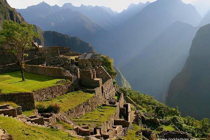
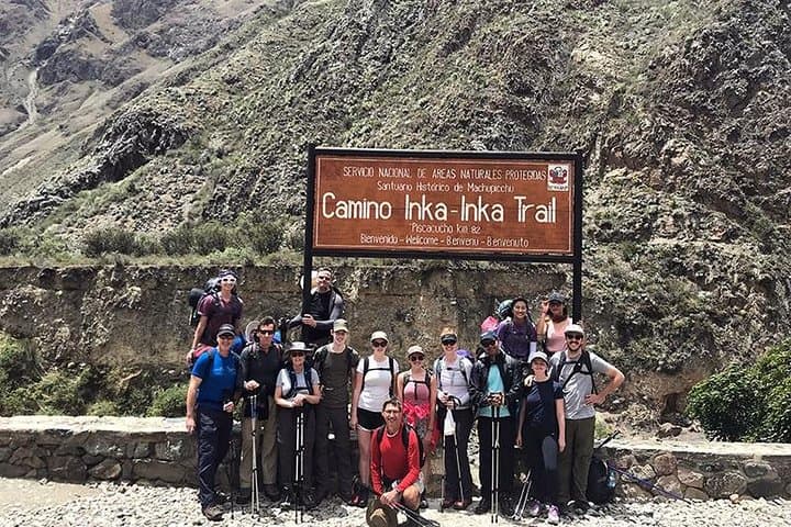
This two-day route covers roughly 10 miles (16 km) from the km 104 trailhead to the Sun Gate at Machu Picchu, threading cloud-forest, waterfalls and exposed terraces. The route passes Chachabamba and Wiñay Wayna—Inca sites that reveal how pre-Columbian engineers worked with steep Andean slopes—and ends at the citadel around 2,430 m (7,970 ft).
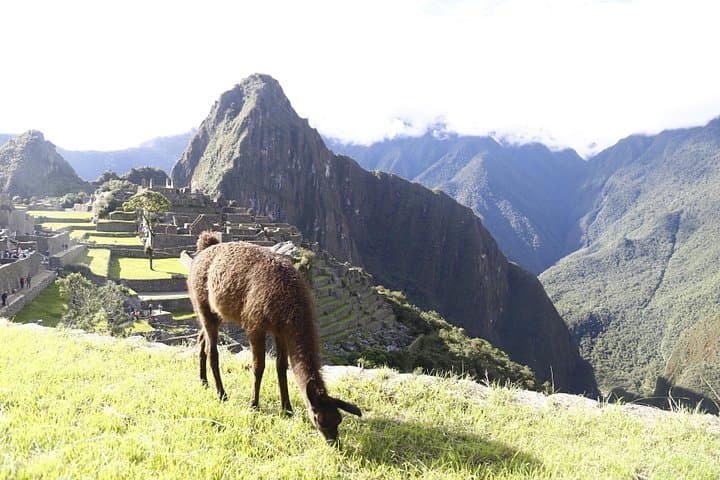
Geologically the corridor sits where Andean uplift meets jungle erosion; moss-covered stonework and narrow tunnels are a reminder that rock and water have shaped this route for millennia. Culturally the trail is a living route: llamas graze terraces, Quechua names mark nearby peaks, and the story of Hiram Bingham’s 1911 rediscovery is never far from a guide’s narration.
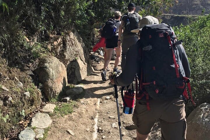
Practically, expect long hiking days with moderate elevation changes, persistent humidity and sudden showers in the rainy season. Bring layered clothing, a waterproof shell, 2–3 liters of water, and snacks; protect your camera from mist. Start early to reach the Sun Gate at dawn when the light makes the ruins appear to rise from the clouds.
Permits limit daily entry—book well ahead—and allow time to acclimatize in Cusco before departure. The last stretch down to Aguas Calientes is a sharp, restorative descent followed by a short bus or train transfer. The trail demands respect: move steadily, read the terrain, and let the mountains set your pace.
moderate.
2 days.
Moderate fitness with prior hiking experience and good cardiovascular health; acclimatization to altitude is important.
Yes—permits for the Inca Trail are limited and linked to your passport; book well in advance, especially in high season.
The 2-day option is shorter in distance but still strenuous due to long days, altitude and steep sections—expect sustained effort rather than technical climbing.
No—this itinerary includes an overnight in a hostel in Aguas Calientes rather than camping on the trail.
Yes, but Huayna Picchu requires a separate permit and timed entry; ask your operator to reserve early as spots sell out fast.
Machu Picchu was a ceremonial and administrative center tied to the Inca empire; Hiram Bingham brought it to global attention in 1911.
Permits and daily visitor caps protect fragile ruins and the trail; follow ‘leave no trace’ rules and avoid walking off designated paths.
PERU TRAVEL COMPANY operates guided outdoor trips and adventures with an emphasis on safety, stewardship, and memorable experiences.
Morning fog lifts off the Urubamba and the trail ahead glistens with damp stone and orchids; you feel the path underfoot—ancient paving that still remembers the sandals of the Inca.
Morning fog lifts off the Urubamba and the trail ahead glistens with damp stone and orchids; you feel the path underfoot—ancient paving that still remembers the sandals of the Inca.
This two-day route covers roughly 10 miles (16 km) from the km 104 trailhead to the Sun Gate at Machu Picchu, threading cloud-forest, waterfalls and exposed terraces. The route passes Chachabamba and Wiñay Wayna—Inca sites that reveal how pre-Columbian engineers worked with steep Andean slopes—and ends at the citadel around 2,430 m (7,970 ft).
Geologically the corridor sits where Andean uplift meets jungle erosion; moss-covered stonework and narrow tunnels are a reminder that rock and water have shaped this route for millennia. Culturally the trail is a living route: llamas graze terraces, Quechua names mark nearby peaks, and the story of Hiram Bingham’s 1911 rediscovery is never far from a guide’s narration.
Practically, expect long hiking days with moderate elevation changes, persistent humidity and sudden showers in the rainy season. Bring layered clothing, a waterproof shell, 2–3 liters of water, and snacks; protect your camera from mist. Start early to reach the Sun Gate at dawn when the light makes the ruins appear to rise from the clouds.
Permits limit daily entry—book well ahead—and allow time to acclimatize in Cusco before departure. The last stretch down to Aguas Calientes is a sharp, restorative descent followed by a short bus or train transfer. The trail demands respect: move steadily, read the terrain, and let the mountains set your pace.