THE ADVENTURE COLLECTIVE® · Independent discovery and booking for outdoor travel

Descend from the high Andean pass above La Paz into the humid Yungas on the historic El Choro Inka Trail. This three-day trek traces ancient stone paths, crosses cloud forest and rivers, and finishes in the lowland town of Chairo.
Descend from the high Andean pass above La Paz into the humid Yungas on the historic El Choro Inka Trail. This three-day trek traces ancient stone paths, crosses cloud forest and rivers, and finishes in the lowland town of Chairo.
At dawn the ridge opens and the wind pushes off the high Andes like a last warning. Hikers set out from the high-altitude pass near La Paz and begin a steady descent through cloud-scrub and puna grass into the thick, humid folds of the Yungas. Stone Inca steps give way to packed dirt, wooden footbridges, and forested singletrack as the valley drops nearly 2,900 meters over three days.
Verified experiences and guided adventures in the surrounding area.
Operated by Latina Travel · La Paz, La Paz
At dawn the ridge opens and the wind pushes off the high Andes like a last warning. Hikers set out from the high-altitude pass near La Paz and begin a steady descent through cloud-scrub and puna grass into the thick, humid folds of the Yungas. Stone Inca steps give way to packed dirt, wooden footbridges, and forested singletrack as the valley drops nearly 2,900 meters over three days.
This is an old trade route. The trail follows Inca-built causeways and terraced slopes that once linked highland communities with lowland farms. Geologically the route slices through steep Andean escarpments carved by rivers and landslides; you pass shale and sandstone outcrops that widen into the humid, biodiverse belt of the eastern slopes.
Culturally the route threads small Aymara and campesino villages where traditional agriculture endures and local guides will point out stonework and irrigation channels. Wildlife moves just off-trail: toucans, Andean cock-of-the-rocks and small monkeys populate the lower reaches.
Practical guidance: expect three full hiking days—roughly 6–7 hours on days one and two, 3–4 hours on day three—covering about 25–35 km total. Altitude loss is rapid; carry a lightweight daypack, waterproof layers, and plan for muddy sections in the rainy season (November–March). Nights are in tents on established camps; guides handle cooking and logistics. Hydrate well at high elevation, use trekking poles for technical descents, and leave no trace: the trail’s stonework and fragile cloud forest recover slowly from erosion and human impact.
moderate.
3 days.
Good aerobic fitness for multiple days of hiking (6–7 hours/day on long days); comfortable with sustained descents and uneven terrain.
No technical experience is required, but prior exposure to altitude helps; spend a day or two in La Paz and notify guides of any altitude symptoms.
Meals include breakfasts, lunches, and dinners cooked by the guide; nights are in tents with provided mattresses at designated campsites.
The trail is open year-round but the wet season (Nov–Mar) brings heavy rain, mud, and slick bridges—plan accordingly.
There is no national permit system for this route, but guided treks arrange access and coordinate with local communities; always book through reputable operators.
The trail follows pre-Columbian Inca routes used for trade and communication between highland and lowland communities; surviving stonework and terraces reflect that legacy.
The Yungas is biodiverse but erosion-prone; stick to established campsites, pack out waste, and avoid widening the trail to protect fragile soils and endemic species.
Latina Travel operates guided outdoor trips and adventures with an emphasis on safety, stewardship, and memorable experiences.
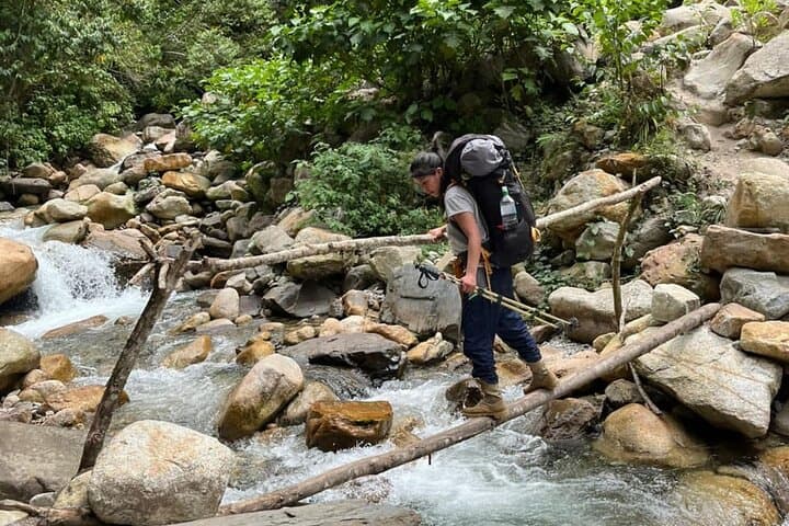
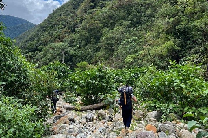
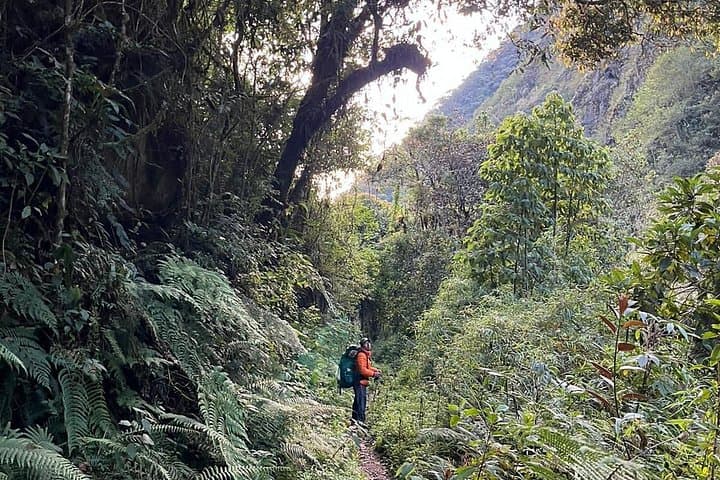
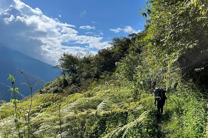
At dawn the ridge opens and the wind pushes off the high Andes like a last warning. Hikers set out from the high-altitude pass near La Paz and begin a steady descent through cloud-scrub and puna grass into the thick, humid folds of the Yungas. Stone Inca steps give way to packed dirt, wooden footbridges, and forested singletrack as the valley drops nearly 2,900 meters over three days.
At dawn the ridge opens and the wind pushes off the high Andes like a last warning. Hikers set out from the high-altitude pass near La Paz and begin a steady descent through cloud-scrub and puna grass into the thick, humid folds of the Yungas. Stone Inca steps give way to packed dirt, wooden footbridges, and forested singletrack as the valley drops nearly 2,900 meters over three days.
This is an old trade route. The trail follows Inca-built causeways and terraced slopes that once linked highland communities with lowland farms. Geologically the route slices through steep Andean escarpments carved by rivers and landslides; you pass shale and sandstone outcrops that widen into the humid, biodiverse belt of the eastern slopes.
Culturally the route threads small Aymara and campesino villages where traditional agriculture endures and local guides will point out stonework and irrigation channels. Wildlife moves just off-trail: toucans, Andean cock-of-the-rocks and small monkeys populate the lower reaches.
Practical guidance: expect three full hiking days—roughly 6–7 hours on days one and two, 3–4 hours on day three—covering about 25–35 km total. Altitude loss is rapid; carry a lightweight daypack, waterproof layers, and plan for muddy sections in the rainy season (November–March). Nights are in tents on established camps; guides handle cooking and logistics. Hydrate well at high elevation, use trekking poles for technical descents, and leave no trace: the trail’s stonework and fragile cloud forest recover slowly from erosion and human impact.