THE ADVENTURE COLLECTIVE® · Independent discovery and booking for outdoor travel

Climb Chaparrastique (San Miguel), El Salvador’s classic conic volcano — a steep, high‑altitude trek over loose volcanic scree with panoramic views. This guide covers what to expect, safety basics, and local context before you go.
Climb Chaparrastique (San Miguel), El Salvador’s classic conic volcano — a steep, high‑altitude trek over loose volcanic scree with panoramic views. This guide covers what to expect, safety basics, and local context before you go.
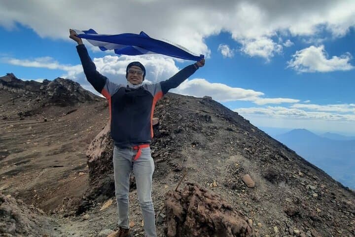
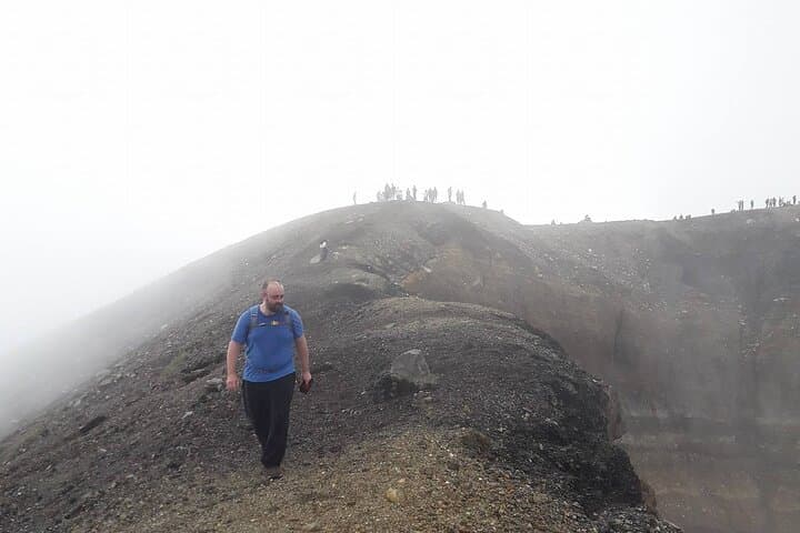
Morning light hits the ridgeline and the volcano answers with a sharp, geometric silhouette — a near-perfect cone rising to 2,130 meters above the coastal plain. On approach the trail cuts from coffee plantations into scrubby volcanic slopes, the air changing from humid lowland warmth to thin, brisk wind as hikers climb toward the crater.
Verified experiences and guided adventures in the surrounding area.
Operated by Natural Trekking Central America · San Miguel, San Miguel
Morning light hits the ridgeline and the volcano answers with a sharp, geometric silhouette — a near-perfect cone rising to 2,130 meters above the coastal plain. On approach the trail cuts from coffee plantations into scrubby volcanic slopes, the air changing from humid lowland warmth to thin, brisk wind as hikers climb toward the crater.
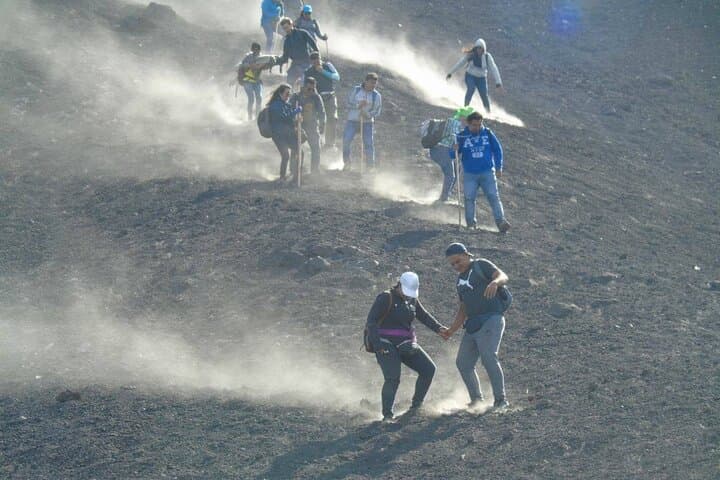
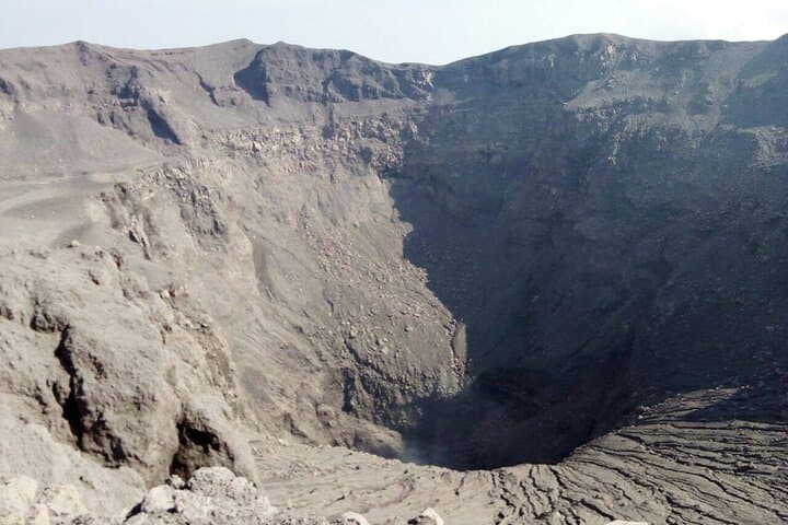
Geologically, Chaparrastique — commonly called San Miguel — is one of El Salvador’s most active stratovolcanoes; its steep flanks are built from layers of ash and hardened lava that make for loose, rapid scree on the ascent and smart footing on descent. Culturally the volcano shapes local life: towns around its base plant coffee on the richer lower slopes and mark eruptions in oral history. You’ll see signs of past flows and recent fumarolic activity; eruptions as recent as the 21st century underscore the need for respect and updated local guidance.
Practically, expect a long, sustained climb with sections of steep switchbacks and loose volcanic gravel. Plan for early starts to avoid midday heat and afternoon showers, carry at least 2–3 liters of water, sturdy boots, and trekking poles for stability on scree. Altitude reaches about 2,130 m but ascent profiles are steep rather than technical — no ropes required, but good fitness and careful footing are essential. Local guides provide transport, route knowledge, and cultural context; check eruption advisories before you go. With appropriate preparation this is a demanding, high-reward hike: raw volcanic terrain, commanding views over the Gulf of Fonseca, and a real sense of standing on an active peak that continues to shape the land and people around it.
challenging.
8–12 hours.
Should be in good aerobic condition with experience on steep, sustained hikes; ability to handle long descents on loose scree.
Total on-mountain time varies with fitness and route but typically 6–10 hours round trip; the full excursion including transport often runs 8–12 hours.
Chaparrastique is active; climbs are possible when local authorities and guides report safe conditions — always check recent advisories and follow guide instructions.
A guide is strongly recommended for safety and local knowledge; permits aren’t usually required for day hikes but operators often arrange access as part of a tour.
Sturdy, high-traction hiking boots are best for steep, loose volcanic terrain; trail runners may be acceptable for experienced hikers but offer less ankle protection.
Chaparrastique (San Miguel) has a long history of eruptions and is a defining landmark for eastern El Salvador; communities around it have agricultural traditions shaped by volcanic soils.
Trails on active volcanoes are prone to erosion and sensitive vegetation; follow Leave No Trace, avoid widening paths, and support local guides who manage low‑impact access.
Natural Trekking Central America operates guided outdoor trips and adventures with an emphasis on safety, stewardship, and memorable experiences.
Morning light hits the ridgeline and the volcano answers with a sharp, geometric silhouette — a near-perfect cone rising to 2,130 meters above the coastal plain. On approach the trail cuts from coffee plantations into scrubby volcanic slopes, the air changing from humid lowland warmth to thin, brisk wind as hikers climb toward the crater.
Morning light hits the ridgeline and the volcano answers with a sharp, geometric silhouette — a near-perfect cone rising to 2,130 meters above the coastal plain. On approach the trail cuts from coffee plantations into scrubby volcanic slopes, the air changing from humid lowland warmth to thin, brisk wind as hikers climb toward the crater.
Geologically, Chaparrastique — commonly called San Miguel — is one of El Salvador’s most active stratovolcanoes; its steep flanks are built from layers of ash and hardened lava that make for loose, rapid scree on the ascent and smart footing on descent. Culturally the volcano shapes local life: towns around its base plant coffee on the richer lower slopes and mark eruptions in oral history. You’ll see signs of past flows and recent fumarolic activity; eruptions as recent as the 21st century underscore the need for respect and updated local guidance.
Practically, expect a long, sustained climb with sections of steep switchbacks and loose volcanic gravel. Plan for early starts to avoid midday heat and afternoon showers, carry at least 2–3 liters of water, sturdy boots, and trekking poles for stability on scree. Altitude reaches about 2,130 m but ascent profiles are steep rather than technical — no ropes required, but good fitness and careful footing are essential. Local guides provide transport, route knowledge, and cultural context; check eruption advisories before you go. With appropriate preparation this is a demanding, high-reward hike: raw volcanic terrain, commanding views over the Gulf of Fonseca, and a real sense of standing on an active peak that continues to shape the land and people around it.