THE ADVENTURE COLLECTIVE® · Independent discovery and booking for outdoor travel

A compact, moderate trek above Potrerillos Dam that delivers sweeping Andean panoramas in 2–3 hours. Expect rocky pitches, wind-swept ridgelines, and a high-reward summit view accessible from Mendoza.
A compact, moderate trek above Potrerillos Dam that delivers sweeping Andean panoramas in 2–3 hours. Expect rocky pitches, wind-swept ridgelines, and a high-reward summit view accessible from Mendoza.
You push off from the trailhead with Mendoza still shrinking behind you — the wind here has an appetite, pressing at your shoulders and clearing your view. The path climbs through scrub-covered slopes, stepping over loose stone and braided goat tracks until the Potrerillos reservoir unrolls below like a slab of blue glass. At the summit of Cerro Bayo, the Andes push the horizon into a serrated line that feels both near and endlessly distant.
Verified experiences and guided adventures in the surrounding area.
Operated by Gray Line Argentina · Potrerillos, Mendoza Province
You push off from the trailhead with Mendoza still shrinking behind you — the wind here has an appetite, pressing at your shoulders and clearing your view. The path climbs through scrub-covered slopes, stepping over loose stone and braided goat tracks until the Potrerillos reservoir unrolls below like a slab of blue glass. At the summit of Cerro Bayo, the Andes push the horizon into a serrated line that feels both near and endlessly distant.
This short but sharp trek traces landscapes shaped by Andean uplift and semi-arid erosion: compacted sandstone, limestone outcrops, and wind-peeled scree. Indigenous Huarpes once moved seasonally through these valleys; later, gaucho routes and dam construction altered access and water flow, leaving a mix of cultural markers and modern infrastructure. Local guides point out resilient shrubs, seasonal wildflowers and the occasional condor riding thermals overhead.
Expect a hike of moderate difficulty — steep pitches and rocky steps concentrate effort into 2–3 hours on the trail. The summit viewpoint is the payoff: broad panoramas of the high Andes and the calm water of Potrerillos Dam below.
Practical guidance: start early to avoid strong afternoon winds and the heat of the sun; wear ankle-supporting boots for loose terrain; carry 1–2 liters of water and a layered windbreaker. Follow your guide’s route, keep to established paths to protect fragile vegetation, and leave no trace. With basic preparation this trek makes for a compact, high-reward Andes outing that fits neatly into a morning or half-day from Mendoza.
moderate.
2–3 hours.
Moderate fitness: able to sustain steady uphill walking with short steep sections and manage uneven terrain.
The trekking portion takes about 2–3 hours round trip and is rated moderate—expect steep pitches, rocky trails, and short stretches of scree.
Round-trip transfers from Mendoza city center are included in the excursion, with a morning pickup for the safety briefing and departure.
The route reaches approximately 1,750 meters (5,740 ft) above sea level; altitude effects are mild for most visitors but breathe steadily on climbs.
Children under 8 are not permitted on this activity; participants should have at least a moderate fitness level as noted by the operator.
The valley was traditionally used by Huarpes for seasonal movement; later irrigation and dam construction reshaped local hydrology and access routes.
This semi-arid landscape is fragile—stay on established trails, pack out all waste, and avoid disturbing nesting birds or rare shrubs.
Gray Line Argentina operates guided outdoor trips and adventures with an emphasis on safety, stewardship, and memorable experiences.
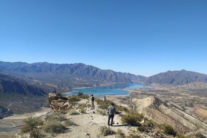
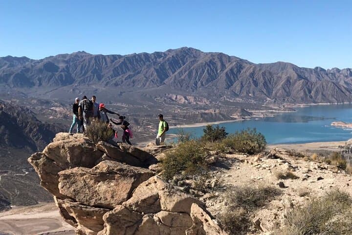
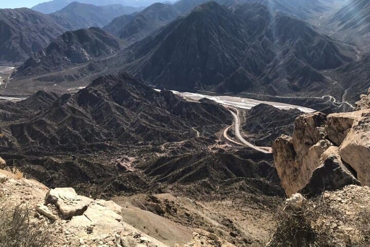
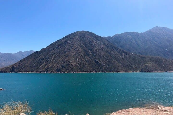
You push off from the trailhead with Mendoza still shrinking behind you — the wind here has an appetite, pressing at your shoulders and clearing your view. The path climbs through scrub-covered slopes, stepping over loose stone and braided goat tracks until the Potrerillos reservoir unrolls below like a slab of blue glass. At the summit of Cerro Bayo, the Andes push the horizon into a serrated line that feels both near and endlessly distant.
You push off from the trailhead with Mendoza still shrinking behind you — the wind here has an appetite, pressing at your shoulders and clearing your view. The path climbs through scrub-covered slopes, stepping over loose stone and braided goat tracks until the Potrerillos reservoir unrolls below like a slab of blue glass. At the summit of Cerro Bayo, the Andes push the horizon into a serrated line that feels both near and endlessly distant.
This short but sharp trek traces landscapes shaped by Andean uplift and semi-arid erosion: compacted sandstone, limestone outcrops, and wind-peeled scree. Indigenous Huarpes once moved seasonally through these valleys; later, gaucho routes and dam construction altered access and water flow, leaving a mix of cultural markers and modern infrastructure. Local guides point out resilient shrubs, seasonal wildflowers and the occasional condor riding thermals overhead.
Expect a hike of moderate difficulty — steep pitches and rocky steps concentrate effort into 2–3 hours on the trail. The summit viewpoint is the payoff: broad panoramas of the high Andes and the calm water of Potrerillos Dam below.
Practical guidance: start early to avoid strong afternoon winds and the heat of the sun; wear ankle-supporting boots for loose terrain; carry 1–2 liters of water and a layered windbreaker. Follow your guide’s route, keep to established paths to protect fragile vegetation, and leave no trace. With basic preparation this trek makes for a compact, high-reward Andes outing that fits neatly into a morning or half-day from Mendoza.