THE ADVENTURE COLLECTIVE® · Independent discovery and booking for outdoor travel

A demanding day hike into Honduras’s cloud forest on the ridges above Lake Yojoa. Expect steep climbs, mist-wrapped trees, waterfalls and blue-water pools—ideal for fit hikers seeking remote scenery and biodiversity.
A demanding day hike into Honduras’s cloud forest on the ridges above Lake Yojoa. Expect steep climbs, mist-wrapped trees, waterfalls and blue-water pools—ideal for fit hikers seeking remote scenery and biodiversity.
Fog sits in tiers across the ridge as the trail rises—at once cool and damp, the cloud forest sizing you up with dripping fern fronds and the distant bass of a waterfall. Hikers begin near Lake Yojoa and push uphill through moss-slick trail, where the air thins toward the park’s high point at roughly 2,080 meters above sea level.
Verified experiences and guided adventures in the surrounding area.
Operated by Honduras Traveling · San Francisco de Yojoa, Cortés
Fog sits in tiers across the ridge as the trail rises—at once cool and damp, the cloud forest sizing you up with dripping fern fronds and the distant bass of a waterfall. Hikers begin near Lake Yojoa and push uphill through moss-slick trail, where the air thins toward the park’s high point at roughly 2,080 meters above sea level.
Declared a national park in 1987, Cerro Azul Meámbar (PANACAM) protects about 312 km² of cloud forest and watershed that feeds the El Cajón hydroelectric system and a string of blue-water pools. Geologically the range is volcanic and heavily eroded, producing steep ridgelines, deep ravines and mineral-rich streams. Local communities, especially around San Francisco de Yojoa, maintain farming and fishing traditions tied to the lake; guides often weave natural history with stories of land management and water rights.
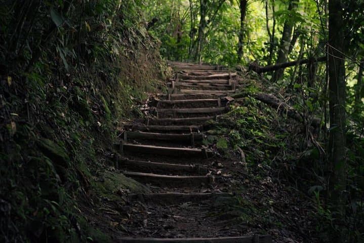
On trail you’ll encounter hanging bromeliads, tree ferns and mixed broadleaf stands, and likely odonate life near clear pools. Expect steep, rocky sections, muddy steps in rain, and short scrambling in places—this is a fitness challenge as much as a nature walk.
Practical guidance: start early to avoid afternoon storms, pack rain protection and at least 2–3 liters of water, and wear grippy hiking boots. Bring insect repellent and layers for wind at higher elevation. If you’re attempting the higher ridge or a full day circuit, hire a local guide for route knowledge and to support community-based conservation efforts.
challenging.
6–7 hours.
Best for very fit hikers used to sustained climbs and uneven terrain; core strength and cardiovascular endurance required
It’s a challenging day hike with sustained elevation gain to about 2,080 m; participants should be in good cardiovascular shape and comfortable with uneven, sometimes muddy terrain.
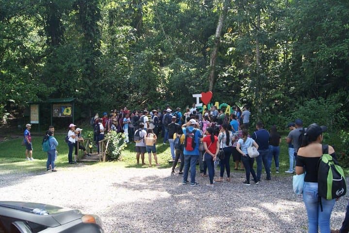
Park access is regulated—many tours include entrance fees and a guide; check with the operator or local park authorities for current fees and rules.
Expect birds (trogons, tanagers), occasional howler monkeys and a range of amphibians and insects near water; sightings depend on season and time of day.
At around 2,000 meters mild altitude effects are possible—stay hydrated, pace yourself, and descend if you feel severe symptoms.
Designated a national park in 1987 to protect cloud-forest watersheds that feed Lake Yojoa and downstream hydroelectric infrastructure, PANACAM has long been important for regional water security and local livelihoods.
The park balances hydropower interests and biodiversity protection; visitors are encouraged to follow leave-no-trace practices and hire local guides to support sustainable tourism.
Honduras Traveling operates guided outdoor trips and adventures with an emphasis on safety, stewardship, and memorable experiences.


Fog sits in tiers across the ridge as the trail rises—at once cool and damp, the cloud forest sizing you up with dripping fern fronds and the distant bass of a waterfall. Hikers begin near Lake Yojoa and push uphill through moss-slick trail, where the air thins toward the park’s high point at roughly 2,080 meters above sea level.
Fog sits in tiers across the ridge as the trail rises—at once cool and damp, the cloud forest sizing you up with dripping fern fronds and the distant bass of a waterfall. Hikers begin near Lake Yojoa and push uphill through moss-slick trail, where the air thins toward the park’s high point at roughly 2,080 meters above sea level.
Declared a national park in 1987, Cerro Azul Meámbar (PANACAM) protects about 312 km² of cloud forest and watershed that feeds the El Cajón hydroelectric system and a string of blue-water pools. Geologically the range is volcanic and heavily eroded, producing steep ridgelines, deep ravines and mineral-rich streams. Local communities, especially around San Francisco de Yojoa, maintain farming and fishing traditions tied to the lake; guides often weave natural history with stories of land management and water rights.
On trail you’ll encounter hanging bromeliads, tree ferns and mixed broadleaf stands, and likely odonate life near clear pools. Expect steep, rocky sections, muddy steps in rain, and short scrambling in places—this is a fitness challenge as much as a nature walk.
Practical guidance: start early to avoid afternoon storms, pack rain protection and at least 2–3 liters of water, and wear grippy hiking boots. Bring insect repellent and layers for wind at higher elevation. If you’re attempting the higher ridge or a full day circuit, hire a local guide for route knowledge and to support community-based conservation efforts.