THE ADVENTURE COLLECTIVE® · Independent discovery and booking for outdoor travel

Drive the famous 59-mile corridor of Cape Hatteras National Seashore with a location-triggered audio guide that narrates shipwrecks, lighthouses, and migrating birds. Download once, use for a year, and explore the Outer Banks at your own pace.
Drive the famous 59-mile corridor of Cape Hatteras National Seashore with a location-triggered audio guide that narrates shipwrecks, lighthouses, and migrating birds. Download once, use for a year, and explore the Outer Banks at your own pace.
You pull off Highway 12 as wind lifts salt spray into the cab and the sound of the ocean edges into the stereo—our guide begins, voice steady, pointing the route ahead. The road ribboning across barrier islands feels like a slow reveal: salt marshes to your left, Atlantic surf to your right, and lighthouses punctuating the horizon like milestones.
Verified experiences and guided adventures in the surrounding area.
Operated by Travel with Action · Nags Head, North Carolina
You pull off Highway 12 as wind lifts salt spray into the cab and the sound of the ocean edges into the stereo—our guide begins, voice steady, pointing the route ahead. The road ribboning across barrier islands feels like a slow reveal: salt marshes to your left, Atlantic surf to your right, and lighthouses punctuating the horizon like milestones.
This stretch of the Outer Banks records centuries of change: shifting inlets carved by hurricanes, the Graveyard of the Atlantic’s shipwreck stories, and colonial secrets from Roanoke to the Blackbeard era. Geology here is active—sand moves, dunes migrate, and the barrier islands themselves are shaped by currents and storms. Culture is maritime: fishing, lifesaving stations, and kiteboarders turning gusts into motion.
The audio tour walks you stop-by-stop, from Bodie Island’s coquina beaches and the Oregon Inlet’s dramatic creation to the Cape Hatteras Lighthouse and Pea Island Wildlife Refuge. Expect short walks at overlooks, quick beach stretches, and interpretive stops where marshes dare you to scan for birds.
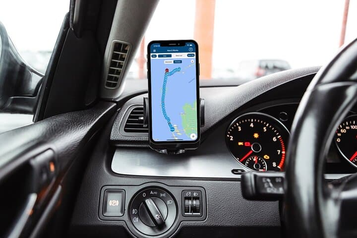
Practical guidance: download the Action app and the tour file on reliable Wi‑Fi before you arrive, pair your phone to your car audio or use headphones for walking segments, and obey local speed limits—many stops have limited parking. Bring layers for wind, a charged phone with offline maps, and water for the drive; the full route runs about 4–6 hours but is modular—pause, explore, and return. This is a road trip that reads like a guided walk: you set the pace, the coast supplies the scene.
easy.
4–6 hours.
Light: primarily driving with short, easy walks at stops; comfortable for most fitness levels.
The full route covers about 59 miles and takes roughly 4–6 hours to complete, but you can start, pause, and resume as you like.
You must download the tour via Wi‑Fi or cellular before arrival; the guide and maps work offline after download.
Yes—the purchase is per car, not per person, making it cost-effective for groups in a single vehicle.
No—this is an audio driving tour only; check individual site hours and admission requirements before visiting.
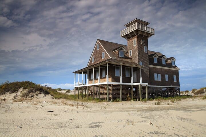
The Outer Banks earned the nickname “Graveyard of the Atlantic” due to frequent shipwrecks; lifesaving stations and lighthouses developed here as a response.
The seashore’s barrier islands are dynamic and protected—stick to marked parking and paths to avoid disturbing nesting birds and fragile dunes.
Travel with Action operates guided outdoor trips and adventures with an emphasis on safety, stewardship, and memorable experiences.


You pull off Highway 12 as wind lifts salt spray into the cab and the sound of the ocean edges into the stereo—our guide begins, voice steady, pointing the route ahead. The road ribboning across barrier islands feels like a slow reveal: salt marshes to your left, Atlantic surf to your right, and lighthouses punctuating the horizon like milestones.
You pull off Highway 12 as wind lifts salt spray into the cab and the sound of the ocean edges into the stereo—our guide begins, voice steady, pointing the route ahead. The road ribboning across barrier islands feels like a slow reveal: salt marshes to your left, Atlantic surf to your right, and lighthouses punctuating the horizon like milestones.
This stretch of the Outer Banks records centuries of change: shifting inlets carved by hurricanes, the Graveyard of the Atlantic’s shipwreck stories, and colonial secrets from Roanoke to the Blackbeard era. Geology here is active—sand moves, dunes migrate, and the barrier islands themselves are shaped by currents and storms. Culture is maritime: fishing, lifesaving stations, and kiteboarders turning gusts into motion.
The audio tour walks you stop-by-stop, from Bodie Island’s coquina beaches and the Oregon Inlet’s dramatic creation to the Cape Hatteras Lighthouse and Pea Island Wildlife Refuge. Expect short walks at overlooks, quick beach stretches, and interpretive stops where marshes dare you to scan for birds.
Practical guidance: download the Action app and the tour file on reliable Wi‑Fi before you arrive, pair your phone to your car audio or use headphones for walking segments, and obey local speed limits—many stops have limited parking. Bring layers for wind, a charged phone with offline maps, and water for the drive; the full route runs about 4–6 hours but is modular—pause, explore, and return. This is a road trip that reads like a guided walk: you set the pace, the coast supplies the scene.