THE ADVENTURE COLLECTIVE® · Independent discovery and booking for outdoor travel

Drive 23.5 miles of Cape Ann coastline with a narrated audio guide from Gloucester to Rockport. Learn maritime history, spot lighthouses and whales, and stop where you like—download the tour before you go.
Drive 23.5 miles of Cape Ann coastline with a narrated audio guide from Gloucester to Rockport. Learn maritime history, spot lighthouses and whales, and stop where you like—download the tour before you go.
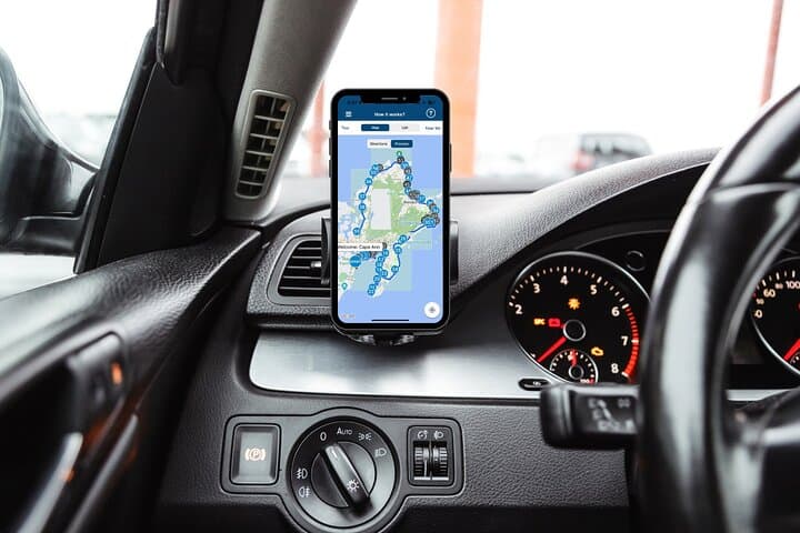
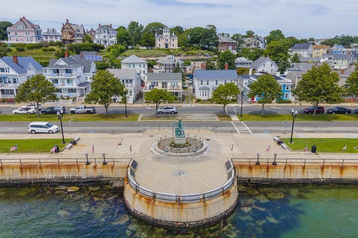
Salt air and the low slap of surf set the tempo as your car pulls away from Stage Fort Park and the Gloucester Visitor Center. The road hugs rocky coves, opens to broad sandy beaches, and threads through fishing wharves whose nets still smell of the sea. Voices on the audio tour cue each landmark—statues, lighthouses, granite piers—turning the drive into a narrated coastal walk.
Verified experiences and guided adventures in the surrounding area.
Operated by Stories with Action · Gloucester, Massachusetts
Salt air and the low slap of surf set the tempo as your car pulls away from Stage Fort Park and the Gloucester Visitor Center. The road hugs rocky coves, opens to broad sandy beaches, and threads through fishing wharves whose nets still smell of the sea. Voices on the audio tour cue each landmark—statues, lighthouses, granite piers—turning the drive into a narrated coastal walk.
This stretch of Cape Ann carries layered history: colonial ship captains who sailed to China, a 19th‑century granite industry that moved floors and facades across the Atlantic, and the modern legacy of The Perfect Storm, which left both scars and stories along these shores. Geology here is blunt and uncompromising—glacially scoured granite with ledges dropping to kelp-strewn tidepools, and narrow beaches formed where coves gather sand.
Culture is maritime: working harbors, fisherfolk, and small museums that keep memory of cod, schooners, and lighthouse keepers alive. Nature asserts itself too—seabirds wheel above, seals haul out on hidden rocks, and whales sometimes push the offshore silence into a sudden spray of breath.
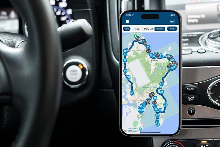
Practical guidance: download the Action Tour Guide app and the tour file before you arrive; it works offline. The route spans about 23.5 miles and runs 2–3 hours with more than 40 audio stories; plan time for stops at Halibut Point, Bearskin Neck, and Annisquam Light. Respect posted signs, parking rules, and wildlife closures—especially nesting shorebirds. For best photos, aim for low sun in morning or late afternoon and bring a charged phone, a car charger, and a light jacket—the coast changes fast.
easy.
2–3 hours.
Minimal fitness required; mostly driving with short walks at viewpoints and piers.
One tour purchase covers a single vehicle; everyone in the car can listen together using the same downloaded tour.
No—download the tour in the Action Tour Guide app ahead of time and it will run offline without cellular data.
No—entrance fees for museums, lighthouses, or boat trips are not included; check opening hours and book separately as needed.
The tour begins and ends at the Gloucester Visitor Center at Stage Fort Park (24 Hough Ave), forming a loop of roughly 23.5 miles.
Gloucester and Rockport grew on shipbuilding, fishing, and 19th‑century granite export—maritime trade shaped towns and lighthouses dotting the coast.
Much of the shoreline is protected or managed; stick to marked paths, obey nesting-season closures, and pack out trash to protect dunes and seal haulouts.
Stories with Action operates guided outdoor trips and adventures with an emphasis on safety, stewardship, and memorable experiences.

Salt air and the low slap of surf set the tempo as your car pulls away from Stage Fort Park and the Gloucester Visitor Center. The road hugs rocky coves, opens to broad sandy beaches, and threads through fishing wharves whose nets still smell of the sea. Voices on the audio tour cue each landmark—statues, lighthouses, granite piers—turning the drive into a narrated coastal walk.
Salt air and the low slap of surf set the tempo as your car pulls away from Stage Fort Park and the Gloucester Visitor Center. The road hugs rocky coves, opens to broad sandy beaches, and threads through fishing wharves whose nets still smell of the sea. Voices on the audio tour cue each landmark—statues, lighthouses, granite piers—turning the drive into a narrated coastal walk.
This stretch of Cape Ann carries layered history: colonial ship captains who sailed to China, a 19th‑century granite industry that moved floors and facades across the Atlantic, and the modern legacy of The Perfect Storm, which left both scars and stories along these shores. Geology here is blunt and uncompromising—glacially scoured granite with ledges dropping to kelp-strewn tidepools, and narrow beaches formed where coves gather sand.
Culture is maritime: working harbors, fisherfolk, and small museums that keep memory of cod, schooners, and lighthouse keepers alive. Nature asserts itself too—seabirds wheel above, seals haul out on hidden rocks, and whales sometimes push the offshore silence into a sudden spray of breath.
Practical guidance: download the Action Tour Guide app and the tour file before you arrive; it works offline. The route spans about 23.5 miles and runs 2–3 hours with more than 40 audio stories; plan time for stops at Halibut Point, Bearskin Neck, and Annisquam Light. Respect posted signs, parking rules, and wildlife closures—especially nesting shorebirds. For best photos, aim for low sun in morning or late afternoon and bring a charged phone, a car charger, and a light jacket—the coast changes fast.