THE ADVENTURE COLLECTIVE® · Independent discovery and booking for outdoor travel

Stand where two oceans meet and the African continent ends: Cape Agulhas mixes maritime history, wind-sculpted geology, and the daily life of a working coastline. This full-day tour delivers lighthouse views, wildlife chances, and practical coastal walking—bring layers and plan around tides.
Stand where two oceans meet and the African continent ends: Cape Agulhas mixes maritime history, wind-sculpted geology, and the daily life of a working coastline. This full-day tour delivers lighthouse views, wildlife chances, and practical coastal walking—bring layers and plan around tides.
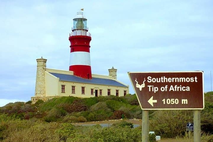
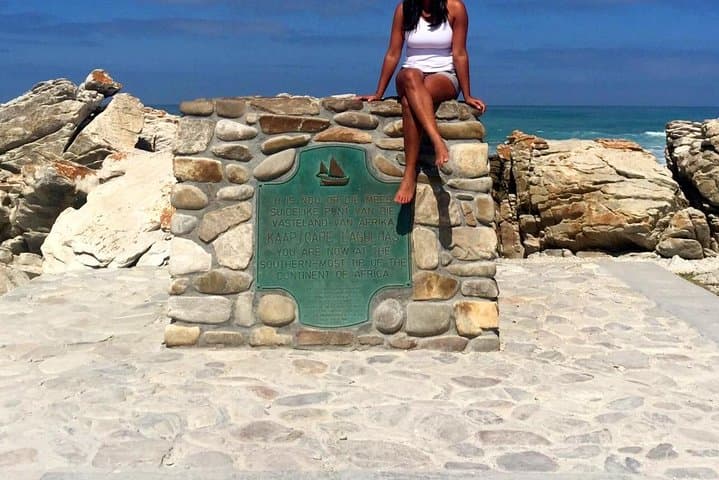
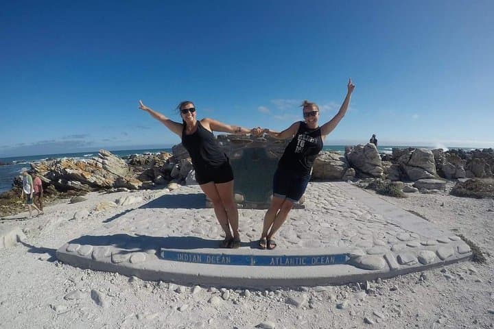
A cold wind off two oceans hits the car park before you reach the rusted sign marking the southernmost tip of Africa. Salt sprays the air; a low, flat coastline stretches east and west and the lighthouse—white brick, 1849—stands like a practical answer to the sea’s appetite. You can walk to the exact point where the map of continents ends and the Atlantic and Indian Oceans meet, then stand with one foot facing each great current.
Verified experiences and guided adventures in the surrounding area.
Operated by Once in Africa Travel · L'Agulhas, Western Cape
A cold wind off two oceans hits the car park before you reach the rusted sign marking the southernmost tip of Africa. Salt sprays the air; a low, flat coastline stretches east and west and the lighthouse—white brick, 1849—stands like a practical answer to the sea’s appetite. You can walk to the exact point where the map of continents ends and the Atlantic and Indian Oceans meet, then stand with one foot facing each great current.
The cape’s coastline is sculpted of hard, weathered sandstone and wave-cut platforms formed over millennia by the Agulhas Current and frequent storms. The lighthouse and the adjacent topographic map reflect a maritime history of wrecks and navigation: the Agulhas Bank is notorious for shoals that once sent countless ships to the rocks, so this is both geography lesson and maritime memorial.
Culturally the region is small-town coastal South Africa—fishing boats in Struisbaai, local seafood stalls, and a pace dictated by tides and wind. In season you may spot southern right whales offshore or oystercatchers probing the strand.
Practically, this is an accessible eight-hour day trip from nearby towns. Expect exposed walking on uneven rock, strong wind, and wide-open sun. Wear windproof layers, sturdy shoes with grip, and carry water and sun protection. Check tide and weather before you go and allow time for short detours—Struisbaai jetty for fresh seafood or the nearby topographic map installation for a close-up of the continent. The shore demands respect: stay off fragile flora and heed park signage so this meeting point of oceans remains raw and clear for the next visitor.
easy.
8 hours.
Suitable for most fitness levels; involves short, easy walks on uneven ground and time spent standing outdoors.
The full-day shared tour runs about 8 hours, including transport time and stops at key viewpoints and the lighthouse.
Visitors can view and photograph the Cape Agulhas Lighthouse; access inside may be limited—check with the tour operator for current openings.
Southern right whales are most commonly seen June–November; sightings are seasonal and weather-dependent.
Main parking and some viewing areas are accessible, but rocky shoreline sections are uneven and may not be suitable for wheelchairs.
Cape Agulhas Lighthouse (operational since 1849) marks a treacherous maritime zone where the Agulhas Bank caused numerous 19th-century shipwrecks; the spot is a long-standing navigation landmark.
Cape Agulhas lies within protected land and nearby marine areas—stay on paths, avoid disturbing breeding birds, and observe posted rules to protect fragile coastal vegetation and marine life.
Once in Africa Travel operates guided outdoor trips and adventures with an emphasis on safety, stewardship, and memorable experiences.
A cold wind off two oceans hits the car park before you reach the rusted sign marking the southernmost tip of Africa. Salt sprays the air; a low, flat coastline stretches east and west and the lighthouse—white brick, 1849—stands like a practical answer to the sea’s appetite. You can walk to the exact point where the map of continents ends and the Atlantic and Indian Oceans meet, then stand with one foot facing each great current.
A cold wind off two oceans hits the car park before you reach the rusted sign marking the southernmost tip of Africa. Salt sprays the air; a low, flat coastline stretches east and west and the lighthouse—white brick, 1849—stands like a practical answer to the sea’s appetite. You can walk to the exact point where the map of continents ends and the Atlantic and Indian Oceans meet, then stand with one foot facing each great current.
The cape’s coastline is sculpted of hard, weathered sandstone and wave-cut platforms formed over millennia by the Agulhas Current and frequent storms. The lighthouse and the adjacent topographic map reflect a maritime history of wrecks and navigation: the Agulhas Bank is notorious for shoals that once sent countless ships to the rocks, so this is both geography lesson and maritime memorial.
Culturally the region is small-town coastal South Africa—fishing boats in Struisbaai, local seafood stalls, and a pace dictated by tides and wind. In season you may spot southern right whales offshore or oystercatchers probing the strand.
Practically, this is an accessible eight-hour day trip from nearby towns. Expect exposed walking on uneven rock, strong wind, and wide-open sun. Wear windproof layers, sturdy shoes with grip, and carry water and sun protection. Check tide and weather before you go and allow time for short detours—Struisbaai jetty for fresh seafood or the nearby topographic map installation for a close-up of the continent. The shore demands respect: stay off fragile flora and heed park signage so this meeting point of oceans remains raw and clear for the next visitor.