THE ADVENTURE COLLECTIVE® · Independent discovery and booking for outdoor travel

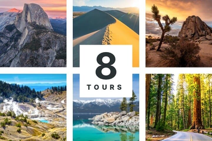
Drive California your way with GPS-driven audio tours that steer you through Tahoe’s shores, Yosemite’s granite, Death Valley’s salt flats and Joshua Tree’s boulders. Download offline guides, follow turn-by-turn narration, and customize stops across eight national and state parks.
Drive California your way with GPS-driven audio tours that steer you through Tahoe’s shores, Yosemite’s granite, Death Valley’s salt flats and Joshua Tree’s boulders. Download offline guides, follow turn-by-turn narration, and customize stops across eight national and state parks.
You pull off a two-lane highway at dawn, the phone chime swapping narration into your ear while pine-scented air pushes against the windshield. The GPS audio cues slide you from alpine switchbacks above Lake Tahoe into the hush of a sequoia grove, then later the desert rocks of Joshua Tree heat and shimmer like a living atlas. Rivers dare you to linger; salt flats push the horizon wide and strange.
Verified experiences and guided adventures in the surrounding area.
Operated by Shaka Guide Apps · San Francisco, California
You pull off a two-lane highway at dawn, the phone chime swapping narration into your ear while pine-scented air pushes against the windshield. The GPS audio cues slide you from alpine switchbacks above Lake Tahoe into the hush of a sequoia grove, then later the desert rocks of Joshua Tree heat and shimmer like a living atlas. Rivers dare you to linger; salt flats push the horizon wide and strange.
California’s landscapes tell a layered story: Sierra Nevada granite carved by glaciers, the Basin-and-Range geology that created Death Valley’s salt pans, volcanic domes at Lassen and ancient coast redwoods that survived millennia of climate shifts. Indigenous cultures — Washoe, Miwok, Paiute, Yurok and others — have long shaped human ties to these places; mining and conservation eras then remapped the land into parks and highways.
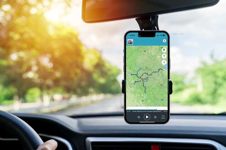
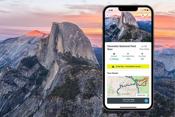
This self-guided audio bundle pairs turn-by-turn navigation with local history, geology primers and practical stops. Download tours on Wi‑Fi, load offline maps, and plan flexible days: drive-focused legs punctuated by short hikes (Eagle Falls, Emerald Bay) or longer outings (Ryan Mountain, Bumpass Hell).
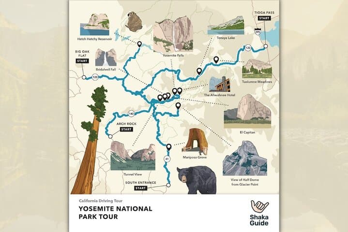
Practical edge: start early to beat heat and crowds, carry a full phone battery and a paper backup of directions for remote roads, and respect seasonal access — Tioga Pass and some high-elevation roads close in winter. Hydrate, layer for big daily temperature swings, and leave fragile sites undisturbed. The bundle hands you the route and the stories; you choose the pace and the views.
easy.
Variable — multi-day (up to 8 days).
Suitable for most fitness levels; primarily driving with optional short to moderate hikes that require standard hiking fitness
No—download the audio tours and offline maps to your Shaka Guide app before you leave Wi‑Fi; GPS still works offline for narration and directions.
Tours never expire once redeemed in the app, so you can replay or space stops over multiple days at your leisure.
Yes—the audio tour is licensed per vehicle, so your group can share a single purchase and playback during the drive.
No—national and state park entrance fees, permits, or parking passes are separate; check each park’s website for current costs and required reservations.
The routes trace Indigenous homelands and later mining, logging, and conservation histories that shaped the park system and California’s modern road network.
Download maps to reduce data use, follow Leave No Trace, and avoid off‑trail travel in fragile habitats; many parks use permit systems or timed entries to limit impacts.
Shaka Guide Apps operates guided outdoor trips and adventures with an emphasis on safety, stewardship, and memorable experiences.
You pull off a two-lane highway at dawn, the phone chime swapping narration into your ear while pine-scented air pushes against the windshield. The GPS audio cues slide you from alpine switchbacks above Lake Tahoe into the hush of a sequoia grove, then later the desert rocks of Joshua Tree heat and shimmer like a living atlas. Rivers dare you to linger; salt flats push the horizon wide and strange.
You pull off a two-lane highway at dawn, the phone chime swapping narration into your ear while pine-scented air pushes against the windshield. The GPS audio cues slide you from alpine switchbacks above Lake Tahoe into the hush of a sequoia grove, then later the desert rocks of Joshua Tree heat and shimmer like a living atlas. Rivers dare you to linger; salt flats push the horizon wide and strange.
California’s landscapes tell a layered story: Sierra Nevada granite carved by glaciers, the Basin-and-Range geology that created Death Valley’s salt pans, volcanic domes at Lassen and ancient coast redwoods that survived millennia of climate shifts. Indigenous cultures — Washoe, Miwok, Paiute, Yurok and others — have long shaped human ties to these places; mining and conservation eras then remapped the land into parks and highways.
This self-guided audio bundle pairs turn-by-turn navigation with local history, geology primers and practical stops. Download tours on Wi‑Fi, load offline maps, and plan flexible days: drive-focused legs punctuated by short hikes (Eagle Falls, Emerald Bay) or longer outings (Ryan Mountain, Bumpass Hell).
Practical edge: start early to beat heat and crowds, carry a full phone battery and a paper backup of directions for remote roads, and respect seasonal access — Tioga Pass and some high-elevation roads close in winter. Hydrate, layer for big daily temperature swings, and leave fragile sites undisturbed. The bundle hands you the route and the stories; you choose the pace and the views.