THE ADVENTURE COLLECTIVE® · Independent discovery and booking for outdoor travel

Trace an Andean route from Cajamarca to Chachapoyas, visiting Chachapoyas-era mausoleums, the stone fortress of Kuelap and the towering Gocta waterfall. This five-day journey blends archaeology, canyon scenery and cloud-forest hiking with practical transport between towns.
Trace an Andean route from Cajamarca to Chachapoyas, visiting Chachapoyas-era mausoleums, the stone fortress of Kuelap and the towering Gocta waterfall. This five-day journey blends archaeology, canyon scenery and cloud-forest hiking with practical transport between towns.
You crest a high, winding pass as cloud forest breathes against the van’s windows—green cliffs drop toward the Marañón and the road threads villages where corrugated roofs glint. Over five days the landscape keeps changing: broad Andean plateaus, carved river canyons, and finally the stone walls of Kuelap rising like a man-made cliff.
Verified experiences and guided adventures in the surrounding area.
Operated by Time To Travel · Chachapoyas, Amazonas
You crest a high, winding pass as cloud forest breathes against the van’s windows—green cliffs drop toward the Marañón and the road threads villages where corrugated roofs glint. Over five days the landscape keeps changing: broad Andean plateaus, carved river canyons, and finally the stone walls of Kuelap rising like a man-made cliff.
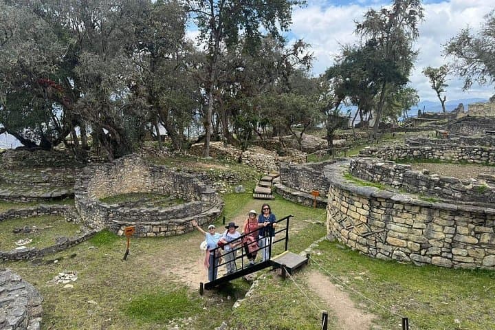
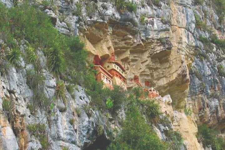
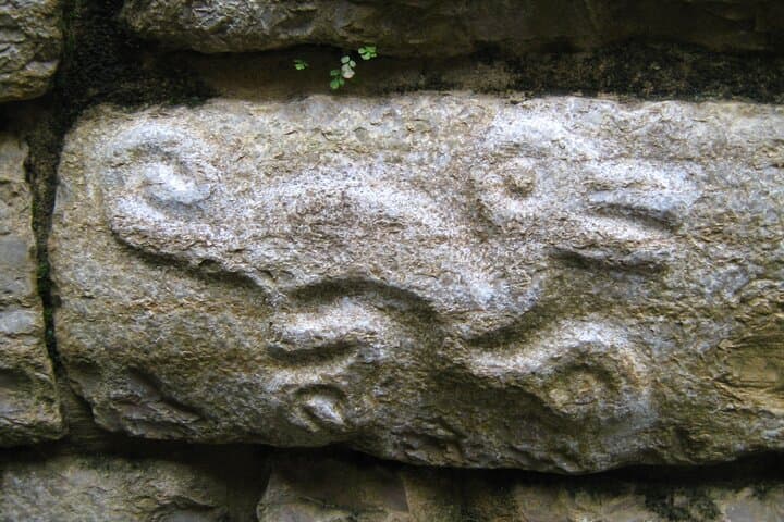
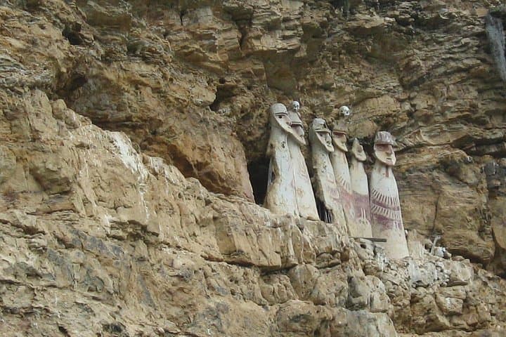
This route follows the footprint of the Chachapoyas culture: funeral towers at Revash, the wood-and-mud sarcophagi at Karajía, and the Leymebamba museum where hundreds of mummies remind you people lived and died here long before the Spanish. Geologically the region is a transition zone—limestone escarpments, humid cloud forest, and deep canyons cut by the Utcubamba and Marañón rivers—so expect mossy cliffs and constant moisture on rock surfaces.
Local life is visible from the road: market stalls, coffee plots, and villages that still practice Andean weaving. Practicalities matter: travel between towns is long (multiple 3–6 hour drives), roads can be narrow and slow, and Kuelap is best reached via the short cable-car lift and a steep walk across the top ridge.
Plan early starts to avoid afternoon rain and crowds at Gocta, where a roughly 11 km round-trip trail or horseback option leads through forest to the waterfall viewpoint. Bring layered rain gear, good traction footwear, and water for high-altitude hiking—altitude and humidity combine to make simple hikes more demanding. With moderate fitness and sensible gear this multi-day loop mixes archaeology, canyon vistas, and cloud-forest trails into a compact, vividly local Andean adventure.
moderate.
5 days.
Moderate fitness: able to handle multiple days of 3–6 hour drives, several hikes up to 11 km with elevation change
The common route is about 11 km round-trip with modest climbs; you can hire a horse for part of the way. Expect 3–5 hours depending on pace and stops.
Guides are recommended—many sites are archaeological and guides provide context and help navigate trails, though you can visit some areas independently.
Altitude ranges around 2,000–3,000 m on this itinerary; drink water, avoid heavy exertion on day one, and speak to your doctor about medication if you have prior sensitivity.
Main roads between Cajamarca and Chachapoyas are paved in stretches but can be narrow and windy; modern vehicles with AC are used but travel times remain long.
The Chachapoyas culture (the "Cloud People") built fortified hilltop settlements, cliffside tombs and distinctive wooden sarcophagi centuries before Inca expansion.
This cloud-forest corridor is ecologically sensitive; stick to trails, avoid single-use plastics, and support local guides and museums that invest in cultural and habitat preservation.
Time To Travel operates guided outdoor trips and adventures with an emphasis on safety, stewardship, and memorable experiences.
You crest a high, winding pass as cloud forest breathes against the van’s windows—green cliffs drop toward the Marañón and the road threads villages where corrugated roofs glint. Over five days the landscape keeps changing: broad Andean plateaus, carved river canyons, and finally the stone walls of Kuelap rising like a man-made cliff.
You crest a high, winding pass as cloud forest breathes against the van’s windows—green cliffs drop toward the Marañón and the road threads villages where corrugated roofs glint. Over five days the landscape keeps changing: broad Andean plateaus, carved river canyons, and finally the stone walls of Kuelap rising like a man-made cliff.
This route follows the footprint of the Chachapoyas culture: funeral towers at Revash, the wood-and-mud sarcophagi at Karajía, and the Leymebamba museum where hundreds of mummies remind you people lived and died here long before the Spanish. Geologically the region is a transition zone—limestone escarpments, humid cloud forest, and deep canyons cut by the Utcubamba and Marañón rivers—so expect mossy cliffs and constant moisture on rock surfaces.
Local life is visible from the road: market stalls, coffee plots, and villages that still practice Andean weaving. Practicalities matter: travel between towns is long (multiple 3–6 hour drives), roads can be narrow and slow, and Kuelap is best reached via the short cable-car lift and a steep walk across the top ridge.
Plan early starts to avoid afternoon rain and crowds at Gocta, where a roughly 11 km round-trip trail or horseback option leads through forest to the waterfall viewpoint. Bring layered rain gear, good traction footwear, and water for high-altitude hiking—altitude and humidity combine to make simple hikes more demanding. With moderate fitness and sensible gear this multi-day loop mixes archaeology, canyon vistas, and cloud-forest trails into a compact, vividly local Andean adventure.