THE ADVENTURE COLLECTIVE® · Independent discovery and booking for outdoor travel

A day hike from Tirana that pairs calm reservoir shores with a steep, rewarding ascent to Gamti ridgeline. Expect mixed forest, limestone scree and wide views over Bovilla — ideal for hikers with moderate fitness.
A day hike from Tirana that pairs calm reservoir shores with a steep, rewarding ascent to Gamti ridgeline. Expect mixed forest, limestone scree and wide views over Bovilla — ideal for hikers with moderate fitness.
The trail starts where the blue of Bovilla Lake meets broken limestone slopes and scrubby Mediterranean pines; morning light pares the water into a sheet of metal, and the first steps lead you along a low, steady grade that eases you into the mountain.
Verified experiences and guided adventures in the surrounding area.
Operated by Go as Local · Tirana, Tirana
The trail starts where the blue of Bovilla Lake meets broken limestone slopes and scrubby Mediterranean pines; morning light pares the water into a sheet of metal, and the first steps lead you along a low, steady grade that eases you into the mountain.
Bovilla is an artificial reservoir that supplies drinking water to Tirana, carved into limestone and marl that record the region’s tectonic past. The route climbs in two acts: an accessible lakeside section through mixed oak and maquis, then a narrower, steeper approach to Gamti’s ridgeline where the geology changes to broken scree and exposed bedrock. Locals once grazed sheep on these slopes and small shepherd paths remain, giving the hike a lived-in, rural feel.
The cultural pull is simple — this is a working watershed and a weekend escape for Tirana residents. Birds of prey quarter the air; distant villages punctuate the skyline. Expect clear, sweeping views over the reservoir and back toward the Accursed (Prokletije) foothills on fair days.
Practical side: the full loop to Gamti and back takes roughly 6–8 hours depending how far you push toward the peak. Wear grippy hiking boots for the steep, narrow sections and be prepared for loose rock on the final ascent. Carry at least 2 liters of water (no reliable fills on the route), sun protection, and basic first aid. Respect signs — parts of the shore protect drinking water and access can be restricted.
Start early to avoid heat and crowds; a guide or local driver simplifies logistics and ensures you follow permitted access.
moderate.
6–8 hours.
Moderately fit — comfortable with sustained uphill walking and some exposed, narrow sections.
The full outing typically takes 6–8 hours round trip from the lakehead, depending on pace and how far you push past intermediate viewpoints.
Because Bovilla is a primary drinking-water reservoir for Tirana, swimming and most recreational access along parts of the shore is restricted—follow posted signs and local guidance.
A guide is not strictly required for the basic lakeside sections, but local guides simplify logistics, parking and ensure you respect restricted areas; permit requirements can vary so check locally.
The lower trail is gradual; the final approach to Gamti becomes steep and narrow with loose rock and requires careful footing but no technical climbing moves.
Bovilla is an artificial reservoir created to supply Tirana with potable water; the surrounding slopes carry a rural grazing history evident in old shepherd tracks.
The area is managed as a watershed, so minimizing pollution and staying on trails helps protect drinking water quality and fragile vegetation.
Go as Local operates guided outdoor trips and adventures with an emphasis on safety, stewardship, and memorable experiences.
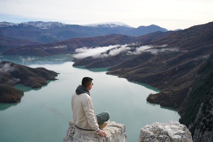
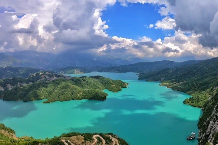
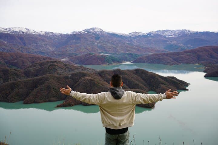
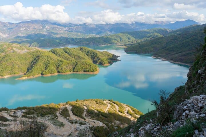
The trail starts where the blue of Bovilla Lake meets broken limestone slopes and scrubby Mediterranean pines; morning light pares the water into a sheet of metal, and the first steps lead you along a low, steady grade that eases you into the mountain.
The trail starts where the blue of Bovilla Lake meets broken limestone slopes and scrubby Mediterranean pines; morning light pares the water into a sheet of metal, and the first steps lead you along a low, steady grade that eases you into the mountain.
Bovilla is an artificial reservoir that supplies drinking water to Tirana, carved into limestone and marl that record the region’s tectonic past. The route climbs in two acts: an accessible lakeside section through mixed oak and maquis, then a narrower, steeper approach to Gamti’s ridgeline where the geology changes to broken scree and exposed bedrock. Locals once grazed sheep on these slopes and small shepherd paths remain, giving the hike a lived-in, rural feel.
The cultural pull is simple — this is a working watershed and a weekend escape for Tirana residents. Birds of prey quarter the air; distant villages punctuate the skyline. Expect clear, sweeping views over the reservoir and back toward the Accursed (Prokletije) foothills on fair days.
Practical side: the full loop to Gamti and back takes roughly 6–8 hours depending how far you push toward the peak. Wear grippy hiking boots for the steep, narrow sections and be prepared for loose rock on the final ascent. Carry at least 2 liters of water (no reliable fills on the route), sun protection, and basic first aid. Respect signs — parts of the shore protect drinking water and access can be restricted.
Start early to avoid heat and crowds; a guide or local driver simplifies logistics and ensures you follow permitted access.