THE ADVENTURE COLLECTIVE® · Independent discovery and booking for outdoor travel

Walk 2.5 miles through the streets where the American Revolution unfolded. This self-guided Freedom Trail tour uses GPS-triggered audio to connect you to Boston Common, Faneuil Hall, Old North Church and more—at your own pace.
Walk 2.5 miles through the streets where the American Revolution unfolded. This self-guided Freedom Trail tour uses GPS-triggered audio to connect you to Boston Common, Faneuil Hall, Old North Church and more—at your own pace.
You step off the city sidewalks into an older rhythm: cobblestones click under your shoes, the golden dome of the State House catches light, and a breeze off the harbor pushes the scent of salt and coffee toward you. The Freedom Trail is a 2.5-mile ribbon through Boston’s layered past—public parks, burial grounds, meeting halls and church steeples that still point toward a story of dissent.
Verified experiences and guided adventures in the surrounding area.
Operated by Drives & Detours · Boston, MA
You step off the city sidewalks into an older rhythm: cobblestones click under your shoes, the golden dome of the State House catches light, and a breeze off the harbor pushes the scent of salt and coffee toward you. The Freedom Trail is a 2.5-mile ribbon through Boston’s layered past—public parks, burial grounds, meeting halls and church steeples that still point toward a story of dissent.
This route threads through raw colonial history and urban geology. Beacon Hill and nearby hills are glacial drumlins reshaped by landfill and nineteenth-century expansion, while the harbor’s edge remembers a time when Boston’s economy was built on ships and trade. The trail links sites tied to Paul Revere, Samuel Adams and the city’s working-class merchants; each stop reveals how ordinary streets became stages for extraordinary events.
Neighborhoods along the way—Beacon Hill, the North End, the Financial District—hold distinct flavors: brick alleys, Italian bakeries, and pocket parks that locals guard fiercely. Copp’s Hill and Granary Burying Ground temper the walk with quiet and weathered stones that make history tactile.
Practical guidance: download the Drives & Detours app and the tour before you go; the audio is GPS-triggered and works offline. Allow 2–3 hours at a relaxed pace, wear supportive shoes — cobbles demand steady footing — and bring a charged phone for maps and narration. Start early to avoid crowds and midafternoon heat, and be prepared for crossings and short stretches of vehicular traffic. Respect burial grounds and exhibit patience at busy landmarks; this is a walking history lesson with the city as your classroom.
easy.
2–3 hours.
Suitable for most fitness levels; requires basic walking endurance and ability to manage stairs and uneven sidewalks.
No—once you download the tour via the Drives & Detours app your access is flexible and valid for 180 days; start whenever it suits you.
Much of the Freedom Trail follows sidewalks and paved paths, but there are cobblestones, steps and narrow alleys that may limit full accessibility—check specific sites in advance.
Plan 2–3 hours at a relaxed pace; allow extra time for museum visits, food stops or slower walking on uneven surfaces.
Download the tour and its audio in advance—Drives & Detours supports offline use so the experience continues without cell service.
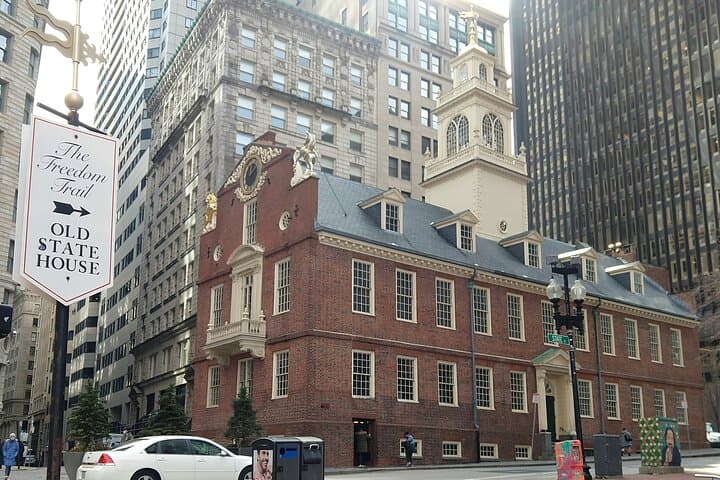
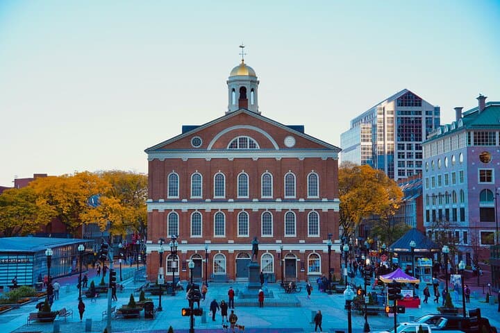
The Freedom Trail links roughly 16 historic sites across 2.5 miles that chart Boston’s role in the American Revolution, from public speeches at Faneuil Hall to signals sent from the Old North Church.
Stay on sidewalks and respect burial grounds and memorials; supporting local historic trusts and small businesses helps fund preservation of these fragile urban sites.
Drives & Detours operates guided outdoor trips and adventures with an emphasis on safety, stewardship, and memorable experiences.

You step off the city sidewalks into an older rhythm: cobblestones click under your shoes, the golden dome of the State House catches light, and a breeze off the harbor pushes the scent of salt and coffee toward you. The Freedom Trail is a 2.5-mile ribbon through Boston’s layered past—public parks, burial grounds, meeting halls and church steeples that still point toward a story of dissent.
You step off the city sidewalks into an older rhythm: cobblestones click under your shoes, the golden dome of the State House catches light, and a breeze off the harbor pushes the scent of salt and coffee toward you. The Freedom Trail is a 2.5-mile ribbon through Boston’s layered past—public parks, burial grounds, meeting halls and church steeples that still point toward a story of dissent.
This route threads through raw colonial history and urban geology. Beacon Hill and nearby hills are glacial drumlins reshaped by landfill and nineteenth-century expansion, while the harbor’s edge remembers a time when Boston’s economy was built on ships and trade. The trail links sites tied to Paul Revere, Samuel Adams and the city’s working-class merchants; each stop reveals how ordinary streets became stages for extraordinary events.
Neighborhoods along the way—Beacon Hill, the North End, the Financial District—hold distinct flavors: brick alleys, Italian bakeries, and pocket parks that locals guard fiercely. Copp’s Hill and Granary Burying Ground temper the walk with quiet and weathered stones that make history tactile.
Practical guidance: download the Drives & Detours app and the tour before you go; the audio is GPS-triggered and works offline. Allow 2–3 hours at a relaxed pace, wear supportive shoes — cobbles demand steady footing — and bring a charged phone for maps and narration. Start early to avoid crowds and midafternoon heat, and be prepared for crossings and short stretches of vehicular traffic. Respect burial grounds and exhibit patience at busy landmarks; this is a walking history lesson with the city as your classroom.