THE ADVENTURE COLLECTIVE® · Independent discovery and booking for outdoor travel

Stand on Bolafjall’s cliff-edge platform to peer across the North Atlantic, then hike into Syðridalur to explore a near-century-old lignite mine. This compact Westfjords tour blends dramatic viewpoints with hands-on industrial history in a single half-day outing.
Stand on Bolafjall’s cliff-edge platform to peer across the North Atlantic, then hike into Syðridalur to explore a near-century-old lignite mine. This compact Westfjords tour blends dramatic viewpoints with hands-on industrial history in a single half-day outing.
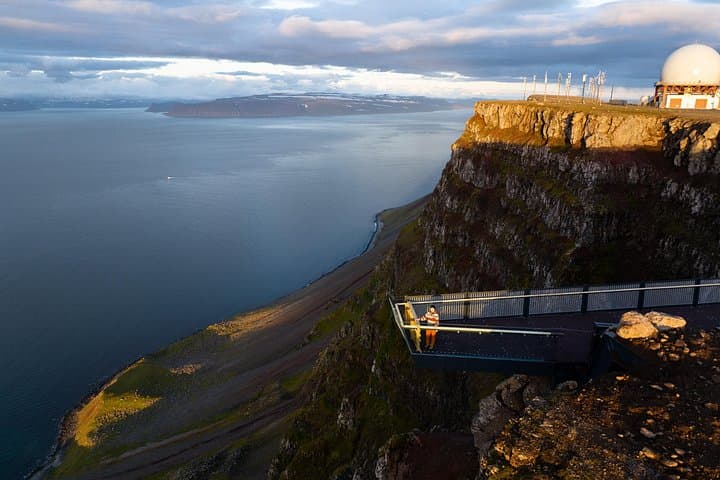
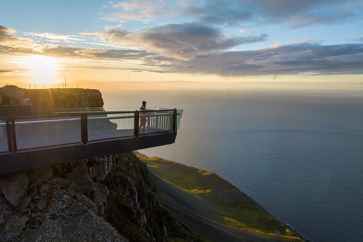
You crest the gravel road and the sea opens — a slab of Atlantic that seems intent on testing the horizon. At the Bolafjall platform the wind has character: it pushes, it whistles and it rewards. From the 628 m ridge the fjord below cuts deep; across the water the empty, roadless expanse of Hornstrandir hangs on the skyline like a promise.
Verified experiences and guided adventures in the surrounding area.
Operated by Wakeboarding Iceland · Bolungarvík, Westfjords
You crest the gravel road and the sea opens — a slab of Atlantic that seems intent on testing the horizon. At the Bolafjall platform the wind has character: it pushes, it whistles and it rewards. From the 628 m ridge the fjord below cuts deep; across the water the empty, roadless expanse of Hornstrandir hangs on the skyline like a promise.
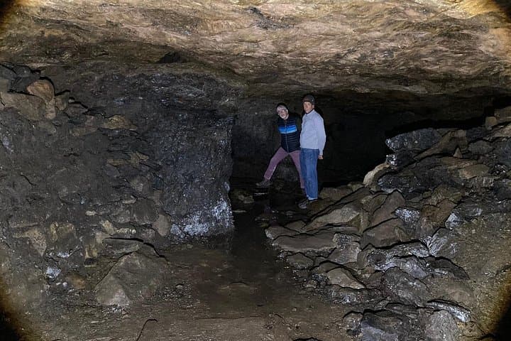
This short, focused outing pairs modern observation with industrial archaeology. Bolafjall’s metal-and-glass viewing platform was installed to let visitors peer across sheer cliffs to the Djúpið (Isafjörður deep) and the distant Hörnstrandir reserve while also passing an old NATO radar installation now operated locally by the coast guard. The descent into Syðridalur leads to a compact lignite mine worked briefly during and after World War I — to enter you’ll crouch, then stand as the gallery opens up. Along the marked trail you move through coastal scrub, low stone walls and rivulets that once served fishing and farming hamlets.
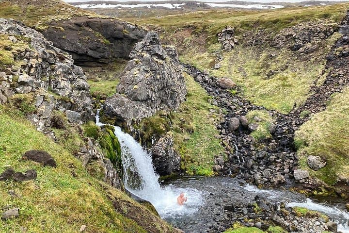
Expect a 20–30 minute walk to the mine from the roadhead, mixed gravel and rock underfoot, and short, exposed sections at the sky walk. The tour typically lasts about four hours with transport from Ísafjörður or nearby Bolungarvík. Practical notes: windproof layers, solid boots and a headlamp matter; the area’s fragile tundra responds poorly to off-trail traffic. If you time it right you can combine history, sea-views and a brisk dip in a river-fed pool by the mine — Icelandic contrast in one outing.
moderate.
3–4 hours.
Moderate fitness—comfortable walking on uneven terrain and short climbs; not suitable for those with serious back or heart conditions.
The marked trail from the roadhead to the mine takes roughly 20–30 minutes at a moderate pace and includes gravel and rocky footing.
The platform is secured and designed for visitors, but guides may restrict access in very high winds; follow crew guidance for your safety.
Entry requires crouching and crawling into a low tunnel before it opens up; it is not recommended for those with limited mobility or serious spinal conditions.
Cold-water swims are possible in a nearby river or waterfall; bring swimwear and a towel, but be prepared for very cold temperatures and check with guides for safe entry points.
Lignite was mined in Syðridalur from about 1917–1921 when wartime coal shortages made local fuel valuable; Bolafjall later hosted NATO radar infrastructure built by Americans and now managed by the Icelandic coast guard.
The Westfjords’ tundra and cliff nesting colonies are sensitive—stay on marked paths, pack out trash, and avoid disturbing bird cliffs and archaeological features.
Wakeboarding Iceland operates guided outdoor trips and adventures with an emphasis on safety, stewardship, and memorable experiences.
You crest the gravel road and the sea opens — a slab of Atlantic that seems intent on testing the horizon. At the Bolafjall platform the wind has character: it pushes, it whistles and it rewards. From the 628 m ridge the fjord below cuts deep; across the water the empty, roadless expanse of Hornstrandir hangs on the skyline like a promise.
You crest the gravel road and the sea opens — a slab of Atlantic that seems intent on testing the horizon. At the Bolafjall platform the wind has character: it pushes, it whistles and it rewards. From the 628 m ridge the fjord below cuts deep; across the water the empty, roadless expanse of Hornstrandir hangs on the skyline like a promise.
This short, focused outing pairs modern observation with industrial archaeology. Bolafjall’s metal-and-glass viewing platform was installed to let visitors peer across sheer cliffs to the Djúpið (Isafjörður deep) and the distant Hörnstrandir reserve while also passing an old NATO radar installation now operated locally by the coast guard. The descent into Syðridalur leads to a compact lignite mine worked briefly during and after World War I — to enter you’ll crouch, then stand as the gallery opens up. Along the marked trail you move through coastal scrub, low stone walls and rivulets that once served fishing and farming hamlets.
Expect a 20–30 minute walk to the mine from the roadhead, mixed gravel and rock underfoot, and short, exposed sections at the sky walk. The tour typically lasts about four hours with transport from Ísafjörður or nearby Bolungarvík. Practical notes: windproof layers, solid boots and a headlamp matter; the area’s fragile tundra responds poorly to off-trail traffic. If you time it right you can combine history, sea-views and a brisk dip in a river-fed pool by the mine — Icelandic contrast in one outing.