THE ADVENTURE COLLECTIVE® · Independent discovery and booking for outdoor travel

Take a short, elevated urban escape: a 60-minute rooftop picnic on Bogotá’s highest helipad with sweeping views of the Cerros Orientales and a spread of Cundiboyacense fruits. Ideal for photographers and newcomers who want an immediate sense of the city’s geography and flavor.
Take a short, elevated urban escape: a 60-minute rooftop picnic on Bogotá’s highest helipad with sweeping views of the Cerros Orientales and a spread of Cundiboyacense fruits. Ideal for photographers and newcomers who want an immediate sense of the city’s geography and flavor.
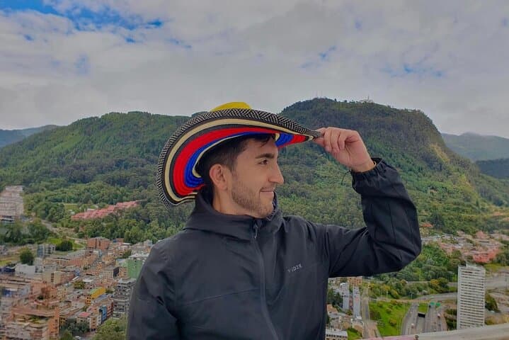
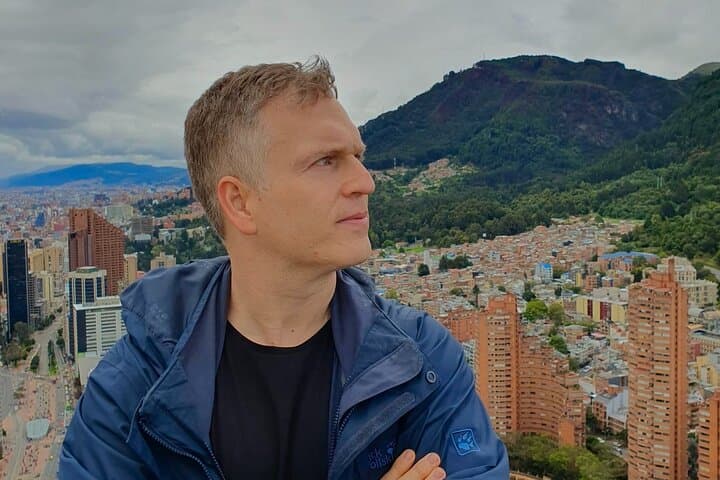
You climb a secured stairwell, the city shrinking beneath you until the rooftop opens to a circular helipad and a 360° sweep of the Cerros Orientales cutting the eastern skyline. Wind pushes against your jacket; the Andes rise like folded maps, neighborhoods and parks arranged below. A spread of bright Cundiboyacense fruits—lulo, uchuva, granadilla—sits on a blanket as a certified guide points out barrios, transport corridors and the subtle ridges of the Eastern Cordillera.
Verified experiences and guided adventures in the surrounding area.
Operated by Jonathan Muñoz · Bogotá, Cundinamarca
You climb a secured stairwell, the city shrinking beneath you until the rooftop opens to a circular helipad and a 360° sweep of the Cerros Orientales cutting the eastern skyline. Wind pushes against your jacket; the Andes rise like folded maps, neighborhoods and parks arranged below. A spread of bright Cundiboyacense fruits—lulo, uchuva, granadilla—sits on a blanket as a certified guide points out barrios, transport corridors and the subtle ridges of the Eastern Cordillera.
Bogotá perches high on the Andean plateau at roughly 2,640 meters; the Cerros Orientales are the foothills of the Eastern Andes and shaped much of the city’s growth since Spanish settlement in the 16th century. The helipad picnic is less about long treks and more about urban perspective: geology meeting urbanism, local gastronomy meeting skyline photography. The experience highlights Bogotá’s layered history—pre-Hispanic settlements, colonial grid expansion and rapid 20th-century urbanization—visible in the patchwork below.
Practical guidance: the meeting point is Café Tostao at Parque Bicentenario (Cra. 7 #24-56). The visit lasts about 60 minutes and includes exclusive rooftop access; building security requires ID and sometimes passport details. Weather can shift quickly—bring a windproof layer and sun protection; the operator provides umbrellas when needed. This is suitable for most fitness levels but not recommended for those with serious cardiovascular issues. Arrive 10–15 minutes early for security checks, charge your camera, and pick golden hour for the best light and clearest views.
easy.
1 hour.
Minimal exertion required; suitable for most adults and children who can manage stairs and brief standing periods at altitude.
The meeting point is in front of Café Tostao at Parque Bicentenario, Cra. 7 #24-56; arrive 10–15 minutes early for check-in.
The full experience lasts about 60 minutes, including the helipad picnic and panoramic viewing time.
Yes—infants must sit on an adult’s lap; specialized infant seats are available on request.
It is not recommended for travelers with serious cardiovascular problems due to altitude and exposed conditions; consult your doctor first.
Bogotá was founded in 1538 and expanded outward from its colonial core; the Cerros Orientales have long defined the city’s eastern boundary and influenced land use and microclimates.
The Eastern Hills face pressure from urban development; visitors should avoid trampling vegetation and carry out any picnic waste to reduce impact on sensitive slopes.
Jonathan Muñoz operates guided outdoor trips and adventures with an emphasis on safety, stewardship, and memorable experiences.


You climb a secured stairwell, the city shrinking beneath you until the rooftop opens to a circular helipad and a 360° sweep of the Cerros Orientales cutting the eastern skyline. Wind pushes against your jacket; the Andes rise like folded maps, neighborhoods and parks arranged below. A spread of bright Cundiboyacense fruits—lulo, uchuva, granadilla—sits on a blanket as a certified guide points out barrios, transport corridors and the subtle ridges of the Eastern Cordillera.
You climb a secured stairwell, the city shrinking beneath you until the rooftop opens to a circular helipad and a 360° sweep of the Cerros Orientales cutting the eastern skyline. Wind pushes against your jacket; the Andes rise like folded maps, neighborhoods and parks arranged below. A spread of bright Cundiboyacense fruits—lulo, uchuva, granadilla—sits on a blanket as a certified guide points out barrios, transport corridors and the subtle ridges of the Eastern Cordillera.
Bogotá perches high on the Andean plateau at roughly 2,640 meters; the Cerros Orientales are the foothills of the Eastern Andes and shaped much of the city’s growth since Spanish settlement in the 16th century. The helipad picnic is less about long treks and more about urban perspective: geology meeting urbanism, local gastronomy meeting skyline photography. The experience highlights Bogotá’s layered history—pre-Hispanic settlements, colonial grid expansion and rapid 20th-century urbanization—visible in the patchwork below.
Practical guidance: the meeting point is Café Tostao at Parque Bicentenario (Cra. 7 #24-56). The visit lasts about 60 minutes and includes exclusive rooftop access; building security requires ID and sometimes passport details. Weather can shift quickly—bring a windproof layer and sun protection; the operator provides umbrellas when needed. This is suitable for most fitness levels but not recommended for those with serious cardiovascular issues. Arrive 10–15 minutes early for security checks, charge your camera, and pick golden hour for the best light and clearest views.