THE ADVENTURE COLLECTIVE® · Independent discovery and booking for outdoor travel

Spend a half-day with a naturalist exploring Blue Ridge Parkway waterfalls and overlooks near Asheville. This small-group tour mixes short hikes, geology, and curated photo stops to show both famous falls and hidden cascades.
Spend a half-day with a naturalist exploring Blue Ridge Parkway waterfalls and overlooks near Asheville. This small-group tour mixes short hikes, geology, and curated photo stops to show both famous falls and hidden cascades.
Morning fog clings to the ridgeline as the van eases onto the Blue Ridge Parkway and the guide points to the first pullout. Water sings ahead — a shallow ribbon that soon becomes a cataract — daring you to move closer for the view. Over five and a half hours you’ll leap between overlooks and forested trails, each stop chosen for light, geology, and the best camera angles.
Verified experiences and guided adventures in the surrounding area.
Morning fog clings to the ridgeline as the van eases onto the Blue Ridge Parkway and the guide points to the first pullout. Water sings ahead — a shallow ribbon that soon becomes a cataract — daring you to move closer for the view. Over five and a half hours you’ll leap between overlooks and forested trails, each stop chosen for light, geology, and the best camera angles.
This route threads through land shaped by ancient uplifted metamorphic rock and carved by streams that feed dramatic falls. The Parkway itself is a New Deal-era road that opened access to these high-elevation landscapes and the Cherokee homelands that predate it. Expect rhododendron thickets, monospecific stands of hemlock in cooler ravines, and sweeping western-facing views that catch late afternoon light.
Hikes are short to moderate — commonly 0.5–3 miles per stop with 200–800 feet of elevation gain on uneven, sometimes wet terrain. Trails include rocky bootpaths, rooty singletrack and slick stone near cascades, so steady footing matters. Your naturalist guides narrate local ecology, point out lesser-known cascades and photo compositions, and time breaks to avoid crowds on popular overlooks.
Practical: wear grippy footwear, pack layers for variable mountain weather, and bring water and a waterproof shell. Morning starts and weekday departures reduce traffic; leave electronics accessible for quick shots but carry a small daypack for hands-free hiking. Respect posted signage at falls and stay on trails — many streams are fragile and the best viewpoints require care.
moderate.
5–6 hours.
Good for travelers who can handle several short hikes totaling up to 4–6 miles across uneven terrain and modest climbs.
The tour runs about 5–6 hours with multiple short hikes—typically 0.5–3 miles per stop and total walking of roughly 3–6 miles depending on the itinerary.
Most departures pick up from central Asheville hotels or a designated meeting point in town; the operator confirms exact pickup locations at booking.
Yes if they are comfortable with short hikes on uneven terrain; inform the operator of mobility concerns so they can advise and adjust stops.
Pets are usually not permitted on guided group hikes along the Parkway for safety and wildlife reasons—check the tour provider’s policy before bringing a pet.
The Blue Ridge Parkway was built during the 1930s–40s as a scenic connector and visitor access route through lands long inhabited by the Cherokee and reshaped by Appalachian logging and recovery.
High visitation stresses fragile streambanks and plant communities; stick to trails, pack out waste, and avoid disturbing riparian vegetation to reduce erosion and habitat loss.
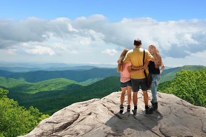
Morning fog clings to the ridgeline as the van eases onto the Blue Ridge Parkway and the guide points to the first pullout. Water sings ahead — a shallow ribbon that soon becomes a cataract — daring you to move closer for the view. Over five and a half hours you’ll leap between overlooks and forested trails, each stop chosen for light, geology, and the best camera angles.
Morning fog clings to the ridgeline as the van eases onto the Blue Ridge Parkway and the guide points to the first pullout. Water sings ahead — a shallow ribbon that soon becomes a cataract — daring you to move closer for the view. Over five and a half hours you’ll leap between overlooks and forested trails, each stop chosen for light, geology, and the best camera angles.
This route threads through land shaped by ancient uplifted metamorphic rock and carved by streams that feed dramatic falls. The Parkway itself is a New Deal-era road that opened access to these high-elevation landscapes and the Cherokee homelands that predate it. Expect rhododendron thickets, monospecific stands of hemlock in cooler ravines, and sweeping western-facing views that catch late afternoon light.
Hikes are short to moderate — commonly 0.5–3 miles per stop with 200–800 feet of elevation gain on uneven, sometimes wet terrain. Trails include rocky bootpaths, rooty singletrack and slick stone near cascades, so steady footing matters. Your naturalist guides narrate local ecology, point out lesser-known cascades and photo compositions, and time breaks to avoid crowds on popular overlooks.
Practical: wear grippy footwear, pack layers for variable mountain weather, and bring water and a waterproof shell. Morning starts and weekday departures reduce traffic; leave electronics accessible for quick shots but carry a small daypack for hands-free hiking. Respect posted signage at falls and stay on trails — many streams are fragile and the best viewpoints require care.