THE ADVENTURE COLLECTIVE® · Independent discovery and booking for outdoor travel

A compact coastal hike that climbs from mangrove-lined beach to a 550 ft viewpoint above Marigot Bay. Choose a moderate one-summit route or an extreme two-summit option—either delivers sweeping bay views, native birds, and local fruit along the trail.
A compact coastal hike that climbs from mangrove-lined beach to a 550 ft viewpoint above Marigot Bay. Choose a moderate one-summit route or an extreme two-summit option—either delivers sweeping bay views, native birds, and local fruit along the trail.
You step off the boat and the bay breathes around you: low mangrove roots knot the shoreline, white sand gives way to a narrow trail that cuts up a green northern ridge. Sea-salt air mixes with the syrup of local fruits as birds call you inland; within an hour the bay has dropped away below and the viewpoint—about 550 feet above sea level—opens up like a folded map of coral and volcanic coast.
Verified experiences and guided adventures in the surrounding area.
Operated by Lush Excursions · Marigot Bay, Castries Quarter
You step off the boat and the bay breathes around you: low mangrove roots knot the shoreline, white sand gives way to a narrow trail that cuts up a green northern ridge. Sea-salt air mixes with the syrup of local fruits as birds call you inland; within an hour the bay has dropped away below and the viewpoint—about 550 feet above sea level—opens up like a folded map of coral and volcanic coast.
Marigot Bay has long been a sheltered anchor for colonial ships and small local craft, its steep hills the remains of volcanic uplift and erosive Caribbean weather. Along the Billy Goat Trail you move through littoral mangroves, a pocket beach, and then scrubby hillside undergrowth; geology here is volcanic basalt and ash, worn into compact ridges that give surprisingly stable hand- and footholds on the steeper sections.
Culturally the walk is a local storybook: seasonal berries, talkative birds, and guide-shared notes on Creole farming and the bay’s place in island life. You’ll see signs of small-scale fishing and the occasional hilltop ruin where timber and stone were once stacked by early settlers.
Practical guidance: routes split into a moderate option (single summit) and an extreme option (two summits); expect roughly 3–6 km round-trip and 550 ft of ascent on the longer loop, taking 2–4 hours depending on pace and route. Wear sturdy, closed-toe shoes, bring 1–2 liters of water, reef-safe sunscreen, and a light rain shell in wet months. Morning departures avoid midday heat and cruise congestion. Stick to the guide’s route to protect mangroves and sensitive flora.
moderate.
2–4 hours.
Moderate fitness needed: steady uphill sections and uneven surfaces require good balance and cardiovascular comfort.
Routes range from moderate (single summit, steady uphill) to extreme (two summits with steeper scrambles). Expect uneven footing and up to ~550 ft of ascent; choose based on your experience.
Yes—this itinerary is organized for cruise passengers with short boat transfers into Marigot Bay; confirm the meeting point and timing with your operator before disembarkation.
Not recommended for children under 8 or travelers with serious back, heart, or pregnancy-related conditions; a moderate level of fitness is advised.
Yes—local guides, fees, and taxes are typically included; guides share natural and cultural insights and manage route safety for groups.
Marigot Bay served as a sheltered anchorage during colonial-era naval activity and grew into a small fishing and boat-building community influenced by French and British colonial periods.
Mangrove stands and coastal vegetation are sensitive—stay on marked paths, avoid removing fruit or plants, and use reef-safe sunscreen to protect marine habitats.
Lush Excursions operates guided outdoor trips and adventures with an emphasis on safety, stewardship, and memorable experiences.
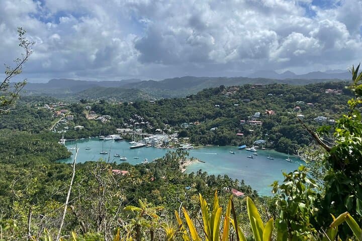
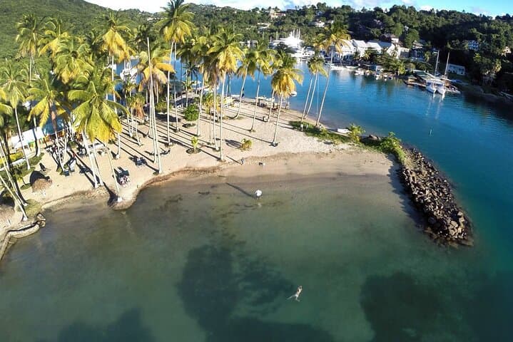
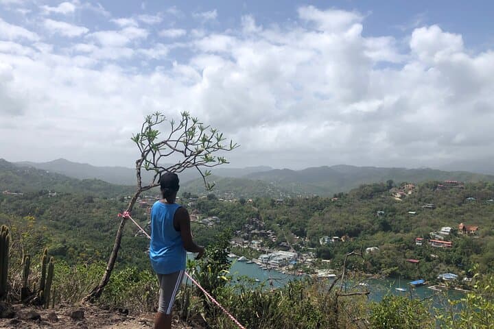
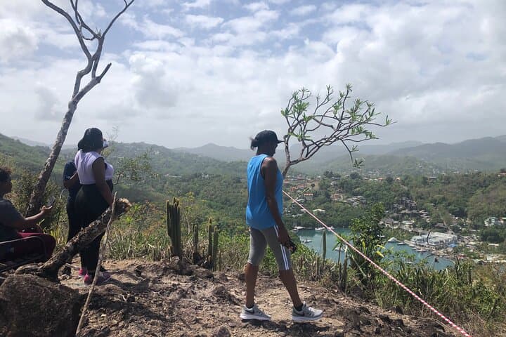
You step off the boat and the bay breathes around you: low mangrove roots knot the shoreline, white sand gives way to a narrow trail that cuts up a green northern ridge. Sea-salt air mixes with the syrup of local fruits as birds call you inland; within an hour the bay has dropped away below and the viewpoint—about 550 feet above sea level—opens up like a folded map of coral and volcanic coast.
You step off the boat and the bay breathes around you: low mangrove roots knot the shoreline, white sand gives way to a narrow trail that cuts up a green northern ridge. Sea-salt air mixes with the syrup of local fruits as birds call you inland; within an hour the bay has dropped away below and the viewpoint—about 550 feet above sea level—opens up like a folded map of coral and volcanic coast.
Marigot Bay has long been a sheltered anchor for colonial ships and small local craft, its steep hills the remains of volcanic uplift and erosive Caribbean weather. Along the Billy Goat Trail you move through littoral mangroves, a pocket beach, and then scrubby hillside undergrowth; geology here is volcanic basalt and ash, worn into compact ridges that give surprisingly stable hand- and footholds on the steeper sections.
Culturally the walk is a local storybook: seasonal berries, talkative birds, and guide-shared notes on Creole farming and the bay’s place in island life. You’ll see signs of small-scale fishing and the occasional hilltop ruin where timber and stone were once stacked by early settlers.
Practical guidance: routes split into a moderate option (single summit) and an extreme option (two summits); expect roughly 3–6 km round-trip and 550 ft of ascent on the longer loop, taking 2–4 hours depending on pace and route. Wear sturdy, closed-toe shoes, bring 1–2 liters of water, reef-safe sunscreen, and a light rain shell in wet months. Morning departures avoid midday heat and cruise congestion. Stick to the guide’s route to protect mangroves and sensitive flora.