THE ADVENTURE COLLECTIVE® · Independent discovery and booking for outdoor travel

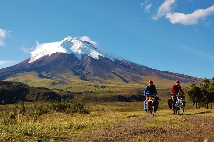
Cycle the high puna beneath Cotopaxi’s cone on a full‑day small‑group tour from Quito. Expect 15 miles of dirt road at 13,000 ft, dramatic volcanic scenery, and a picnic with mountain views.
Cycle the high puna beneath Cotopaxi’s cone on a full‑day small‑group tour from Quito. Expect 15 miles of dirt road at 13,000 ft, dramatic volcanic scenery, and a picnic with mountain views.
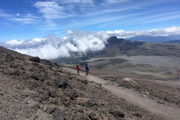
A cold wind from the summit pushes across the plains as riders clip in on a dirt track beneath an impossible cone. The air is thin and clean; the volcano watches, restless and indifferent. Beginning in Quito before dawn, the route follows the Pan‑American south into Cotopaxi National Park, where volcanic scree, pumice fields and páramo grass open to long sightlines and sudden gusts.
Verified experiences and guided adventures in the surrounding area.
Operated by Rebecca Adventure Travel · Latacunga, Cotopaxi
A cold wind from the summit pushes across the plains as riders clip in on a dirt track beneath an impossible cone. The air is thin and clean; the volcano watches, restless and indifferent. Beginning in Quito before dawn, the route follows the Pan‑American south into Cotopaxi National Park, where volcanic scree, pumice fields and páramo grass open to long sightlines and sudden gusts.
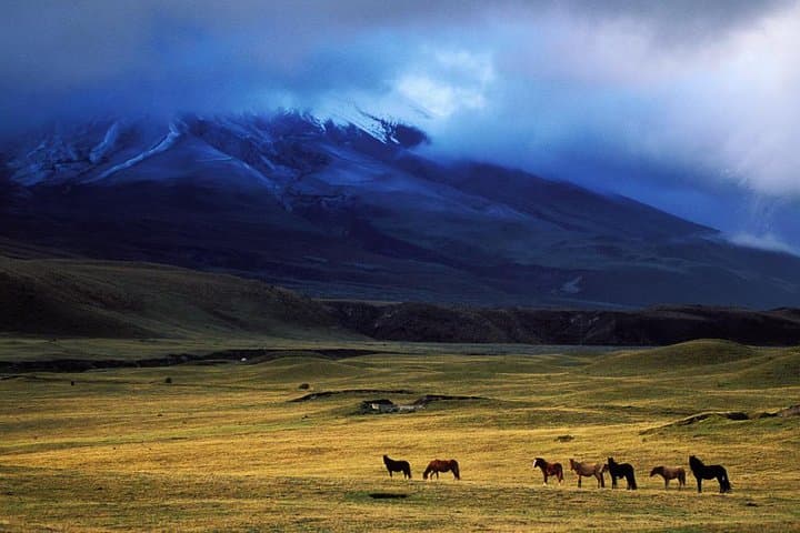
Cotopaxi is one of the highest active stratovolcanoes on Earth and its eruptions have shaped the high Andean landscape—scattered rocks and the remains of agricultural terraces hint at pre‑Inca and Inca-era human use of these elevations. Geologically, the area is young and unstable, with ash layers and lahar plains that tell of explosive pasts. Local haciendas and small Andean communities still herd llamas and cattle across the puna, and you may pass shepherds guiding animals along faint tracks.
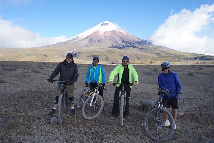
Practically, expect about 15 miles of mostly flat dirt roads and singletrack at roughly 4,000 m (13,000 ft). Altitude is the defining challenge: pace yourself, sip water often, and watch for lightheadedness. Weather can flip quickly from sun to sleet; layered, waterproof clothing and a helmet are mandatory. The operator supplies a mountain bike and helmet, and the day finishes with a late picnic overlooking Inca-era ruins before returning to Quito. This is a full-day outing — bring snacks, sunscreen SPF 50+, and a small daypack. With reasonable fitness and basic off‑road skills, the ride is an approachable high‑altitude introduction to the Avenue of Volcanoes.
moderate.
8–10 hours.
Moderate fitness; able to pedal 15 miles on dirt at high altitude and remain steady for several hours.
The terrain is mostly flat, but the thin air at 4,000 m makes sustained effort harder; moderate fitness and prior cycling experience help.
Transport from Quito meeting point, mountain bike and helmet, a picnic lunch, and multilingual assistance are included.
Yes—deer, alpacas and wild Andean birds are commonly spotted, especially in quieter sections of the park.
Operators may change or cancel the route for safety; bring waterproof clothing and confirm cancellation policy before booking.
Human communities have used Cotopaxi’s highlands for centuries; Spanish colonial records and indigenous oral histories note both reverence and practical use of the páramo.
Cotopaxi National Park is protected, but high visitor numbers stress fragile puna vegetation; stay on designated tracks and pack out all trash.
Rebecca Adventure Travel operates guided outdoor trips and adventures with an emphasis on safety, stewardship, and memorable experiences.
A cold wind from the summit pushes across the plains as riders clip in on a dirt track beneath an impossible cone. The air is thin and clean; the volcano watches, restless and indifferent. Beginning in Quito before dawn, the route follows the Pan‑American south into Cotopaxi National Park, where volcanic scree, pumice fields and páramo grass open to long sightlines and sudden gusts.
A cold wind from the summit pushes across the plains as riders clip in on a dirt track beneath an impossible cone. The air is thin and clean; the volcano watches, restless and indifferent. Beginning in Quito before dawn, the route follows the Pan‑American south into Cotopaxi National Park, where volcanic scree, pumice fields and páramo grass open to long sightlines and sudden gusts.
Cotopaxi is one of the highest active stratovolcanoes on Earth and its eruptions have shaped the high Andean landscape—scattered rocks and the remains of agricultural terraces hint at pre‑Inca and Inca-era human use of these elevations. Geologically, the area is young and unstable, with ash layers and lahar plains that tell of explosive pasts. Local haciendas and small Andean communities still herd llamas and cattle across the puna, and you may pass shepherds guiding animals along faint tracks.
Practically, expect about 15 miles of mostly flat dirt roads and singletrack at roughly 4,000 m (13,000 ft). Altitude is the defining challenge: pace yourself, sip water often, and watch for lightheadedness. Weather can flip quickly from sun to sleet; layered, waterproof clothing and a helmet are mandatory. The operator supplies a mountain bike and helmet, and the day finishes with a late picnic overlooking Inca-era ruins before returning to Quito. This is a full-day outing — bring snacks, sunscreen SPF 50+, and a small daypack. With reasonable fitness and basic off‑road skills, the ride is an approachable high‑altitude introduction to the Avenue of Volcanoes.