THE ADVENTURE COLLECTIVE® · Independent discovery and booking for outdoor travel

See Bozeman, the Bridger Range, Lone Peak and Hylite Canyon from a fixed‑wing plane. This private aerial tour delivers sweeping views, pilot commentary, and an efficient way to orient your Montana adventure.
See Bozeman, the Bridger Range, Lone Peak and Hylite Canyon from a fixed‑wing plane. This private aerial tour delivers sweeping views, pilot commentary, and an efficient way to orient your Montana adventure.
You lift off from the tarmac and the valley opens beneath you: patchwork ranchland, a ribbon of the Gallatin River, the jagged teeth of the Bridger Range rising to the north. In a compact fixed‑wing plane with a pilot-guide, the world compresses into a set of clear lines—the ridgelines, the ski runs at Bridger Bowl, the glitter of Hylite Lake—and you read the land like a topographic map in motion.
Verified experiences and guided adventures in the surrounding area.
Operated by Lone Peak Aviation · Bozeman, Montana
You lift off from the tarmac and the valley opens beneath you: patchwork ranchland, a ribbon of the Gallatin River, the jagged teeth of the Bridger Range rising to the north. In a compact fixed‑wing plane with a pilot-guide, the world compresses into a set of clear lines—the ridgelines, the ski runs at Bridger Bowl, the glitter of Hylite Lake—and you read the land like a topographic map in motion.
The Bozeman valley sits on the edge of the northern Rockies, where uplifted sedimentary layers and older volcanic features meet. From the air you see the Spanish Peaks to the southwest, Lone Peak’s sheer face, and the broad basin that drew ranchers and later mountain settlers. This is ancestral country for Crow and Shoshone peoples; the region’s trails and waterways have long guided people before recreational use reshaped access.
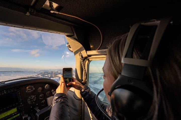
On a 60–180 minute private flight you’ll pass downtown Bozeman, Montana State University, Hylite Canyon, and the more remote ranges—an efficient way to orient before hiking or driving in. Headsets for pilot‑passenger comms are standard, and small‑plane etiquette matters: light luggage, stable seating, and attention to the briefing.
Practical notes: meet at Million Air FBO at Bozeman Yellowstone International Airport; arrive early to use facilities. Flights are weather‑dependent and may be canceled for storms or low ceilings; the provider enforces a 450 lb total passenger weight limit, so plan bookings accordingly. Sunset flights offer the most dramatic shadows and color, while morning sorties often give the clearest visibility. For anyone curious about Montana from above, this is an efficient, low‑effort way to see an expansive, rugged landscape—bring a jacket, a good camera, and a readiness for the tight, exhilarating vantage of a small aircraft.
easy.
1–3 hours.
Suitable for all fitness levels; passengers should be able to sit upright and follow safety instructions.
Flights range from about 60 to 180 minutes depending on the chosen option and routing; the listing specifies the exact duration you booked.
Meet at Million Air FBO at Bozeman Yellowstone International Airport; the waiting area includes restrooms and pre‑flight briefings.
The aircraft is private but the total passenger weight cannot exceed 450 lb; disclose weights at booking and follow the operator’s guidance.
Yes—safety is primary. Flights are canceled in poor weather or low ceilings; the operator offers a full refund if canceled 24+ hours before departure per policy.
Bozeman Valley sits at the northern edge of lands long used by Crow and Shoshone peoples and later drew ranchers and rail settlers in the 19th century.
Flights minimize footprint by staying within established corridors and following FAA rules; avoid low passes over wildlife and respect no‑fly restrictions for sensitive areas.
Lone Peak Aviation operates guided outdoor trips and adventures with an emphasis on safety, stewardship, and memorable experiences.
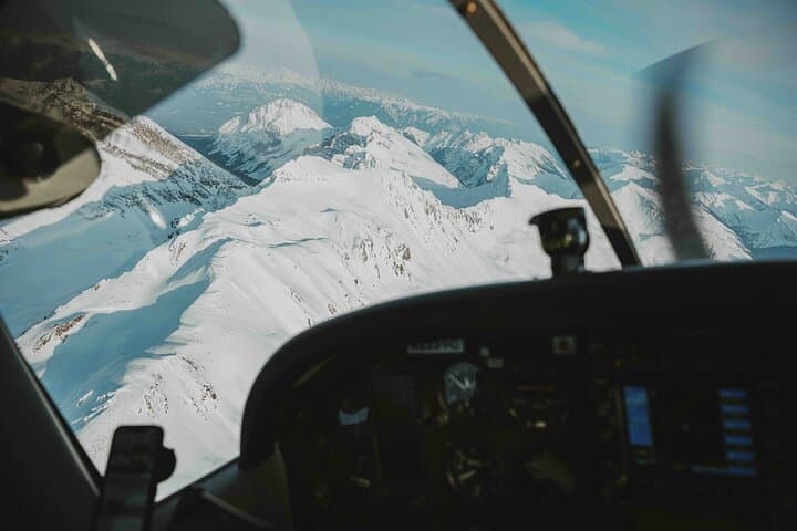
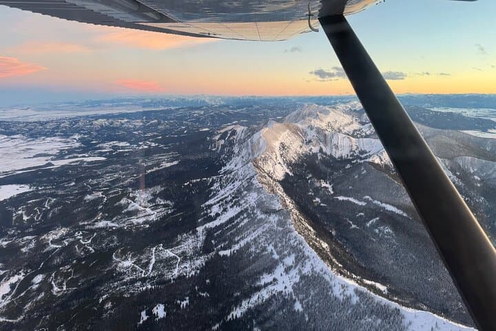
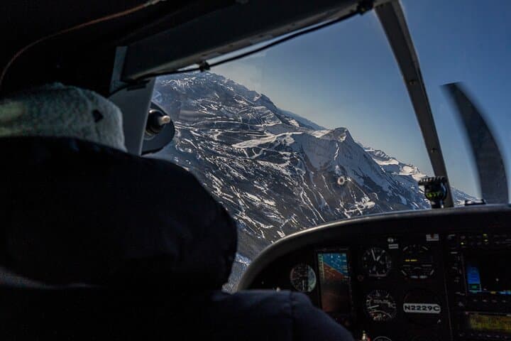
You lift off from the tarmac and the valley opens beneath you: patchwork ranchland, a ribbon of the Gallatin River, the jagged teeth of the Bridger Range rising to the north. In a compact fixed‑wing plane with a pilot-guide, the world compresses into a set of clear lines—the ridgelines, the ski runs at Bridger Bowl, the glitter of Hylite Lake—and you read the land like a topographic map in motion.
You lift off from the tarmac and the valley opens beneath you: patchwork ranchland, a ribbon of the Gallatin River, the jagged teeth of the Bridger Range rising to the north. In a compact fixed‑wing plane with a pilot-guide, the world compresses into a set of clear lines—the ridgelines, the ski runs at Bridger Bowl, the glitter of Hylite Lake—and you read the land like a topographic map in motion.
The Bozeman valley sits on the edge of the northern Rockies, where uplifted sedimentary layers and older volcanic features meet. From the air you see the Spanish Peaks to the southwest, Lone Peak’s sheer face, and the broad basin that drew ranchers and later mountain settlers. This is ancestral country for Crow and Shoshone peoples; the region’s trails and waterways have long guided people before recreational use reshaped access.
On a 60–180 minute private flight you’ll pass downtown Bozeman, Montana State University, Hylite Canyon, and the more remote ranges—an efficient way to orient before hiking or driving in. Headsets for pilot‑passenger comms are standard, and small‑plane etiquette matters: light luggage, stable seating, and attention to the briefing.
Practical notes: meet at Million Air FBO at Bozeman Yellowstone International Airport; arrive early to use facilities. Flights are weather‑dependent and may be canceled for storms or low ceilings; the provider enforces a 450 lb total passenger weight limit, so plan bookings accordingly. Sunset flights offer the most dramatic shadows and color, while morning sorties often give the clearest visibility. For anyone curious about Montana from above, this is an efficient, low‑effort way to see an expansive, rugged landscape—bring a jacket, a good camera, and a readiness for the tight, exhilarating vantage of a small aircraft.