THE ADVENTURE COLLECTIVE® · Independent discovery and booking for outdoor travel

Run 20 km through High Atlas ridgelines and traditional Berber villages on a single-day trail program from Asni. Expect rocky singletrack, forested balconies, village tea stops and panoramic views down to the Azzaden Valley.
Run 20 km through High Atlas ridgelines and traditional Berber villages on a single-day trail program from Asni. Expect rocky singletrack, forested balconies, village tea stops and panoramic views down to the Azzaden Valley.
A cold wind off the High Atlas cuts across the trail as runners leave Asni and climb into the first village; pine needles scuff underfoot and the valley opens toward distant ridgelines. The route threads old mule tracks, climbs a steep irrigation channel, crosses a pine forest where eagles wheel and wild boar push through understory, then crests a small col with a clear view down into the Azzaden Valley. From there the path drops to Tinzert and Id Aissa—stone houses and terraced fields that still use the same routes schoolchildren travel each day—before a balcony trail runs to Tizi Oudit and a final descent to Agersioual valley and the waiting vehicle.
Verified experiences and guided adventures in the surrounding area.
Operated by Atlas Mountains Day Trip · Asni, Marrakesh-Safi
A cold wind off the High Atlas cuts across the trail as runners leave Asni and climb into the first village; pine needles scuff underfoot and the valley opens toward distant ridgelines. The route threads old mule tracks, climbs a steep irrigation channel, crosses a pine forest where eagles wheel and wild boar push through understory, then crests a small col with a clear view down into the Azzaden Valley. From there the path drops to Tinzert and Id Aissa—stone houses and terraced fields that still use the same routes schoolchildren travel each day—before a balcony trail runs to Tizi Oudit and a final descent to Agersioual valley and the waiting vehicle.
The landscape is part of the High Atlas geomorphic system: folded sedimentary rock uplifted and carved by winter snowmelt, feeding the rivulets that shaped the terraces. Berber (Amazigh) communities here maintain centuries-old agricultural practices; language, pottery and communal tea rituals are visible in even the smallest village.
Expect roughly 20 km of running on rocky, singletrack and dirt roads with intermittent steep pitch; maximum altitude near 2,400 m, and 3–4 hours at a steady trail-run pace. Practical notes: wear grippy trail shoes, carry 1–2 liters of water, and plan for rapidly changing mountain weather. Start early to avoid midday heat, pace climbs conservatively, and respect village life—ask before photographing homes. The run blends cultural contact, exposed ridgelines and technical footing: it rewards steady pacing and mountain respect.
challenging.
3–4 hours.
Good aerobic fitness and previous trail-running experience advisable; comfortable with sustained climbs and technical footing.
The itinerary covers roughly 20 km with a maximum elevation near 2,400 m; plan for several sustained climbs and descents.
Strong beginners with trail experience can attempt it, but the technical descents and altitude make it better suited to fit, intermediate trail runners.
The program provides bottled water and snacks; bring additional hydration if you sweat heavily or run at a faster pace.
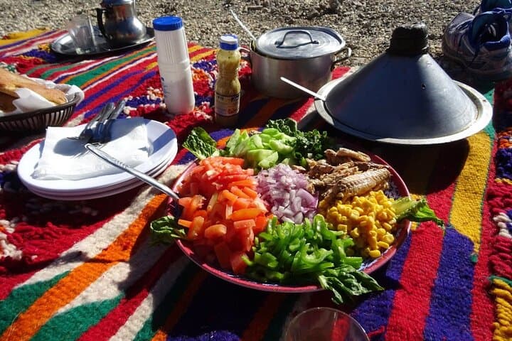
Yes—routes pass through small Berber villages where hosts may offer tea; approach respectfully and ask before photographing or entering private areas.
These trails have linked High Atlas villages for generations, used by shepherds and farmers trading between valley terraces and mountain pastures.
Stay on established paths to avoid eroding fragile terraced slopes; local guides help minimize footprint and support village economies.
Atlas Mountains Day Trip operates guided outdoor trips and adventures with an emphasis on safety, stewardship, and memorable experiences.


A cold wind off the High Atlas cuts across the trail as runners leave Asni and climb into the first village; pine needles scuff underfoot and the valley opens toward distant ridgelines. The route threads old mule tracks, climbs a steep irrigation channel, crosses a pine forest where eagles wheel and wild boar push through understory, then crests a small col with a clear view down into the Azzaden Valley. From there the path drops to Tinzert and Id Aissa—stone houses and terraced fields that still use the same routes schoolchildren travel each day—before a balcony trail runs to Tizi Oudit and a final descent to Agersioual valley and the waiting vehicle.
A cold wind off the High Atlas cuts across the trail as runners leave Asni and climb into the first village; pine needles scuff underfoot and the valley opens toward distant ridgelines. The route threads old mule tracks, climbs a steep irrigation channel, crosses a pine forest where eagles wheel and wild boar push through understory, then crests a small col with a clear view down into the Azzaden Valley. From there the path drops to Tinzert and Id Aissa—stone houses and terraced fields that still use the same routes schoolchildren travel each day—before a balcony trail runs to Tizi Oudit and a final descent to Agersioual valley and the waiting vehicle.
The landscape is part of the High Atlas geomorphic system: folded sedimentary rock uplifted and carved by winter snowmelt, feeding the rivulets that shaped the terraces. Berber (Amazigh) communities here maintain centuries-old agricultural practices; language, pottery and communal tea rituals are visible in even the smallest village.
Expect roughly 20 km of running on rocky, singletrack and dirt roads with intermittent steep pitch; maximum altitude near 2,400 m, and 3–4 hours at a steady trail-run pace. Practical notes: wear grippy trail shoes, carry 1–2 liters of water, and plan for rapidly changing mountain weather. Start early to avoid midday heat, pace climbs conservatively, and respect village life—ask before photographing homes. The run blends cultural contact, exposed ridgelines and technical footing: it rewards steady pacing and mountain respect.