THE ADVENTURE COLLECTIVE® · Independent discovery and booking for outdoor travel

Drive one of America’s highest paved routes with a GPS-timed audio guide that explains geology, mining history and roadside wildlife. Download once, play offline, and follow the Beartooth Highway at your own pace.
Drive one of America’s highest paved routes with a GPS-timed audio guide that explains geology, mining history and roadside wildlife. Download once, play offline, and follow the Beartooth Highway at your own pace.
A ribbon of pavement climbs into thin air as the car rounds a hairpin and the valley drops away—wind whispers across talus fields and the highway dares you higher. On this self-guided audio tour, the Beartooth Highway becomes more than a road: it’s a narrated passage through alpine plateaus, glacial cirques and high lakes that sit above 9,000 feet.
Verified experiences and guided adventures in the surrounding area.
Operated by Travel with Action · Red Lodge, Montana
A ribbon of pavement climbs into thin air as the car rounds a hairpin and the valley drops away—wind whispers across talus fields and the highway dares you higher. On this self-guided audio tour, the Beartooth Highway becomes more than a road: it’s a narrated passage through alpine plateaus, glacial cirques and high lakes that sit above 9,000 feet.
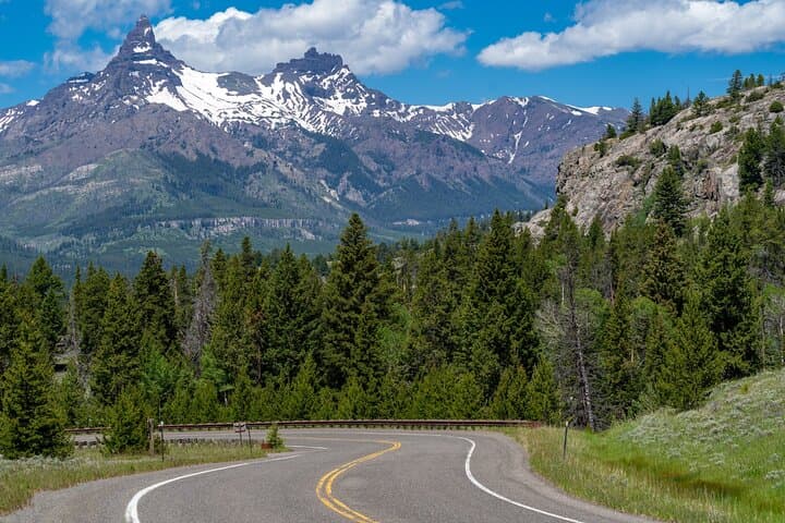
The route links Red Lodge and Cooke City and traces old mining roads and Indigenous travel corridors carved into the Absaroka–Beartooth range. Geology reads like an open book here: granite and metamorphic peaks thrust skyward, while glacial scouring left shallow basins that now hold jewel-blue lakes such as Island Lake. Small mountain towns grew from coal and gold booms; Red Lodge’s 19th-century mining past still shapes the route’s culture and roadside markers.
Expect dramatic elevation gain—the highway reaches near 11,000 feet—short stops at pullouts like the 45th Parallel and Crazy Creek Falls, and wide, exposed vistas from Top of the World and Beartooth Pass. Wildlife is common; slow down for elk, bighorn sheep and marmots crossing the roadway.
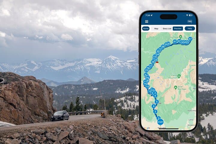
Practically: download Action’s Tour Guide app and the tour file before you arrive; the guide works offline and times narration to GPS locations. Buy one tour per vehicle, connect audio to your car stereo, and allow 2–3 hours plus stops. Watch weather—snow can appear even in summer—and bring warm layers, good traction shoes for short walks, and a full tank of gas. Follow pullouts and speed limits; the experience is best when you pause for the views and leave the high country as you found it.
easy.
2–3 hours.
No special fitness required for driving, but short walks at pullouts may involve uneven ground and light elevation gain—expect thinner air at higher elevations.
No—purchase one tour per vehicle and share the audio with all passengers via your car stereo or speakers.
The highway typically opens the Friday before Memorial Day and closes in early October, but exact dates depend on snow and road crews—check local road status before you travel.
No—download the tour ahead of time using Wi‑Fi or cellular; the app and offline maps work without signal once downloaded.
No—this audio tour does not include park or attraction entrance fees; purchase any required permits or passes separately.
Red Lodge and Cooke City grew during 19th-century mining booms; many roadside names and small towns reflect that coal-and-gold era.
High alpine tundra is fragile—stay on paved areas and established pullouts, pack out all waste, and avoid approaching or feeding wildlife.
Travel with Action operates guided outdoor trips and adventures with an emphasis on safety, stewardship, and memorable experiences.
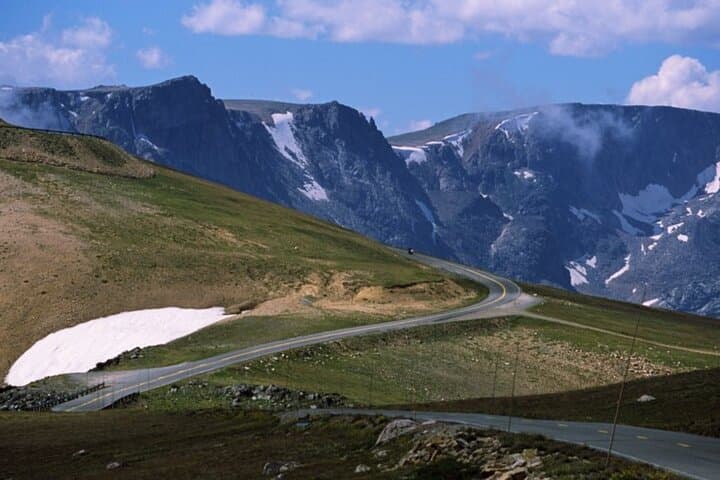

A ribbon of pavement climbs into thin air as the car rounds a hairpin and the valley drops away—wind whispers across talus fields and the highway dares you higher. On this self-guided audio tour, the Beartooth Highway becomes more than a road: it’s a narrated passage through alpine plateaus, glacial cirques and high lakes that sit above 9,000 feet.
A ribbon of pavement climbs into thin air as the car rounds a hairpin and the valley drops away—wind whispers across talus fields and the highway dares you higher. On this self-guided audio tour, the Beartooth Highway becomes more than a road: it’s a narrated passage through alpine plateaus, glacial cirques and high lakes that sit above 9,000 feet.
The route links Red Lodge and Cooke City and traces old mining roads and Indigenous travel corridors carved into the Absaroka–Beartooth range. Geology reads like an open book here: granite and metamorphic peaks thrust skyward, while glacial scouring left shallow basins that now hold jewel-blue lakes such as Island Lake. Small mountain towns grew from coal and gold booms; Red Lodge’s 19th-century mining past still shapes the route’s culture and roadside markers.
Expect dramatic elevation gain—the highway reaches near 11,000 feet—short stops at pullouts like the 45th Parallel and Crazy Creek Falls, and wide, exposed vistas from Top of the World and Beartooth Pass. Wildlife is common; slow down for elk, bighorn sheep and marmots crossing the roadway.
Practically: download Action’s Tour Guide app and the tour file before you arrive; the guide works offline and times narration to GPS locations. Buy one tour per vehicle, connect audio to your car stereo, and allow 2–3 hours plus stops. Watch weather—snow can appear even in summer—and bring warm layers, good traction shoes for short walks, and a full tank of gas. Follow pullouts and speed limits; the experience is best when you pause for the views and leave the high country as you found it.