THE ADVENTURE COLLECTIVE® · Independent discovery and booking for outdoor travel

Soar above Baltimore’s Inner Harbor on a 10-minute helicopter flight that compresses the city’s maritime history and skyline into a single, panoramic view. Ideal for celebrations, this quick tour offers unique photo angles of M&T Bank Stadium, Transamerica Tower, and waterfront neighborhoods.
Soar above Baltimore’s Inner Harbor on a 10-minute helicopter flight that compresses the city’s maritime history and skyline into a single, panoramic view. Ideal for celebrations, this quick tour offers unique photo angles of M&T Bank Stadium, Transamerica Tower, and waterfront neighborhoods.
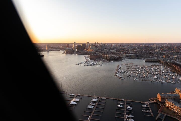
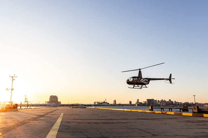
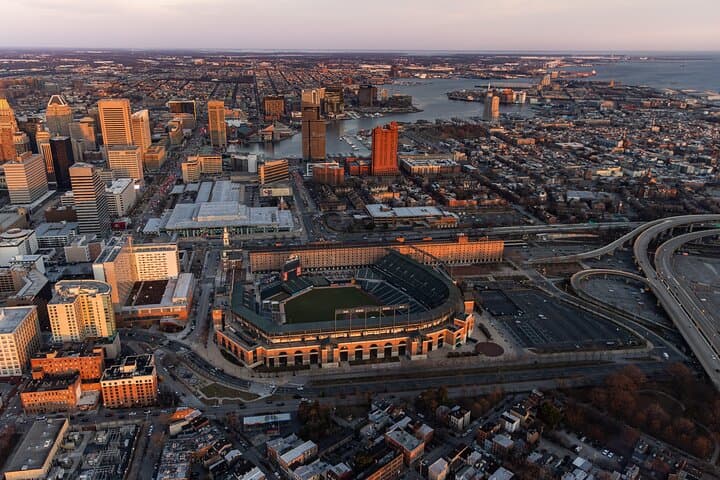
You lift off from a low-slung pier and the city rearranges itself beneath you — brick warehouses, freeway ribbons, and the glassy spine of the Transamerica Tower shrinking into a neat model. The helicopter banks gently over the Inner Harbor; water glints, cruise ships look toy-sized, and M&T Bank Stadium becomes a patterned disk of seats and ramps. In ten minutes the urban grid converts into a cinematic sequence of rooftop textures and river cutaways.
Verified experiences and guided adventures in the surrounding area.
Operated by MyFlight Tours · Baltimore, MD
You lift off from a low-slung pier and the city rearranges itself beneath you — brick warehouses, freeway ribbons, and the glassy spine of the Transamerica Tower shrinking into a neat model. The helicopter banks gently over the Inner Harbor; water glints, cruise ships look toy-sized, and M&T Bank Stadium becomes a patterned disk of seats and ramps. In ten minutes the urban grid converts into a cinematic sequence of rooftop textures and river cutaways.
Baltimore’s harbor was once a working estuary, the endpoint of the Patapsco River and a 19th-century industrial corridor. The Inner Harbor’s modern skyline grew from a civic redevelopment push in the 1970s; from the air you can read that history in the change of building materials and reclaimed waterfronts. Geologically, the harbor sits at the western edge of the Chesapeake Bay estuary system, where tidal channels shape shorelines and expose the city’s maritime ties. Culturally, neighborhoods like Fells Point and Federal Hill are visible markers of the city’s immigrant and working-class past, while new developments narrate recent investment.
Practical guidance: book morning or late-afternoon slots for calmer winds and softer light; bring a camera with a fast shutter and a polarizer to reduce glare. Wear layers — rotor wash pulls cool air off the water — and declare any accessibility or weight considerations when booking. Expect safety briefings, weight-and-balance checks, and strict weather cancellations. For a short flight, the payoff is a compact, high-impact perspective that makes familiar streets feel newly navigable. This tour is primarily sightseeing: move light, arrive early, and let the pilot point out the city’s edges as you fly.
easy.
10 minutes.
Suitable for all fitness levels; must be able to sit unassisted and follow safety directions
The departure building is wheelchair accessible, but boarding may require assistance; notify the operator in advance so staff can prepare.
Infants may ride on laps, and operators commonly ask for passenger weights for balance—provide accurate weights during booking.
Flights are canceled in unsafe conditions and typically refunded if canceled at least 24 hours prior; same-day cancellations may occur due to wind or low visibility.
Early morning or late afternoon offers softer light and calmer air, improving visibility and color contrast for photos.
The Inner Harbor was a 19th-century industrial port that was redeveloped in the 1970s into a public waterfront, reshaping the city’s relationship with its maritime edge.
Helicopter flights add noise and fuel emissions; choose operators that minimize low passes over sensitive habitats and support local groups such as the Chesapeake Bay Foundation.
MyFlight Tours operates guided outdoor trips and adventures with an emphasis on safety, stewardship, and memorable experiences.

You lift off from a low-slung pier and the city rearranges itself beneath you — brick warehouses, freeway ribbons, and the glassy spine of the Transamerica Tower shrinking into a neat model. The helicopter banks gently over the Inner Harbor; water glints, cruise ships look toy-sized, and M&T Bank Stadium becomes a patterned disk of seats and ramps. In ten minutes the urban grid converts into a cinematic sequence of rooftop textures and river cutaways.
You lift off from a low-slung pier and the city rearranges itself beneath you — brick warehouses, freeway ribbons, and the glassy spine of the Transamerica Tower shrinking into a neat model. The helicopter banks gently over the Inner Harbor; water glints, cruise ships look toy-sized, and M&T Bank Stadium becomes a patterned disk of seats and ramps. In ten minutes the urban grid converts into a cinematic sequence of rooftop textures and river cutaways.
Baltimore’s harbor was once a working estuary, the endpoint of the Patapsco River and a 19th-century industrial corridor. The Inner Harbor’s modern skyline grew from a civic redevelopment push in the 1970s; from the air you can read that history in the change of building materials and reclaimed waterfronts. Geologically, the harbor sits at the western edge of the Chesapeake Bay estuary system, where tidal channels shape shorelines and expose the city’s maritime ties. Culturally, neighborhoods like Fells Point and Federal Hill are visible markers of the city’s immigrant and working-class past, while new developments narrate recent investment.
Practical guidance: book morning or late-afternoon slots for calmer winds and softer light; bring a camera with a fast shutter and a polarizer to reduce glare. Wear layers — rotor wash pulls cool air off the water — and declare any accessibility or weight considerations when booking. Expect safety briefings, weight-and-balance checks, and strict weather cancellations. For a short flight, the payoff is a compact, high-impact perspective that makes familiar streets feel newly navigable. This tour is primarily sightseeing: move light, arrive early, and let the pilot point out the city’s edges as you fly.