THE ADVENTURE COLLECTIVE® · Independent discovery and booking for outdoor travel

See the Badlands from a new vantage: a 40‑minute small‑plane tour that places jagged buttes, prairie dog towns and the Cheyenne River in a single, sweeping view. Perfect for photographers and first‑time visitors who want the park’s layout and geology in one flight.
See the Badlands from a new vantage: a 40‑minute small‑plane tour that places jagged buttes, prairie dog towns and the Cheyenne River in a single, sweeping view. Perfect for photographers and first‑time visitors who want the park’s layout and geology in one flight.
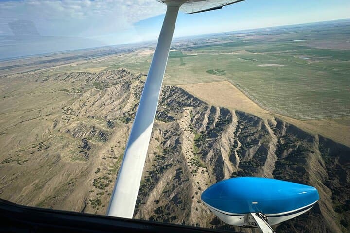
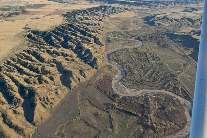
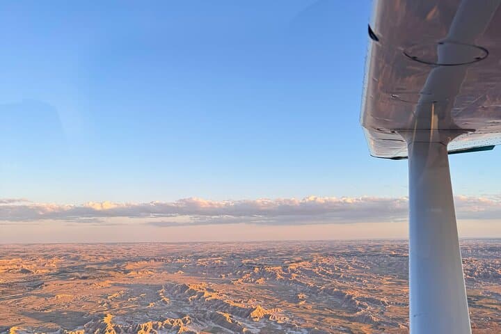
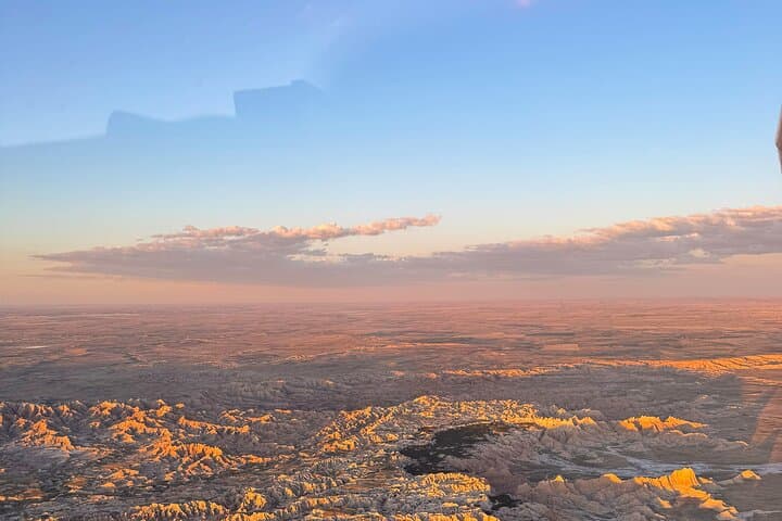
You lift off from the high plains and the Badlands opens beneath you like a carved relief—ridges, buttes and multicolored mounds peeling away into the distance. In a small, windowed aircraft every seat is a front-row view; wind-sheared rock bands and the braided course of the Cheyenne River unfold while a local pilot points out ridgelines, prairie dog towns and relics of the Cold War.
Verified experiences and guided adventures in the surrounding area.
Operated by Fly Badlands · Wall, South Dakota
You lift off from the high plains and the Badlands opens beneath you like a carved relief—ridges, buttes and multicolored mounds peeling away into the distance. In a small, windowed aircraft every seat is a front-row view; wind-sheared rock bands and the braided course of the Cheyenne River unfold while a local pilot points out ridgelines, prairie dog towns and relics of the Cold War.
The Badlands are layered history: sediment laid down millions of years ago, fossil beds that have yielded ancient mammals, and lands long used by the Oglala Lakota. Geology paints the scene in bands of tan, red and yellow; erosion sculpts pinnacles and spires that seem to move with the light. From above you see landscapes not easily read on the ground—Sage Creek Basin’s broad bowls, the sharp escarpment at Wall, and the checkerboard of mixed-grass prairie.
This 40‑minute flight is part sightseeing, part orientation—ideal for photographers and anyone wanting a quick, comprehensive look at formations that make no sense from a car window. Expect narrated commentary, noise‑dampening headsets, and photo opportunities of Robert’s Prairie Dog Town, Pinnacles Overlook and the Minuteman Missile National Historic Site.
Practical notes: flights can be bumpy and are weather dependent, so book with a flexible window and bring layers—the plane is cooler than the ground. Check weight and height limits at booking, charge your camera, and arrive early for a preflight briefing. Aerial perspective changes your sense of scale; this short, focused flight is the most efficient way to understand the Badlands’ sweep and structure.
easy.
40 minutes.
No special fitness required; passengers must be able to board a small plane and follow safety instructions.
The tour is a 40‑minute scenic flight; allow extra time for check‑in and a preflight safety briefing.
Yes—operators collect weight and height during booking and may have limits for safety and balance; age policies vary but families are welcome.
Flights are weather dependent; operators cancel or reschedule for safety with refund policies typically requiring 24+ hours for full refunds.
Yes—photography is encouraged; use noise‑dampening headsets and follow crew instructions to avoid distracting the pilot.
The Badlands preserve layers of Cenozoic sediments rich in fossil mammals and lie within lands long used by Oglala Lakota communities; Cold War relics like the Minuteman Missile site add 20th‑century history to the scene.
The Badlands’ soils and grasslands are fragile—stay on designated routes, avoid disturbing prairie dog towns, and choose operators who follow low‑impact flight corridors to minimize wildlife disturbance.
Fly Badlands operates guided outdoor trips and adventures with an emphasis on safety, stewardship, and memorable experiences.
You lift off from the high plains and the Badlands opens beneath you like a carved relief—ridges, buttes and multicolored mounds peeling away into the distance. In a small, windowed aircraft every seat is a front-row view; wind-sheared rock bands and the braided course of the Cheyenne River unfold while a local pilot points out ridgelines, prairie dog towns and relics of the Cold War.
You lift off from the high plains and the Badlands opens beneath you like a carved relief—ridges, buttes and multicolored mounds peeling away into the distance. In a small, windowed aircraft every seat is a front-row view; wind-sheared rock bands and the braided course of the Cheyenne River unfold while a local pilot points out ridgelines, prairie dog towns and relics of the Cold War.
The Badlands are layered history: sediment laid down millions of years ago, fossil beds that have yielded ancient mammals, and lands long used by the Oglala Lakota. Geology paints the scene in bands of tan, red and yellow; erosion sculpts pinnacles and spires that seem to move with the light. From above you see landscapes not easily read on the ground—Sage Creek Basin’s broad bowls, the sharp escarpment at Wall, and the checkerboard of mixed-grass prairie.
This 40‑minute flight is part sightseeing, part orientation—ideal for photographers and anyone wanting a quick, comprehensive look at formations that make no sense from a car window. Expect narrated commentary, noise‑dampening headsets, and photo opportunities of Robert’s Prairie Dog Town, Pinnacles Overlook and the Minuteman Missile National Historic Site.
Practical notes: flights can be bumpy and are weather dependent, so book with a flexible window and bring layers—the plane is cooler than the ground. Check weight and height limits at booking, charge your camera, and arrive early for a preflight briefing. Aerial perspective changes your sense of scale; this short, focused flight is the most efficient way to understand the Badlands’ sweep and structure.