THE ADVENTURE COLLECTIVE® · Independent discovery and booking for outdoor travel

Leave Marrakech for a full-day circuit through Imlil, Ait Souka, Tamatert and Asni valleys, combining short hikes, a camel ride and a Berber house lunch. The trip highlights waterfalls, orchard-filled valleys and a plateau at ~2,000 m with sweeping views of Mount Toubkal.
Leave Marrakech for a full-day circuit through Imlil, Ait Souka, Tamatert and Asni valleys, combining short hikes, a camel ride and a Berber house lunch. The trip highlights waterfalls, orchard-filled valleys and a plateau at ~2,000 m with sweeping views of Mount Toubkal.
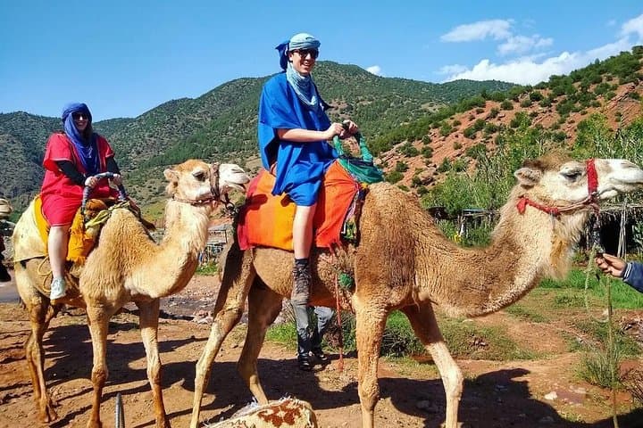
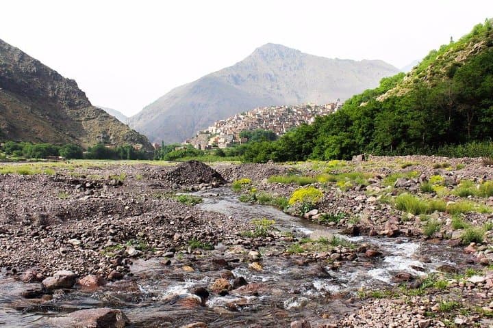
Dust from Marrakech falls away on the first switchback and the High Atlas opens like a map of stone. Travelers feel the air change—cooler, thinner—by the time the group reaches small villages clinging to terraces and the first olive trees. A short camel ride at a village edge offers a playful counterpoint to the walking sections, and a nearby stream dares visitors to follow its path toward a waterfall.
Verified experiences and guided adventures in the surrounding area.
Operated by Trips From Marrakech · Imlil, Marrakech-Safi
Dust from Marrakech falls away on the first switchback and the High Atlas opens like a map of stone. Travelers feel the air change—cooler, thinner—by the time the group reaches small villages clinging to terraces and the first olive trees. A short camel ride at a village edge offers a playful counterpoint to the walking sections, and a nearby stream dares visitors to follow its path toward a waterfall.
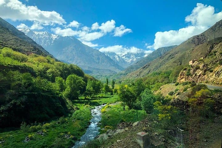
The route threads through Imlil, Ait Souka, Tamatert and Asni valleys, moving from river-carved gullies to a limestone plateau near Imi Ntalat. Geologically the area is an uplifted mass of folded sedimentary rock, with volcanic intrusions that create steep ridgelines and broad plateaus. Culturally, Berber communities have farmed these slopes for generations; lunch in a Berber house showcases tagine and couscous and a cooperative where women press argan oil reveals local production techniques.
Expect a 7–8 hour day that includes a guided 1–1.5 hour round-trip waterfall walk, valley drives, and time at viewpoints around 2,000 m elevation where Toubkal (4,167 m / 13,665 ft) dominates the skyline. Terrain alternates paved village lanes, rocky footpaths and short ascents; weather can swing from sun to wind-driven showers.
Practical guidance: wear sturdy hiking shoes, dress in layers for temperature swings, carry at least 1.5–2 L of water and sun protection, and bring small change for local purchases and the cooperative. The tour is best in clear weather for views and photos, and the guide’s local knowledge makes stops more than scenic—each village is an active chapter of Atlas life.
moderate.
7–8 hours.
Moderate fitness—comfortable with a 1–2 hour walk on uneven trails and short climbs
The guided waterfall walk is about 1–1.5 hours round-trip, over uneven but well-trodden paths; there are cafe options by the river if you prefer not to walk.
Yes—camel rides during this day trip are short and supervised; guides help mount and dismount and adjust for comfort.
A traditional Berber lunch (salad or soup, tagine or couscous, dessert and drinks) is included; snacks and tea visits are typically provided at cooperatives.
This tour is not recommended for people with serious spinal or cardiovascular conditions due to uneven terrain and a long day; consult the operator if in doubt.
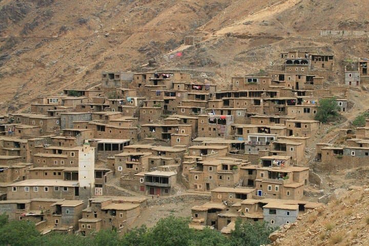
Berber communities have farmed Atlas slopes for centuries; many villages use traditional adobe construction and seasonal orchards shaped by terracing practices.
Visitors should avoid single-use plastics, stick to marked paths to limit erosion, and buy local products to support community-based economies.
Trips From Marrakech operates guided outdoor trips and adventures with an emphasis on safety, stewardship, and memorable experiences.
Dust from Marrakech falls away on the first switchback and the High Atlas opens like a map of stone. Travelers feel the air change—cooler, thinner—by the time the group reaches small villages clinging to terraces and the first olive trees. A short camel ride at a village edge offers a playful counterpoint to the walking sections, and a nearby stream dares visitors to follow its path toward a waterfall.
Dust from Marrakech falls away on the first switchback and the High Atlas opens like a map of stone. Travelers feel the air change—cooler, thinner—by the time the group reaches small villages clinging to terraces and the first olive trees. A short camel ride at a village edge offers a playful counterpoint to the walking sections, and a nearby stream dares visitors to follow its path toward a waterfall.
The route threads through Imlil, Ait Souka, Tamatert and Asni valleys, moving from river-carved gullies to a limestone plateau near Imi Ntalat. Geologically the area is an uplifted mass of folded sedimentary rock, with volcanic intrusions that create steep ridgelines and broad plateaus. Culturally, Berber communities have farmed these slopes for generations; lunch in a Berber house showcases tagine and couscous and a cooperative where women press argan oil reveals local production techniques.
Expect a 7–8 hour day that includes a guided 1–1.5 hour round-trip waterfall walk, valley drives, and time at viewpoints around 2,000 m elevation where Toubkal (4,167 m / 13,665 ft) dominates the skyline. Terrain alternates paved village lanes, rocky footpaths and short ascents; weather can swing from sun to wind-driven showers.
Practical guidance: wear sturdy hiking shoes, dress in layers for temperature swings, carry at least 1.5–2 L of water and sun protection, and bring small change for local purchases and the cooperative. The tour is best in clear weather for views and photos, and the guide’s local knowledge makes stops more than scenic—each village is an active chapter of Atlas life.