THE ADVENTURE COLLECTIVE® · Independent discovery and booking for outdoor travel

Leave Marrakech at dawn for a full-day hike from Imlil to the Tizi Mzik pass (≈2,400m). Expect steep stone tracks, Berber villages, panoramic views of Toubkal, and a picnic on the ridge.
Leave Marrakech at dawn for a full-day hike from Imlil to the Tizi Mzik pass (≈2,400m). Expect steep stone tracks, Berber villages, panoramic views of Toubkal, and a picnic on the ridge.
By dawn the road out of Marrakech unspools beneath an ochre sky, and the High Atlas closes in like a wall of stone and light. Within an hour the traffic thins and olive groves give way to terraced slopes; Imlil appears as a scatter of flat-roofed houses at 1,740m, the logical base for a climb to Tizi Mzik (≈2,400m).
Verified experiences and guided adventures in the surrounding area.
Operated by Explore Morocco's wonders · Imlil, Marrakech-Safi
By dawn the road out of Marrakech unspools beneath an ochre sky, and the High Atlas closes in like a wall of stone and light. Within an hour the traffic thins and olive groves give way to terraced slopes; Imlil appears as a scatter of flat-roofed houses at 1,740m, the logical base for a climb to Tizi Mzik (≈2,400m).
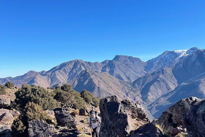
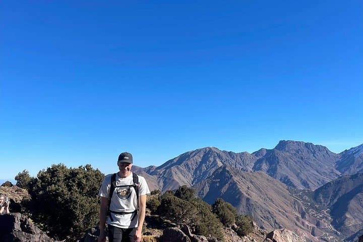
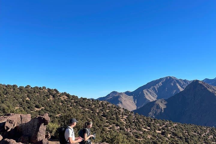
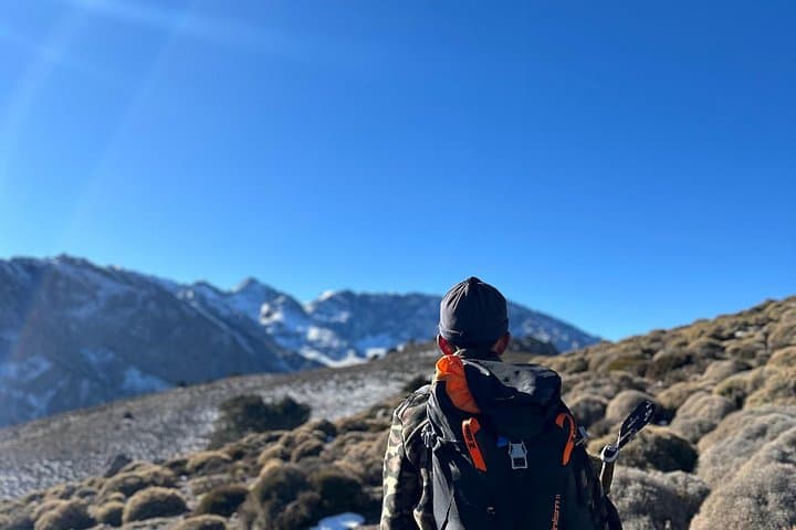
The route climbs out of wooded valley floors onto a sequence of mule tracks and stone stairways carved by generations of Amazigh shepherds. Geologically the Atlas is a young, folded range—rock faces are a mix of schist and limestone that throw dramatic angles into the sky, and on clear days you’ll see the snow-shouldered ridges of the Toubkal massif framing the horizon.
Culturally the hike threads through working landscapes: argan cooperatives, terraced barley plots, and small Berber villages where mint tea is an invitation rather than a ritual. Guides often stop at family homes for tea; these exchanges are as much part of the experience as the summit views.
Practical guidance: expect roughly 600–700m of elevation gain over 4–6 hours of walking (5 hours is typical on this itinerary). Terrain alternates packed earth, rocky switchbacks and short scree sections near the pass—sturdy boots and steady pacing matter. Hydrate early, layer for sharp sun and wind at altitude, and plan for picnic lunch at the pass with panoramic views over Azzaden valley and Toubkal peaks.
The descent takes a different line, offering new village perspectives and a final cup of tea before the drive back to Marrakech—an accessible day that rewards patience, respect, and sensible footwear.
moderate.
5–7 hours (hike portion).
Suitable for regular walkers with basic hill fitness; steady uphill sections require cardiovascular endurance.
The transfer is about 60 km and typically takes 60–90 minutes depending on traffic and road conditions.
Most people tolerate a single-day ascent to 2,400m without issues, but pace yourself and watch for headaches, dizziness or nausea; inform your guide if symptoms appear.
Breakfast, bottled water and a picnic lunch are included; there are also short local stops like argan cooperatives and a tea stop with a family.
A moderate fitness level is sufficient—regular walkers who can manage several hours of uphill hiking will be comfortable.
The High Atlas has been inhabited by Amazigh (Berber) communities for centuries; trails served seasonal shepherding and trade between valleys.
Stick to established tracks to avoid erosion, support local cooperatives for sustainable income, and pack out non-biodegradable waste to protect fragile mountain water sources.
Explore Morocco's wonders operates guided outdoor trips and adventures with an emphasis on safety, stewardship, and memorable experiences.
By dawn the road out of Marrakech unspools beneath an ochre sky, and the High Atlas closes in like a wall of stone and light. Within an hour the traffic thins and olive groves give way to terraced slopes; Imlil appears as a scatter of flat-roofed houses at 1,740m, the logical base for a climb to Tizi Mzik (≈2,400m).
By dawn the road out of Marrakech unspools beneath an ochre sky, and the High Atlas closes in like a wall of stone and light. Within an hour the traffic thins and olive groves give way to terraced slopes; Imlil appears as a scatter of flat-roofed houses at 1,740m, the logical base for a climb to Tizi Mzik (≈2,400m).
The route climbs out of wooded valley floors onto a sequence of mule tracks and stone stairways carved by generations of Amazigh shepherds. Geologically the Atlas is a young, folded range—rock faces are a mix of schist and limestone that throw dramatic angles into the sky, and on clear days you’ll see the snow-shouldered ridges of the Toubkal massif framing the horizon.
Culturally the hike threads through working landscapes: argan cooperatives, terraced barley plots, and small Berber villages where mint tea is an invitation rather than a ritual. Guides often stop at family homes for tea; these exchanges are as much part of the experience as the summit views.
Practical guidance: expect roughly 600–700m of elevation gain over 4–6 hours of walking (5 hours is typical on this itinerary). Terrain alternates packed earth, rocky switchbacks and short scree sections near the pass—sturdy boots and steady pacing matter. Hydrate early, layer for sharp sun and wind at altitude, and plan for picnic lunch at the pass with panoramic views over Azzaden valley and Toubkal peaks.
The descent takes a different line, offering new village perspectives and a final cup of tea before the drive back to Marrakech—an accessible day that rewards patience, respect, and sensible footwear.